Railroad Forums 

  • Tracks behind Abington Shopping Center in Clarks Summit?

  • Pertaining to all railroading subjects, past and present, in Pennsylvania
Pertaining to all railroading subjects, past and present, in Pennsylvania

Moderator: bwparker1

 #532681  by arcanehero
 
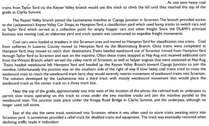
On the hill directly behind the Abington Shopping Center in Clarks Summit, there is some railbed that was possibly abandoned in the 80s when D&H owned the tracks there. It was originally part of the new main line for DL&W. It begins about at the bridge on Knapp Rd and curves away from the main line to the east, then curves back towards it and crosses under the tracks under a bridge built in 1914, curves away from the tracks again towards the west, then curves back and rejoins the line by the Turnpike (I-476) bridge. Basically, it forms an S-shape with the middle crossing beneath the current CP tracks. A topo map from '95 shows the tracks still there, though I am quite certain they were already gone by then.

Does anyone know what the purpose for these tracks was and when they were pulled out?
 #532801  by JhnZ33
 
arcanehero wrote:On the hill directly behind the Abington Shopping Center in Clarks Summit, there is some railbed that was possibly abandoned in the 80s when D&H owned the tracks there. It was originally part of the new main line for DL&W. It begins about at the bridge on Knapp Rd and curves away from the main line to the east, then curves back towards it and crosses under the tracks under a bridge built in 1914, curves away from the tracks again towards the west, then curves back and rejoins the line by the Turnpike (I-476) bridge. Basically, it forms an S-shape with the middle crossing beneath the current CP tracks. A topo map from '95 shows the tracks still there, though I am quite certain they were already gone by then.

Does anyone know what the purpose for these tracks was and when they were pulled out?
From the 2008 Lackawanna & Wyoming Valley RHS calender:

Image

Hope that helps,

JP

 #532824  by arcanehero
 
That was fantastic! Thanks a bunch. I was told by a few people that it was probably part of the old main line, but that solution didn't make much sense to me. This, however, was most helpful. Thanks again!

 #534076  by arcanehero
 
Just another quick question about this -- was this low grade used to cross under the old main as well? Someone sent me a diagram of the old main with a heavy track crossing underneath as this ROW does, and told me the underpass was not used with the new alignment, only the old. I thought the description from the calendar referred to the new main, and old maps and photographs suggest that as well. Any thoughts?