• Tracks behind Abington Shopping Center in Clarks Summit?

  • Pertaining to all railroading subjects, past and present, in Pennsylvania
Pertaining to all railroading subjects, past and present, in Pennsylvania

Moderator: bwparker1

  by arcanehero
 
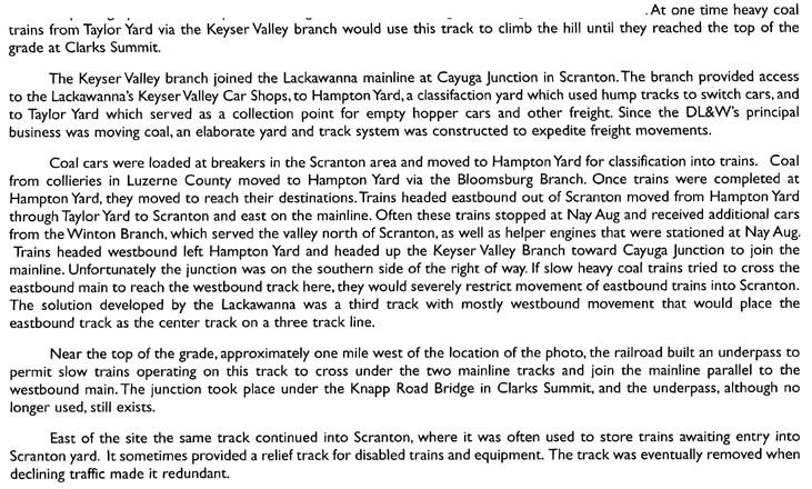
On the hill directly behind the Abington Shopping Center in Clarks Summit, there is some railbed that was possibly abandoned in the 80s when D&H owned the tracks there. It was originally part of the new main line for DL&W. It begins about at the bridge on Knapp Rd and curves away from the main line to the east, then curves back towards it and crosses under the tracks under a bridge built in 1914, curves away from the tracks again towards the west, then curves back and rejoins the line by the Turnpike (I-476) bridge. Basically, it forms an S-shape with the middle crossing beneath the current CP tracks. A topo map from '95 shows the tracks still there, though I am quite certain they were already gone by then.

Does anyone know what the purpose for these tracks was and when they were pulled out?
  by JhnZ33
 
arcanehero wrote:On the hill directly behind the Abington Shopping Center in Clarks Summit, there is some railbed that was possibly abandoned in the 80s when D&H owned the tracks there. It was originally part of the new main line for DL&W. It begins about at the bridge on Knapp Rd and curves away from the main line to the east, then curves back towards it and crosses under the tracks under a bridge built in 1914, curves away from the tracks again towards the west, then curves back and rejoins the line by the Turnpike (I-476) bridge. Basically, it forms an S-shape with the middle crossing beneath the current CP tracks. A topo map from '95 shows the tracks still there, though I am quite certain they were already gone by then.

Does anyone know what the purpose for these tracks was and when they were pulled out?
From the 2008 Lackawanna & Wyoming Valley RHS calender:

Image

Hope that helps,

JP

  by arcanehero
 
That was fantastic! Thanks a bunch. I was told by a few people that it was probably part of the old main line, but that solution didn't make much sense to me. This, however, was most helpful. Thanks again!

  by arcanehero
 
Just another quick question about this -- was this low grade used to cross under the old main as well? Someone sent me a diagram of the old main with a heavy track crossing underneath as this ROW does, and told me the underpass was not used with the new alignment, only the old. I thought the description from the calendar referred to the new main, and old maps and photographs suggest that as well. Any thoughts?