Railroad Forums 

  • Ogden Mine RR and the Edison works.

  • Pertaining to all railroading subjects, past and present, in New Jersey
Pertaining to all railroading subjects, past and present, in New Jersey

Moderator: David

 #15405  by mikedc3
 
Hi,
Anyone know anything about the Ogden Mine road or the Edison mine complex in Sparta? I spent about 3 hours up today and saw some amazing artifacts. Does anyone know when the branch to the mine was closed and ripped up? I know the Iron works closed by 1900, but I have heard that after the Iron operation was done they quarried limestone from the pits up there. How long did this last? I found the remains of a 2-3 track yard inside the mine complex that still had several ties. I don't think ties from the 1800's would still be around today. Did the limestone operation last much longer??
I know everyone is going to recommend the Iron Mine RR's of NJ book, I have tried to find one in the past but didn't have any luck plus, I see Tri-State is trying to re print a new updated version of it by "The end of 2005." So maybe I will just wait for the next version.

Again there is some really neat things up there to see. I recommend this site to anyone who is into the industrial history of NJ. I would appreciate any info on this site.
Thanks,
MDC

You can view all of my pics on my picture page.

http://img13.photobucket.com/albums/v37/MIKEdc3/
Password is pics

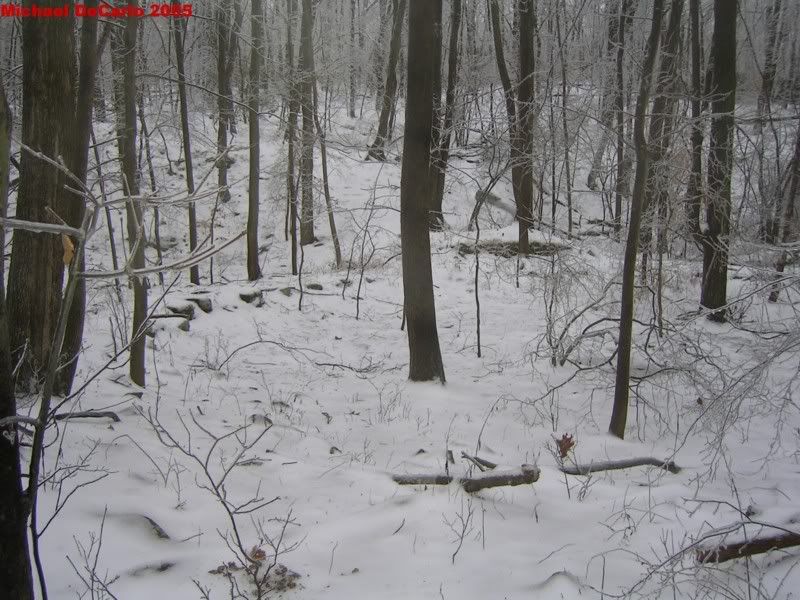
An open mine shaft.
Image

A second mine shaft.
Image

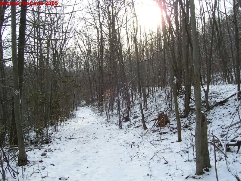
This is the Ogden RR ROW leaving the Edison Mine Complex. Looking south.
Image

 #15508  by cjvrr
 
Great pictures! You got there just before the leaves popped out.


From the NJ Midland website, "By 1935 most of the line had been torn up."

Jefferson Township has some info on their website;

http://jeffersonbicentennial.org/about/history05.html

Also some historic photos;

http://www.nps.gov/edis/26111000.HTM

The "Lowenthal" book is an excellent resource and packed full of info.
 #15599  by eonflux
 
The Morris County Park Commission is having a walk there this fall, not
sure of the date yet.

From the Iron Mine book,

-Scheduled passenger service ended in 1928, discontinued 1932.
-1934, CNJ applied to abandoned Ogden Mine RR.
-1935, ICC permitted abandonment, provided CNJ buy 66% of OM RR
stock offered in 60 days of abandonment date.
-1941, All stock is gathered in, permission granted to abandon.
-Also 1941, CNJ applied to abandon Lake Hopatcong portion of the line.
-June 1941, Removing rail began.
-1948, Most of the right of way been sold.

Phil

 #15626  by SPUI
 
If you can get to the Princeton NJ Public Library, they have a copy of the book (I borrowed it via interlibrary borrowing).

 #15694  by mikedc3
 
Thanks for the reply's. I wish I could find a map of the site showing what was where so that I could make sence of these remains. I went and added captions to the pics tonight. A very neat place!!

 #15829  by CarterB
 
Mike,
I have walked a bit around that area, but not seen the pits nor the old yard. Where are same located? I assume on the North side of the road? I poked around a bit where I could see the OMRR ROW but didn't manage to see near what you have uncovered.

 #15958  by mikedc3
 
Carter,
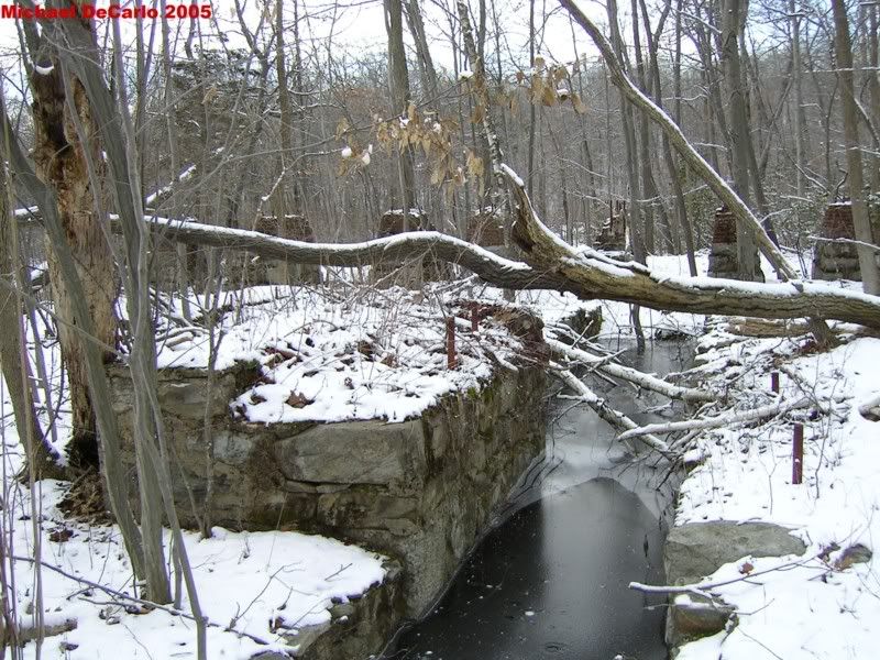
I'll try my best to describe what is where. If your coming up Edison road from Ogdensburg, There is a parking lot on the left hand side of the road. If you park here there is a granite marker with some pictures and a plaque on it. Find the trail behind this marker and walk away from the parking lot. The first thing you will come to is a mine shaft filled to the top with water, This is the shaft with the sign in front of it stating that the shaft is 86 feet deep. Keep walking a few more yards and you will be under some power lines. In this area, you will find the stone lined trenches, with water in them, On the top of these trenches are several threaded rods sticking out where machinery of some kind was once mounted. I think this might have been a power house?? Anyway if you walk up and down the power line ROW, there are several foundations, and other man made stone lined ramps and such. Keep walking on the trail away from the lot on the other side of the power lines and you can easily find the water filled tunnels. I believe that this was a horizontal iron mine and that it's all one tunnel but there are several openings to it. The openings are all fenced in but, you can see them well. Continue on down the trail, and you will soon see a flooded area that looks almost like a river. It's very long and thin, This is the start of what I called the rear iron ore pit. As you walk down this trail, it starts to go up hill. The water filled pit will be on your right. As you go further on the other side of the water, the pit opens up deeper but is at a higher level and parts if it are dry. When I got to the end of the flooded section of the pit, I made a right around the back of the pit. Here I found what I called the mine dump. It's very large and is clearly waste rock in piles. On the far side of this dump up a small hill is another old road or trail. When I got here I made another right. I was now heading back toward the parking lot but on the other side of the pit. Along this trail, there is a fence around the deep section of the pit. When you get to the fence, walk along it back toward the dump, and it comes to a point. There is a hole in the fence here you can walk through to see the inside of the pit. There are several deep trenches here so you need to be careful. Back along the trail, further down there is another hole in the fence, If you go through here you come out on a solid rock wall of sorts. The pit is kind of divided in two sections by this wall. Some of the pit is filled with water that is rust colored near the walls due to the iron in the stone. The entire rock wall your standing on was drilled for blasting. I have no clue why this wall was left. Back on the trail again walking back toward the power lines, you are at a much higher level than the first trail. When you get to the end of the pit, you will start to come back down, In this area, if you walk around, you will find the mine shafts that go straight down. They are surrounded by fences but you can get inside them easily. Once back in the parking lot, on the other side from the marker, you will see an open field with sand in the center. This is where the main part of the plant was. Walk into this field and go to the right near the sand. There is a short, steep hill that has been worn down by motorcycles. Walk up that hill and you are now on the RR ROW. Turn away from the parking lot and walk up the ROW. Several yards up you will see at least two rows of ties, a few foundations, rock walls, and two concrete blocks with very old rail cut off at the top of them. This is the area I called the RR yard. It's easy to find. I then walked further up the ROW. It's built on a pretty high fill here, On the left is a swamp and to the right there is a small pit that I will get back to later. If you follow the ROW further you will get back to Edison road. Cross the road to see the deep stone cut. There are cinders, coal pieces of all sizes, and chunks of ore all along the ROW.
Back on Edison road, walk back toward the lot, there are several foundations for the conveyors on the left side. On the right side, right next to the road you will see a man made raised section of ground, lined by stone walls. Climb up on this and walk in. You will be heading back toward the RR ROW now. After a few yards, You will come to a stone lined trench about 5 feet deep and 4-5 feet wide, look across and you will see two more. They are about 20 feet apart and are at least 50 yards long. They end at the Pit I mentioned earlier. I don't have a clue what these were used for. I thought there might have been some kind of machine in the pit to load the RR cars, but I'm not sure.
Back out on the road, across from the parking lot is another deep pit surrounded by a fence. This is the pit I called the Horseshoe pit. I have seen it called this in books and on web sites. On the side of this pit is a dirt road, There was once a gate across the road but it's now smashed all to hell. Walk up that road and then toward the fence, there are a bunch of small foundations and rock walls here. If you walk up hill along this fence up near the end of the pit someone has a log wedged under the fence. You can easily bend under the fence and go in. This is where I found the Iron clasp looking things sticking out of the ground. There are lots of trees growing in this pit and some of it is filled with water, so It's kind of hard to see down it. The pit is kind of "V" shaped (horse shoe) and you can walk right out to the end with the pit on both sides. This is all I saw when I was there. I'm sure there is more. From the pictures I have seen there were several houses build on the hill behind the main plant for workers. This area is either along the power lines or behind the field near the parking lot. I didn't look behind the mine dump and, I also didn't explore the other side of the horse shoe pit, So I don't know if anything is on that side.

I hope some of this made sense, It's truly a great place to explore.

Does anyone know when the place was torn down? Did Edison do it, or was it torn down later. What I find strange for such a big place that was closed so long ago is that, Other than some bricks here and there, There is not one wall of any building left anywhere in the entire complex other than stone foundations. I have seen pictures of some of the buldings and the walls were made of stone. None of this is left. The entire place was knocked down and either burried or carted away. This seems strange to me judging by some of the other abandand sites around, like Franklyn mines and such, where there are still buildings left.

Here's a few more pics, Sorry they are so big.

Image

Image

Image

 #15988  by David
 
Great Report and pictures as always, Mike! Keep up the good work. Thanks. Hope to visit that area in June.
Last edited by David on Fri Apr 30, 2004 11:22 am, edited 1 time in total.

 #16022  by cjvrr
 
The best bet to figuring this area out is to get a Sanborn map. The were maps for insurance companies that would show each building and what its use was. In the past they could be accessed online, but not anymore. The local town library up there might have them.

If not, a stop at the Sterling Hill Mineral Museum may be of help. Most people working there are locals and know the history of the area well.

From what I have read and remember most of the equipment was reused in other locations for Edison's venture into the cement industry. If the stone building housed the Corliss Engine in the NPS photos, they may have had to dismantle the building to remove it. Remember too that this place ceased function around 1895. This was the only local industry. Since the wood buildings were only a few years old they were probably dismantled and reused elsewhere too.

The mines in Franklin and other places like Hibernia lasted into the 1930s and 1940s.

I would suspect that the trench with the treaded rod next to it did hold the Corliss engine in the NPS photos. The trench seems to be about the right size.

Thanks for the excellent report. I never ventured more than a few hundred feet from the parking area and obviously missed a lot of what remains.

Chris

 #16025  by CarterB
 
Mike,
EXCELLENT report!!

Some history that I have found:

The Ogden Mine RR was completed in 1866 from Ogden Mine in Sparta Township (Edison) to a connection with the Morris Canal at Lake Hopatcong. Operation was by its own management until Dec. 31,1881, from which date it was operated by the Central.

In 1889, Thomas Alva Edison bought the Ogden mine and spent two million dollars on his magnetic separation of iron. 50 homes were built many of which had electricity and running water - which was rare in those days. In 1898, his ore was no longer in demand and the next year he closed down.
Edison got into the cement business after failing at mining ore, Brown said.
On April 3, 1880, Edison received a patent for a magnetic ore separator. He put his invention to work at the Ogden Mine (the mine was apparently named after the inventor's great-grandmother) in Sparta Township, buying or leasing 19,000 acres of Sparta Mountain, according to research done by Howard Case of Sussex.
The ore separator worked, but the ore in the Ogden mine was heavily contaminated with phosphorous, which reduced its value.
When the Edison operation closed in 1902, after high-grade ore had been discovered in the Mesabi Range in Minnesota, the inventor had lost $4 million on the project.

Edison started thinking about how to recoup his losses on the way back to West Orange for the last time. He decided on the cement business, having constructed some cement houses for his workers.
Edison, interested in geology, helped the U.S. Department of the Interior with geological surveys, so he and his staff had no difficulty finding a location for the cement plant.
He settled on the New Village site, on the edge of the cement belt.
Most of the machinery from the Ogden mines was moved to the Edison Cement operations.

The Ogden Mine branch was little used since the mines, natural ice, and the Lake Hopatcong excursions were discontinued. It was removed during World War II except for the short piece between Hopatcong Jct. and Morris County Jct.

 #16399  by jsx
 
The "Iron Mine RRs Of NJ" Book is available at a bookstore in Rockaway (I forget the name, but its right next to Rails To Cottages) They have a great local collection.

Jim

 #16627  by NJ Vike
 
Mike,

You may want to ask Dave Rutan of this site: http://dlw-sussexbranch.com/Dave_Rutan/bio.html

He's a wealth of knowledge in my area and has over 2.000 pictures of Railroading in Sussex County.

 #88323  by mikedc3
 
Guys,
I'm bringing this thread back to the top.
When I first went to Edison mine last year, I really didn't know all that much about it. Since then, I have talked to a lot of people and did a lot of searching online for info on this site, and the Ogden RR. I have also been back there a bunch of times.

A few weeks ago I found this site:

http://www.map-maker.net/pages/269878/index.htm

The guy who runs that site just released a great, great book on the Edison mine called
"Thomas Edison's "Ogden Baby" The New Jersey and Pennsylvania Concentrating Works."

I ordered this book and I have got to say, It's one of the best books I have ever bought. It has maps of the plant when it was open, Arial photos of what's left today with overlays of the old buildings, and tells the whole story of the plant from beginning to end. Using the maps and info in this book I learned that when I went to the site last year, I didn't even see half of what is left up there. Since then, I have gone up there with my camera two more times and took a lot more pictures. I still have more to see too. I had no idea this place was so big, or how much Edison did up on Sparta Mtn. I now have 140 pictures (4 pages worth) on my photo page, and will be adding more soon. I am also starting a web page dedicated to old industrial sites and RR's in NW NJ. I can't recommend this new book enough. If anyone wants to go up there on a Sunday, Let me know. I'd be glad to meet you up there.

Here's a couple more pics.

This is the turntable pit of the Ogden RR. It's located right off Edison Rd. Just past the ROW crossing. The raised land in the rear is where the tract to the pit was.

Image

This is a switchback along a narrow gauge ROW. The upper part went up to the plant, while the lower line went to the "Iron Hill Cut" which was another quarry.

Image

This last one is the remains of the Power house.

Image

 #88332  by Diamond_D
 
Cool shots Mike, I really liked the Cutoff series!

Nice bike too! :-D

 #88780  by CarterB
 
Mike,
What an excellent job you have done of researching and photographing the site. Congratulations on your photobucket web page as well.

How extensive was the narrow guage rr that served the pits? Any photos known to exist of the locos or cars?

I would love to join you, and/or a group sometime this Spring (after the snow but before things leaf out) and browse the area.

Carter Morris