Railroad Forums 

  • Northern Branch customers through the years

  • Pertaining to all railroading subjects, past and present, in New Jersey
Pertaining to all railroading subjects, past and present, in New Jersey

Moderator: David

 #1420500  by pdtrains
 
Reutens millwork siding only held 2 cars. They would only get a couple of cars a month. Closter Feed got 40' box cars of Feed and Peat Moss. Also on the team track a chemical company got SACX (PPG) tank cars of trichloroethene, and Heidenberg mills loaded box cars with huge rolls of cotton wadding. Can't remember who got the box cars of brick. It was also a popular place to leave the overflow of loads for Weyerhaeuser.

I've got full sets of CR ZTS maps from early 1980.....they have most of the tracks that were there in the 1960's. It will take some time, but I'll post them if i can. That should answer most questions about the northern trackage. Oh, and looking at the picks...Cove distributing used to be JA Melnick, back in the 60's. Used to do a drop (flying switch) there to head back east after switching there. I also have slides of passenger and freight trains on the Northern...Mid 1960's
 #1421470  by rscott417
 
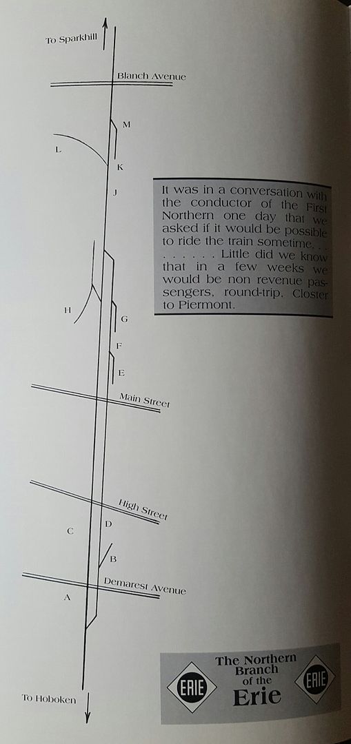
I got an issue of ELHS's The Diamond Vol 11 #2, in it has a brief article on the NB in Closter NJ. Here's a picture of the map thats featured in the article. It has alphabetical listing of the spurs and sidings but doesn't list who the belonged to. Can anyone list them?
Image
 #1421517  by RichM
 
E was the team track. G was Reuten Window, H was JJ Demarest and B was Pascack Stone. I don't know who the original owner of the corrugated box company and the northern most siding on the east side but everything was active in the early sixties.
 #1421585  by pdtrains
 
Your doing pretty good so far. L was Weyerhauser, K was hercules powder (1950's), and M was stevens millwork..they just used the old Herc powder siding lead to unload box cars. The Herc powder siding was long...cud holod 10 50' box cars....often used to store inbound loads for Weyerhauser.
C is the location of the station, and D is the freight house. In later years, when the 2nd track was used only as a siding, loads were spotted at the freight house for a rail to truck transfer company.
 #1421604  by rscott417
 
Thanks for the help guys, so the run down so far is..
A)
B) Pascack Stone
C) Station
D) Freight House
E) Team Track
F)
G) Reuten Window
H) JJ Demarest
J)
K) Hercules Powder
L) Weyerhaeuser
M) Stevens Millwork

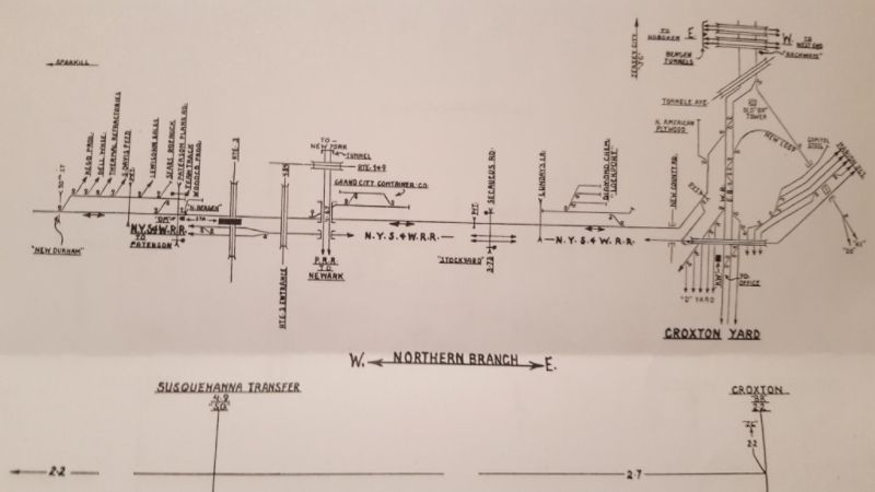
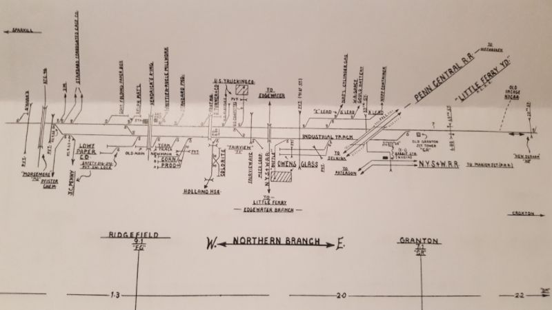
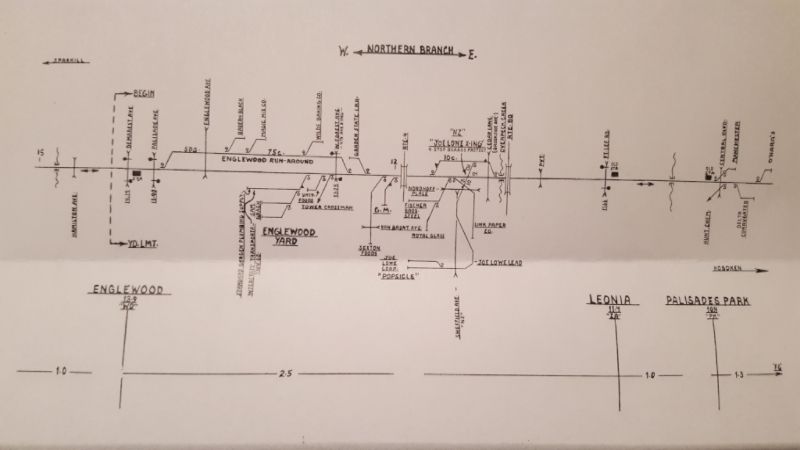
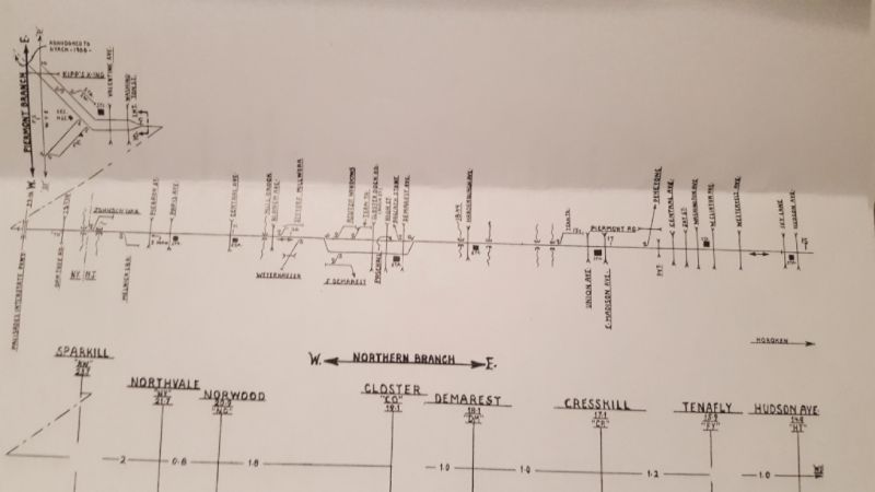
I also just got a very detailed map of the whole branch that I'm going to post, I just need to see what quality level I can get it at.
 #1422185  by rscott417
 
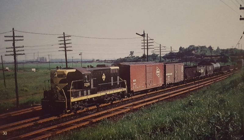
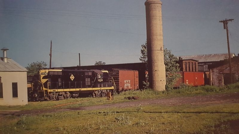
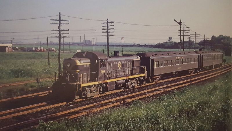
I got an Erie book from Morning Sun that like most books I buy pertaining to the NB only had 2 or 3 pages of information. 2 of the pictures though I thought were pretty interesting. First was a south (east) bound freight with some hoppers and gondolas, not the typical boxcar and tank car I normally see. I'm only assuming but hoppers from the coal dealer in Sparkill and the gondolas from Orangeburg pipe? The second was a NB freight working in Orangeburg along the West Shore Line, and just for the heck of it train #1202 with 2 stillwells.
Image
Image
Image
 #1422256  by rscott417
 
I have seen you post that link in other threads before, I find those maps to be difficult to read. I know the ones I posted are probably difficult also because I took a picture of them to post them but clear as day in my hands and they look pretty similar to the ones on that website. Since there's a size restriction on photos, when I resize them the right side of the picture always gets cut off.
Last edited by rscott417 on Wed Mar 01, 2017 4:59 pm, edited 1 time in total.
 #1422321  by pumpers
 
Can anyone figure out the exact location of the 1st and 3rd photos rscott posted. If the train is headed towards Hoboken as stated, then the view should be looking northwest I assume. That power plant in the background and the semaphore should be giveaways. Also, how about the 3rd track in the background? A Northern siding, or maybe NYSW ...??? It has that meadowlands look, but I don't see the NJ turnpike. Someone help, please.
JS
 #1422344  by SemperFidelis
 
Wow, there's been just a ton of development in the area since then. I guess I shouldn't be so surprised, it is Jersey.

Best I can make it out is the picture was taken by 91st Street. You can see the bridge over the Northernn on the right on the pictures, and the longer bridge over the yard at Little Ferry more to the left.

https://www.google.com/maps/@40.8171791 ... a=!3m1!1e3" onclick="window.open(this.href);return false;