Railroad Forums 

  • US Navy Earle Railroad

  • Pertaining to all railroading subjects, past and present, in New Jersey
Pertaining to all railroading subjects, past and present, in New Jersey

Moderator: David

 #1606529  by R&DB
 
IIRRC there are 4 Naval Supply ships based out of Earle. They provide supplies of all kinds to the Atlantic and Med fleets. (Including weapons) The reasons for the long piers is to protect the pupulace in case of a mishap. Highly the military would allow and civiliian use of the pier.
 #1606537  by JohnFromJersey
 
If the Earle railroad was to be used for any sort of non-military use, it seems commercial use of the piers is out of the question then. Maybe you could use it to have a train running to the SeaStreak Ferry... not sure how many people use that ferry, and not sure how many people would use a MOM line that doesn't go straight to NYC/North Jersey, but requires you to hop off and get onto a ferry into the city. Not only would you have to improve the tracks from Toms River - Farmingdale to at least Class 3, but you'd also have to re-double track the Earle railroad most likely, and would need significant money to upgrade the ferry terminals in Atlantic Highlands.

Honestly, at that rate, you might as well just tear up the Henry Hudson Bike Trail, make it a railroad to the ferry again, and run a shuttle out of Matawan that would take people to and from the ferry terminal. And then have MOM originating in Lakehurst or Toms River, connect onto the Coastline at Red Bank (so people could transfer off if they want to take a train to NY instead of a ferry), and then terminate at the ferry.
 #1606571  by Ken W2KB
 
R&DB wrote: Tue Sep 13, 2022 5:53 pm The reasons for the long piers is to protect the pupulace in case of a mishap. Highly the military would allow and civiliian use of the pier.
Yes, that and another substantial reason is that the water depth of Sandy Hook Bay in that area is only around 10 to 15 feet, so frequent very costly and disruptive dredging would be required for a considerable width over the two mile distance of the pier.
 #1606670  by R&DB
 
In the post Ken quouted above I mistacenly letft out Highly-UN likely.
 #1632587  by NJT4149
 
Caught the train yesterday at Oak Hill Road. Two Baldwins, 65-00367 and 65-00368, working hard on a rare Saturday run!

https://youtu.be/m44WUansadQ?si=s8-rB1FFQfzHM_Wh
Attachments:
IMG_1357.jpeg
IMG_1357.jpeg (3.94 MiB) Viewed 1336 times
 #1632589  by pdtrains
 
Great video of a rare move in the Earle RR. I didnt even know the rebuilt baldwins were still there and running.

Have heard many rumors of the railroads demise. Hopefully not...
 #1632980  by Matt Johnson
 
Any idea why they severed the second track at numerous grade crossings rather than just leaving the inactive track in place? Does that change its classification in some way or otherwise reduce costs?
 #1632991  by RandallW
 
They don't have to maintain the crossing circuitry on the severed tracks, so it reduces costs by reducing maintenance burden.
 #1633002  by JohnFromJersey
 
RandallW wrote: Sat Nov 11, 2023 1:51 pm They don't have to maintain the crossing circuitry on the severed tracks, so it reduces costs by reducing maintenance burden.
It's the US DoD, they don't seem like they need to or want to reduce costs
 #1633181  by GSC
 
The Earle railroad system is quite complex. Wyes and sidings all over. Great view from Google Maps to see just how extensive it is. Would make for a great N-scale layout, you'd need a pretty big room to do it in HO.

It would never happen, but it would make a great commuter line to the piers. Minimum of public grade crossings and almost a straight shot to the Bay. Or a dedicated bus route along Normandy Road.

Since I'm apparently in dream mode, the original ROW of the Raritan & Delaware Bay RR is pretty much open and still in existence as a power line ROW, at least from Red Bank to Rt 36. Why not?
 #1633363  by Bracdude181
 
Speaking of all the tracks on the property, has anyone noticed three old passenger cars sitting on the yard that’s adjacent to the Southern? They are visible on Google Earth.
 #1633415  by BattleshipNJ
 
GSC wrote: Tue Nov 14, 2023 10:01 am Since I'm apparently in dream mode, the original ROW of the Raritan & Delaware Bay RR is pretty much open and still in existence as a power line ROW, at least from Red Bank to Rt 36. Why not?
Property data and boots on the ground tells a different story about the ROW. It is nowhere near intact. There are at several gaps in the ROW that have been parceled out, and something like two dozen homes (and a business or two, I think) that are built directly over the ROW on those parceled out plots. Good luck getting them to vacate. Damn shame, it would’ve been great to have an existing rail link to the Raritan Bay coast, if not for stupid shortsighted politicians.

However, there is an ever-so-slightly more realistic (read: slightly less impossible) possibility. A commuter line along the Earle ROW could branch off and head west near the coast to a future terminal at the existing Belford Harbor channel/ferry terminal. Big pushbacks on that one would be the navy understandably not wanting trains full of random civilians passing through Earle and the destruction of a lot of wetlands to create a new track from Earle west to, and enlarging the ferry terminal at, Belford.
 #1633530  by JohnFromJersey
 
BattleshipNJ wrote: Fri Nov 17, 2023 6:24 pm However, there is an ever-so-slightly more realistic (read: slightly less impossible) possibility. A commuter line along the Earle ROW could branch off and head west near the coast to a future terminal at the existing Belford Harbor channel/ferry terminal. Big pushbacks on that one would be the navy understandably not wanting trains full of random civilians passing through Earle and the destruction of a lot of wetlands to create a new track from Earle west to, and enlarging the ferry terminal at, Belford.
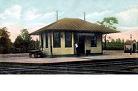
Better solution would be to just convert the old CNJ Seashore Branch / current Henry Hudson Trail back into rail service. If you follow the ROW of the tracks from Matawan north over the Parkway (where the bridge over it still has tracks) and then keep following it East to where it ends in Atlantic Highlands, it is pretty much in-tact and ends at an existing ferry terminal that is not too far from Earle's pier.

Think of it as a mini-River LINE; build a light rail line and have the south terminus be at Matawan station, and have the northeastern terminus be at the Seastreak terminal, with some stations in-between. Having to transfer once or twice to eventually get to the ferry might not be the most ideal situation, but if you can get the arrivals/departures of trains at Matawan to match arrivals/departures of this light rail line, and get those to match arrivals/departures of the Seastreak, most people likely won't mind.
 
It would mean a nice bike path goes away, but from what I've heard and seen from locals around the Henry Hudson Trail up there, it's often used for nefarious activities (usually drugs), so I'm sure it wouldn't be exactly missed by a lot of people, especially if it results in decent commuter service once again.
  • 1
  • 29
  • 30
  • 31
  • 32
  • 33