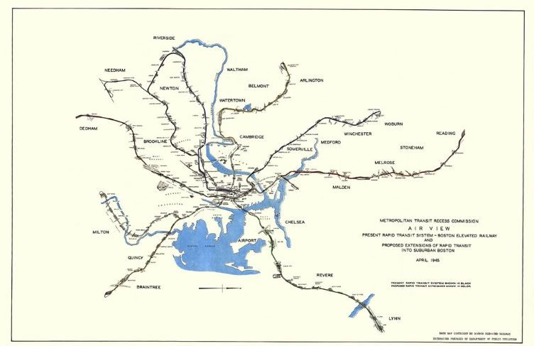
Fred- Yes, I'm surprised that they originally made them as two stations to begin with. Boylston may have been an envisioned jumping off point for extensions never built (like Post Office Square) back in 1897. If you look at the 1945 map, the Tremont St. side of the Pleasant Street Portal is for the Commonwealth Ave. Line (which loops after Auburndale to connect with the Highland Branch).
Octr- Yes, I think that you are right. It appears that what the drawing represents at East Watertown is the end of what we now know as the Red Line and the beginning of a line to Arlington Heights. They wouldn't have known "Light Rail" from heavy snail back in 1945, but who knows whether or not they envisioned a streetcar or rapid route to Arlington ? (Too bad that they didn't draw those little cars on the line like they did on the later map.)
After breaking away from the Highland Branch connection, it suggests a further expansion westerly after the Auburndale Station, over and past the Charles, as well. (Guarantee you that the Middlesex and Boston Street Railway Company would have wanted a piece of that !)
~Paul Joyce~
Moderator: Toy Trains, Model Railroading, Outdoor and Live Steam
Paul Joyce passed away in August, 2013. We honor his memory and his devotion at railroad.net.
