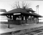
Railroad Forums 

  • Question about RDG row around Egg Harbor City

  • Discussion relating to the PRSL
Discussion relating to the PRSL

Moderator: JJMDiMunno

 #511929  by JJMDiMunno
 
Information re-printed from Tom Moran, via the PRSLHS email message system:
Reading Avenue as in Reading Railroad is the original RoW.
The straightest street (non-highway) in all of South Jersey.
Sure looks like an abandoned 'right-of-way. IT IS.
Heading east towards AC, you may come upon a 'signal tower'
base, all by itself, in the middle of nowhere.

Next time you're in the neighborhood, as you drive south on
NJ Route 50, Philadelphia Avenue, you cross the NJT AC Rail
Line...the next block is Reading Avenue. Turn right and STOP.
You should be 'on' or near abandoned Reading track.
The RoW is mostly a dirt road at this point. Look around,
you'll find track, if it hasn't been paved-over.
Apologies for re-posting, but this info certainly does answer the question.

Mike DiMunno

 #512217  by David
 
If you use Google Earth, you will see that West Aloe Street joins Reading Avenue north of the town. Follow Aloe Street through Egg Harbor. That is the ROW of the Reading line. Reading Ave TTD further north, and the ROW becomes more visible.

 #512944  by CJPat
 
What did the Reading do once it got to the body of water just east of what is now the Airport & GSP? Did the Reading hug tight to the PRR, bridge the lake, or drop south of the lake to avoid it?

 #512970  by prr60
 
CJPat wrote:What did the Reading do once it got to the body of water just east of what is now the Airport & GSP? Did the Reading hug tight to the PRR, bridge the lake, or drop south of the lake to avoid it?
It left the parallel run with the PRR (West Jersey) line near Tilton Road and went south across what is now the ACY air field. It ran south of what is now the lake (the railroad came before the Atlantic City Reservoir was established) and ended up next to the Newfield Branch into Atlantic City.

 #513038  by CJPat
 
That explains why I don't see any trace of a ROW through the woods on the North side of the Airport/Air Base when I view the area with Google Earth. Thanks for the reply, PRR60 :-)