Railroad Forums 

  • What was this spur off the Clarence/Peanut Line?

  • Pertaining to all railroading subjects, past and present, in New York State.
Pertaining to all railroading subjects, past and present, in New York State.

Moderator: Otto Vondrak

 #1541874  by Fireman43
 
Nice narrative and pics.
FACTOID: In regards to that 'cement plant' , trying to search around to find out any info on it came up empty BUT did find a reference to the Akron Plaster Board Co. at 8 Indianola Avenue in the village that apparently had service from the WSRR.

https://www.wnyhistory.org/portfolios/b ... laster.jpg

Came into existence in 1900 to utilize this new mineral called gypsum! Poking around the web quite a few articles on the 'gypsum caves' around Akron but as mentioned nothing on the cement plant out by Cummings Road.
location in center of the map - now named Aakron Line.

https://www.google.com/maps/@43.025061, ... !1e3?hl=en
 #1541896  by SST
 
My brother in law has been quite persistent in finding out about the cement plant. He too wasn't able to find anything. Last night I told him to include "The Peanut Line" and/or "New York Central RR" in his search. Look at what he found!

Image

What amazes me about this plant, is the reach it had around the country. It wasn't just a local plant. I hope somebody makes an information board [plaque] and save this thing before some jack ass says its an eye sore and tears it down.
 #1541963  by SST
 
According to your Newstead post above, the 5 Clarence Center Rd address is where their homes were. The plant that is mentioned in the article that I posted states that it is on the NYC&HR RR. The silos are 200 feet from the ROW right next to Cummings Road. The Cummings silos aren't really at the JCT. But this one is...…

Louisville Cement Company. We think this is the huge quarry along Main St [rt5]. The mobile home neighborhood sits right in between the quarry [auctioning cars] and the JCT. Here is a website with old pictures.


http://cdm16066.contentdm.oclc.org/cdm/ ... 3301/rec/1

In this 1927 aerial photo, you can see the silos on the Peanut. You can also see rail cars on the Peanut on the east side of 93. I don't see anything at 93 and Clarence Center Rd except for homes.
http://www2.erie.gov/aerial_photos/site ... b8_o27.jpg

This picture is the Louisville Cement Plant. It doesn't look like its taking trains from the Peanut. But it does show the spur for from the WS. And I know right where it is and have ridden my bike past it a hundred times. Its just east of the powerlines. Another visitation is required. :-D
http://www2.erie.gov/aerial_photos/site ... b8_n27.jpg
 #1541969  by nydepot
 
The cement/gypsum plants in the Arkron/Clarence area are very hard to decipher.

In your last map link, the little thing up on the Peanut by O27 is Cummings Cement. The huge thing under the Jct is Kelley Island and is off both WS and NYC. Two separate companies.

It took me several years of working with the historians in both areas to figure out what each plant was. They are easily confused and given how long ago some closed (and reopened in new places), it gets harder with each passing decade.
 #1541984  by Fireman43
 
Thank you
A simple mention and picture of the concrete plant literally in passing on your bike and the floodgates open with information..And silly me to think a dead end. Who knew?
In surfing around last night I did find a blog by one of these 'Urban Explorers' that posted pictures of exploring some of the Akron Gypsum caves, from the top of I believe the Cummings Rd cement plant and various area quarries - limestone?
 #1542831  by SST
 
Here are a few more pics that I recently took. After so many years of flying over it and wondering about it, it was a great feeling to finally explore it. I looked for rail in the ground but didn't see anything. Probably removed before they bulldozed the gypsum mine vent.

Image

Image

Target practice. I walked up to the base of the silos and looked underneath. After throwing a stick into the darkness, it is full of water.
Image

The next two photos are from the Louisville Cement Plant-The entrance from the WSRR. It was right where I expected it. What I didn't expect were two RR Ties....correctly located. Not just randomly thrown.

Image

After jumping across a ditch I walked a short distance on the entrance ROW. I would have walked to the end of it but I didn't want to leave my bike unattended. From the looks of it, its been awhile since its usage.
Image

I also noticed "correctly located" pedestals near the entrance. One was still in one piece but pushed off to the side but another was still in the ground but smashed.
 #1542838  by nydepot
 
There are multiple locations being talked about in this thread. I think for future readers it would be helpful if you gave a coordinate or exact address of where you are if you post photos. Not for each photo but for the general location you are visiting.

For example, for the last group of photos, there is no context at all.
 #1556396  by SST
 
With this wild gorgeous weather and today being the last day of it, I rode my bike along the Peanut all the way to Akron. I passed by the Cumnings plant [Silos] and sadly I see "they" have fenced it off. The brush is very thick even with the leaves off of them and therefore I cannot be certain that the entire plant is fenced in or not. But access from the Peanut will require jumping over the fence. Glad I got there earlier this year to check it out. Lets hope they leave it intact vs tearing it down for a condo complex. Awful!
 #1556428  by Fireman43
 
Newstead Historical meeting :on the cement plants - unsure if on this thread or another I remember mention of a meeting was to have been held in September at the Newstead Town Hall on the history of these plants.
I missed it but did anyone attend ?
Mark
 #1556473  by SST
 
Yesterday I got out some last minute biking and rode the Peanut. On my way back from Akron I stopped and explored the Universal Atlas Cement spur. Surprisingly, parts of the ROW are untouched and still in place.

As I entered "the spur" from Clarence Center rd, I didn't see anything obvious. Tons of brush and very thick. I couldn't really tell if the ROW was on my left, under the asphalt or to my right. I kept going. At about .5 [distance marker] you take a hard right turn. Suspicious that I just left the ROW I stopped and looked around. Just couldn't tell. Kept going and made the left turn. The sun is low in the sky with about 1/2 hour of sunlight left so I don't know if its helping or not. As I'm peddling along something catches my left eye. I looked and thought it was a culvert or something but I kept going to where I thought the ROW would be. But it was covered in brush. I turned around and went back to get a better view of the "culvert."

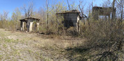
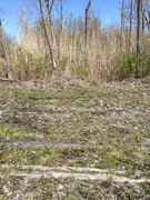
Turns out it is a concrete overpass over Got Creek with ballast to match in the correct position and direction of the ROW! I snapped these pictures and plowed through the brush. Its a RR! This is about .7 or so.

Overpass looking from the bike path: https://i.postimg.cc/dQ28bnMf/IMG-2358-1.jpg

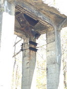
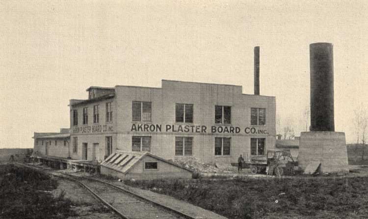
On top of overpass looking north towards the Peanut: https://i.postimg.cc/qBwNcFHp/IMG-2360-1.jpg

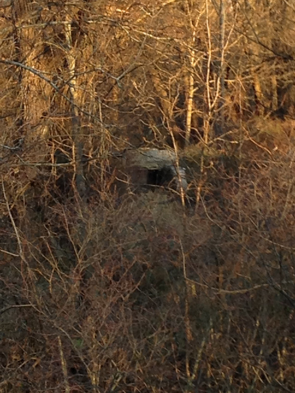
RR ties, plates and spikes at base of ROW which is about 4 feet high: https://i.postimg.cc/7LL4kKQn/IMG-2359-1.jpg

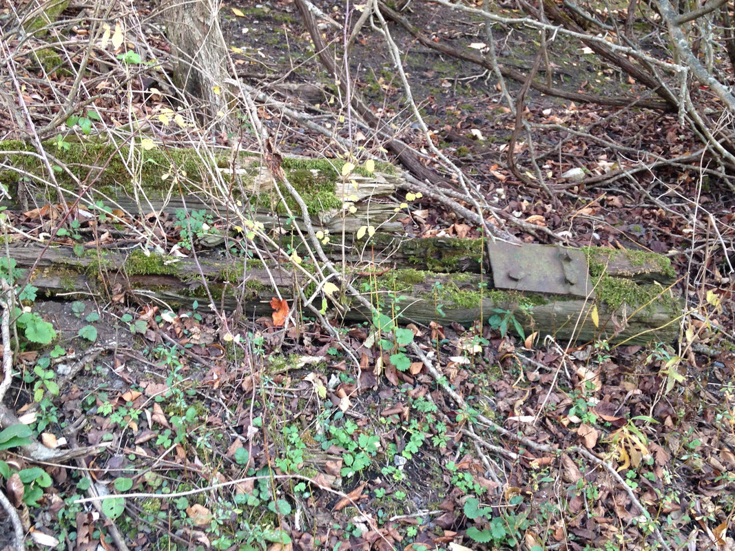
I then turned around and started walking south on the ROW. Again it kinda "disappeared." Not the usual stone ballast.

Looking south at about .8: https://i.postimg.cc/D0SRZz9C/IMG-2361-1.jpg

In the picture above, the "row" takes a bend to the left but just stopped at a pile of dead trees and brush so I didn't think that was the ROW. So I continued straight ahead. The obviousness of a ROW completely disappeared but I kept walking and came to piles of dead trees and brush mixed with trees still standing. Along with all this debris were more RR ties, plates and spikes. This is about 1.0: https://i.postimg.cc/KvkRXrHT/IMG-2362-1.jpg
This is now very close to Roll Rd. After reviewing the Erie County aerial pictures from both 1928 and 1951....Its a match and viewable!

This location with all the debris explains [to me anyways] why the ROW disappeared south of .8. They must have bulldozed the ROW to clear the road bed to make way for these crazy large homes and condos. After exploring the pile of debris I rode further south to Roll Rd, 1.2[the end]. The new development across the street will likely extend the path. The stone has been laid down.

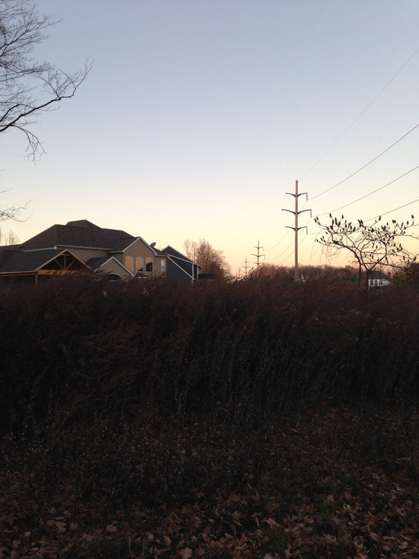
Anyways, now returning to the Peanut I stop again at .5 to take time to view the area and locate the ROW. Now that I know where the powerlines are and the overpass is, I found it and it rises about 6 inches above the rest of the surface area. I did take a picture of it but the light is not enough to really see the difference.

So I turned around and faced north on the ROW. If you take a look at Google satellite pics you'll see that this home has/had at least 20 RR ties in his back yard just about 100 feet straight ahead from where I'm standing. The ROW goes through the guys pool! haha Where I'm standing: 43.006511, -78.652191
https://i.postimg.cc/PqsQBqfW/IMG-2364-1.jpg

I continued north back to the Peanut and stopped before crossing the street cuz I was looking for where the ROW turned to connect. The grass is cut with a bend in it and it would match the likelihood of the ROW. Across the street the brush changes color which also is an obvious place for it. When looking at the Erie County pics and Google Sat pics, they match with what I saw. Right where it belongs.
Google: 43.015729, -78.651082

I did more RR biking the past several days all very exciting. I was in PA on the Little Toby path, the Alleghany RR path north of Emlenton, Pa [more scenic without leaves] and re-entered the tunnel where I fell last year and the Peanut yesterday. Best weekend ever. Next year the Alleghany again through the longer tunnel 3300.