Discussion of the past and present operations of the Long Island Rail Road.

Moderator: Liquidcamphor

  by nyrmetros
 
R36 Combine Coach wrote:Built 1928 (during grade separation) for express/LCL.
Was freight run on this line, and at the bayside station?
  by Doc Emmet Brown
 
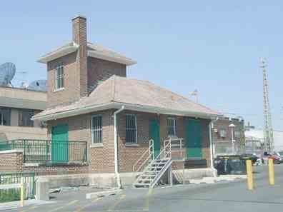
The elevator in the Bayside station was used for Items from passenger trains. The RR used to have combine cars. For mail and REA express items. I seem to remember an rea office on Bell blvd where the elevator still is.
Rea = Railroad express agency.. sort of the ups of its time.
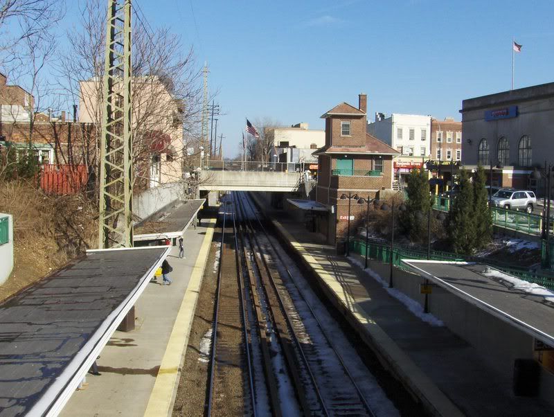
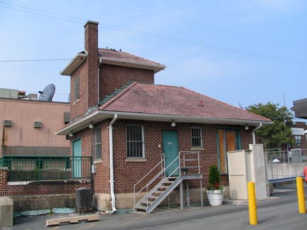
The elevator and freight house are the brick building on the eastbound platform. The green door is the elevator.
I took this picture in 2007 .
Image
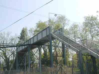
There was also a freight house east of the station on the North side of the tracks, just west of the pedestrian trestle.
The freight house is gone, the trestle is still there. In fact if you look closely you can see the pedestrian trestle in the background.
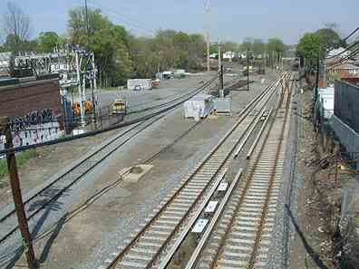
There was also a freight siding just east of the trestle, behind the current substation.
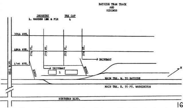
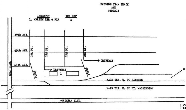
This map is from trains are fun.
Image
This photo is also from trainsarefun.com.
It shows a westward view from the pedestrian trestle, and the old freight house on the north side. Beyond the freight house on the north side, is the old 111 precient. It was next to the firehouse and is now a parking lot.
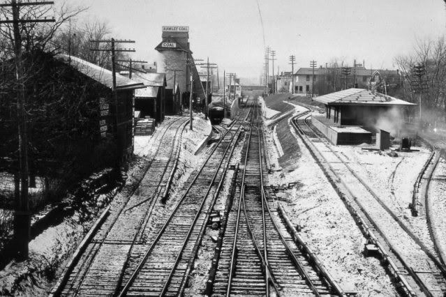
The old freight building in the station can be seen in this picture, on the south side. Im guessing this picture was in the late 20's early 30's. It looked like this untill the late 60's.
Image
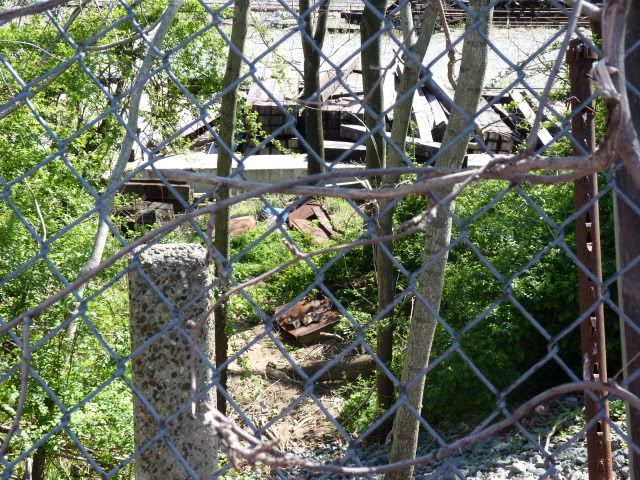
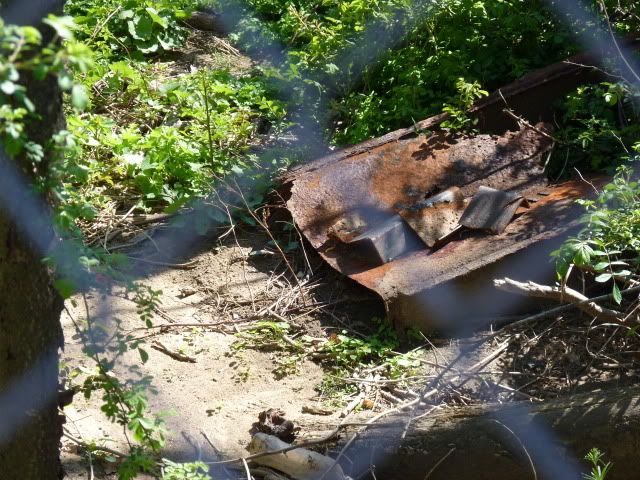
I remember in the 60's when they built the bay terrace shopping center, materials were brought in by train to that siding. There is also a coal slide still there on the north side of whats left of that yard, towards the eastern end of it.
We used to use it as a slide to play on, I lived nearby on 39th ave, two blocks away.
What was once a freight yard is now used by the MofW dept, and sometimes track cars can bee seen layed up in the YARD.
Google LIRR Freight stations, or LIRR Freight Sidings. There you will find lots of info, and pictures, mostly from trainsarefun.com.
Last edited by Doc Emmet Brown on Sun Mar 25, 2012 10:38 pm, edited 3 times in total.
  by nyandw
 
Great photo Doc. Thank you.

Yes the well known the LIRR 1966 map was not credited. However with the several 1000's of material posted almost all given the documentation as best I can.

The Bayside photo of the freight station was credited to its immediate right photo as follows:
Bayside freight station at right, Hawley Coal silo at left, depressed tracks for grade elimination 1/25/30. Looking west towards the station facilities, the express house with elevator shaft is visible in the center background. Note that all the sidings are electrified to allow freight operations with DD1 electric locomotives. (Dave Keller archive) We do not know the photographer.

Freight maps:
http://www.trainsarefun.com/lirr/images ... ington.gif Port Wash LIRR map
http://www.trainsarefun.com/lirr/lirrpa ... ex1903.jpg Time Table No. 26 Index page 1903 Freight Moves Archive: John Fusto.
http://www.trainsarefun.com/lirr/lirrtr ... rona15.jpg Corona LIRR 1966 map
http://www.trainsarefun.com/lirr/lirrtr ... Neck17.jpg Great Neck LIRR 1966 map
http://www.trainsarefun.com/lirr/lirrtr ... gton18.jpg Port Washington 1966 LIRR map

Electrification Notes: Freight sidings electrified: 1927-28 Bob Emery Notes


Image
LIRR #167 216th St. 1978 Photo: A. Joseph Daly

Other structures were unique to the railroad architecture. Express houses were usually open platforms. Later a roof was added but it was still an open, windswept platform. Still later, walls and a sliding door were added and a conventional "box" structure was now in place at the eastern and western ends of the platforms albeit some structures were larger than others and some had larger westbound structures than they had eastbound, because more stuff was shipped off the island rather than on.

While many of these looked the same, there were those that were unique, such as at Patchogue, Huntington (which had a Dutch Colonial/gambrel roof to match the 1910 station), Speonk, Oyster Bay, to name but a few. Research: Dave Keller

Image
Bayside, vacant, mid-1990's Photo: Kevin Walsh
Goods were unloaded on the platform and onto an elevator within the building and unloaded on 41st Road.

Note: Bayside's freight house, for example, was at grade east of the station plaza where the team tracks were located. Ditto for Lynbrook, Valley Stream, etc. Ditto for Lynbrook, Valley Stream, etc. Freight needed a means to be off-loaded which meant at structure at grade and nearby the team tracks.

The brick structure shown at Bayside with elevator accessing the sub-grade station platform was for lowering and raising customer's baggage to and from trains. Perhaps express items as well. Ditto for the elevator shaft visible for many years above the elevated Valley Stream station . . . used for baggage and some express. (Dave Keller info)
Last edited by nyandw on Sun Mar 25, 2012 11:39 pm, edited 3 times in total.
  by Doc Emmet Brown
 
These pics were from this site.
http://classic.forgotten-ny.com/SUBWAYS ... anch2.html
Looking east at whats left of the yard, from the pedestian overpass.. there is still a coal slide hidden in those trees towards the east end of that lot.
As I said we used to play on it when I was a kid.. nice long metal slide, think it was at the base of 217th street or 218th street. Might be in Ny next month, if I go Ill get a picture of it.
Image
The overpass itself.. yes its still there
Image
and the freight station/ex rea agency building.
Image
  by Jeff Smith
 
I think I've actually been to this station (Bayside); good little Italian cafe on the corner right at Bell Blvd overpass. Great Tirimisu! Never realized which LIRR branch it was.
  by nyandw
 
Not freight sidings but: Image 
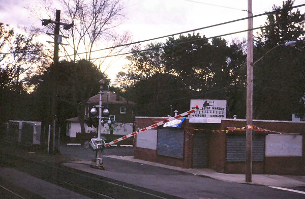
Whistle Stop Market Little Neck Pkwy Little Neck 05/96 View NW Photo: CAPT. William Gilligan US Navy
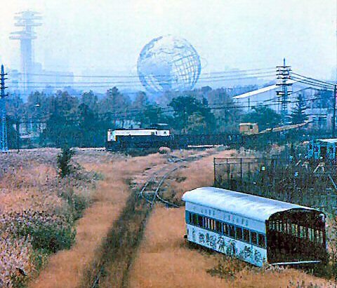
Image
The work train is eastbound on the Port Washington branch. Info: D.Keller/T. Darnell Photo: Tim Darnell

Roosevelt Ave bridge under the #7 line, facing southwest. The track in the foreground is the remains of the old Whitestone branch, looking towards the old 1964 World's Fair site. The cut-up car is in the lower end of Corona Yard, where a LOT of scrapping went on: regular passenger cars, parlors and diesels. This track accessed the yard.
  by R36 Combine Coach
 
At right is the IRT Corona Yard for the #7 line. The LIRR yard here is Shea Yard, as mentioned in other posts.
  by nyandw
 
Note: Bayside's freight house, for example, was at grade east of the station plaza where the team tracks were located. Ditto for Lynbrook, Valley Stream, etc. Ditto for Lynbrook, Valley Stream, etc. Freight needed a means to be off-loaded which meant at structure at grade and nearby the team tracks.

The brick structure shown at Bayside with elevator accessing the sub-grade station platform was for lowering and raising customer's baggage to and from trains. Perhaps express items as well. Ditto for the elevator shaft visible for many years above the elevated Valley Stream station . . . used for baggage and some express.
(Dave Keller info)
  by nyrmetros
 
Thanks for all the info about the Bayside station. It is always great to know the history of your local station.
  by Doc Emmet Brown
 
well im in NY for a few days, maybe ill visit that trestle and take sone 2012 pics from it. The coal slide on 218th street is no more, went to look and it, its rusted and in pieces at the bottom of the hill. took a pic put have no way of transferring it to the computer till i get home..
  by Doc Emmet Brown
 
218th street coal slide is no more, they either pulled it down or it rotted away.. whats left of it..
Image


Image
  by Doc Emmet Brown
 
Not a mile post, just an old LIRR stone fence post. I dont have a timetable anymore I forget what milepost Bayside is. 12 I think, i think, dont remember
  by Ocala Mike
 
Bayside is listed as MP 12.6 in my old Form LI-1.
  by nyandw
 
"Main Track East to Port Washington" on LIRR map 1966 is where MP 11 was located (at the pedestrian crossover which doesn't show on this map.) Bayside station had the ID of N11 (N meaning North Side division and 11 being the nearest milepost). Sure is real close to the location at 218th street. :-) What do ya think?

Image

Reason I'm asking is many mileposts look like this: http://www.trainsarefun.com/lirr/milepo ... eposts.htm

Image MP42 Islip 02/24/08
Photo: Mike McDermet

Image 
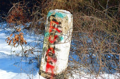
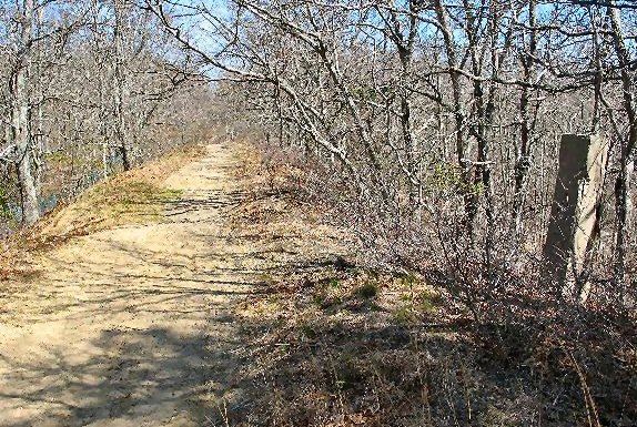
MP96 Sag Harbor Branch 04/22/07 Credit: Unknown
  • 1
  • 3
  • 4
  • 5
  • 6
  • 7