Is it a public trail south of Ruhle Road? Or is it just cleared because they used it for a gas pipeline?
Russ:
Not so sure whether it’ll be an official trail although it is wide, overly groomed and they spent a lot of money to install fencing at strategic spots. My guess is that the Double M Western Tack Store might have finagled a deal to use it for horses. But then again, the pipeline is pretty substantial and you can see from the satellite maps - the construction road continues straight eastward just a short while further south from the Creek:
http://mapper.acme.com/?ll=42.91826,-73 ... 2073.72431 So maybe it was built this solid just for conveyance?
What we hiked was super solid - built like a rail trail not a hiking or mountain biking trail. Couldn’t find any mentioned of it in the Saratoga P.L.A.N. but maybe I missed it. [Next time in the area I plan on mtn biking it]
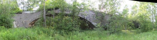
Your pics of the Willow Glen Bridge are more clear than mine, because I visited it in June of 2011.
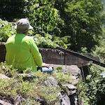
Yes my PICs are clear because there was no foliage. We walked the top and it was sprouting trees!
You can barely see it on the satellite view...
http://mapper.acme.com/?ll=42.91826,-73 ... 2073.72431
Your PICs are great and show it in a entirely different perspective!