• Silver Line Dulles WMATA Metrorail progress/pictures

  • Discussion related to DC area passenger rail services from Northern Virginia to Baltimore, MD. Includes Light Rail and Baltimore Subway.
Discussion related to DC area passenger rail services from Northern Virginia to Baltimore, MD. Includes Light Rail and Baltimore Subway.

Moderators: mtuandrew, therock, Robert Paniagua

  by Sand Box John
 
For Immediate Release
August 20, 2014
http://www.mwaa.com/7286.htm

Image

Airports Authority Statement Regarding TIFIA Loan Closing

Below is a statement from the Metropolitan Washington Airports Authority regarding Wednesday’s closing on a low-interest U.S. Department of Transportation 'Transportation Infrastructure Finance and Innovation Act' (TIFIA) loan for the portion of Dulles Corridor Metrorail Project funded by revenue from the Dulles Toll Road.

The Airports Authority applied for the TIFIA loan in conjunction with its local partners on the Metrorail Project, Fairfax County and Loudoun County, which are finalizing their segments of the loan.

"The finalization of this portion of the federal low-interest TIFIA loan for the Dulles Corridor Metrorail Project is the culmination of a months long team effort and represents $1.28 billion of support for users of the Dulles Toll Road, whose toll payments help fund construction of the Silver Line extension of the Washington region’s Metrorail public transit system.

"The Airports Authority and our project partners made securing a low-interest TIFIA loan a top priority, because of the financial benefits it offered to the Dulles Toll Road users and taxpayers. Thanks to the favorable interest rates the loan provides, as well as the financial commitment from the Commonwealth of Virginia, the Airports Authority will be able to hold tolls at current levels through 2018 and limit future toll increases.[a name="_GoBack"][/b][/color][/url]

"We appreciate the support and dedication of Northern Virginia’s congressional delegation, legislators and officials in Richmond and the numerous local elected, business and community leaders, all of whom have helped make this day possible. We are also grateful for the hard work and support of the TIFIA team at the U.S. Department of Transportation, especially Secretary Anthony Foxx, his predecessor Ray LaHood, Chief Financial Officer and Assistant Secretary for Budget and Programs Sylvia Garcia and her team, without whom this closing would not have happened.

"The Airports Authority will continue to work closely with all our partners to find additional opportunities to minimize future tolls."

In May the U.S. Department of Transportation approved a combined $1.875 billion TIFIA loan for the Airports Authority, Fairfax County and Loudoun County for the Silver Line project. While the closing on the Airports Authority’s $1.28 billion portion of the TIFIA loan has been finalized, Fairfax County and Loudoun County will have additional individual closings on their previously approved portions of the loan later this fall. The Airports Authority will be able to begin drawing on its portion of the loan once all closings are final.

The Metropolitan Washington Airports Authority, established in 1987 by the governments of Virginia and the District of Columbia, manages and operates Ronald Reagan Washington National and Washington Dulles International airports, which together serve more than 40 million passengers a year. The Airports Authority also operates and maintains the Dulles Airport Access Road and the Dulles Toll Road and manages construction of the Silver Line project, a 23-mile extension of the Washington region’s Metrorail system into Loudoun County, Va. No tax dollars are used to operate the toll road, which is funded by toll revenues, or the airports, which are funded through aircraft landing fees, rents and revenues from concessions. The Silver Line construction is funded by a combination of toll-road revenues, airport contributions and federal, state and local government appropriations. The Airports Authority is led by a 17-member board of directors, appointed by the governors of Virginia, Maryland, the mayor of Washington, D.C., and the president of the United States, and generates more than 387,000 jobs and 4.5 percent of GDP in the National Capital Region.

###

Dulles Corridor Metrorail Project progress update e-mail 08 20 2014 posted under Phase I of the Silver line open.
  by Sand Box John
 
"mackievlzpro"
Tree clearing has begun at the western end of the airport for revenue and yard lead tracks.


Actually the northern end.

From traffic advisory e-mail dated 08 01 2014

Construction Activities Continue North of Autopilot Drive at Washington Dulles International Airport

Starting the week of August 4 and continuing into the early fall months, Dulles Corridor Metrorail Project crews will begin site preparation work for the construction of the Silver Line's aerial guideway through the woods at the north end of Washington Dulles International Airport. Drivers should be alert to increased dump truck and heavy equipment traffic along Windshear Road, Materials Road and Ariane Way at the airport between 7 a.m. and 5 p.m., and should remain aware of changing conditions as large vehicles enter and exit the marked construction entrance.

Image

A 24/7 emergency hotline is available for Dulles Corridor Metrorail Project construction-related issues:844-385-7245. For general project information: www.dullesmetro.comor 703-572-0506.

Area where trees are being cleared, yard throat at west end of yard lead west of Horse Pen Run to Dulles Greenway, Dulles Greenway to Windshear Road.
Image
  by JackRussell
 
I was out at the airport about 2 weeks ago, and I could see that they were at work drilling pier foundations along Autopilot Dr - at the time there were about 8 or so that appeared to be complete. At the time the lighting was poor and it was raining so I didn't attempt to take pictures. After Labor day, I will head out there and get proper pictures.

At the time, there was no sign of any above-ground construction, but this didn't surprise me.

I have not seen any sign of any construction activity in and around where the new stations will be.
  by Sand Box John
 
"JackRussell"
I was out at the airport about 2 weeks ago, and I could see that they were at work drilling pier foundations along Autopilot Dr - at the time there were about 8 or so that appeared to be complete. At the time the lighting was poor and it was raining so I didn't attempt to take pictures. After Labor day, I will head out there and get proper pictures.

At the time, there was no sign of any above-ground construction, but this didn't surprise me.

I have not seen any sign of any construction activity in and around where the new stations will be.


This is what I saw out there on 07 26 2014:

Image Image
Site of east end of Dulles Airport station. Site of west end of Dulles Airport station.

Image Image Image
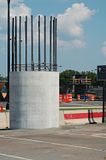
Column shaft Autopilot Drive at Hertz Way. Rebar cage Autopilot Drive at Hertz Way.

Seem the bedrock is reasonable shallow along Autopilot Drive. It appears the column shafts go down to bedrock eliminating the need to pour concrete cap on top of the piles driven to bedrock like was done in Tysons Corner.
  by JDC
 
Joke Insurance wrote:Is it at all possible to build an express route for the DC Silver Line, to where it bypasses certain stations? I haven't looked at the schematics, but if they have cross-over tracks at every station, could that work?

This article talks about it:

http://greatergreaterwashington.org/pos ... re-tracks/
I don't see this ever happening, even if GGW thinks it's technically feasible (under GGW's scheme, this would be technically feasible along the entire system.). The amount of coordination required would be tremendous and Metro simply is not that coordinated - trains bunch up far too much in the core and any express service would simply hit that wall at some point. I'm also not aware of any system that uses 'express trains' but only in skip stop fashion on regular/local lines.
  by Sand Box John
 
"Joke Insurance"
Is it at all possible to build an express route for the DC Silver Line, to where it bypasses certain stations? I haven't looked at the schematics, but if they have cross-over tracks at every station, could that work?


Sure it's possible, provided one could get the funds to build all of the additional infrastructure to support such a schema.

The airport station couldn't generate enough boardings to justify the costs of providing express service. When the full 23 mile 11 station branch is fully built out the airport station will likely account for less then 9 percent of the total boardings generated by the branch and less then 1 percent on the entire Metrorail system.

Fact is, the Silver line would have never been built without the 8 other stations along the route between the airport and Arlington County.

All one has to do is observe the traffic volumes at any given time on any given day on the Dulles Access Road compared to the Dulles Toll Road.
  by JackRussell
 
I went out to the airport earlier today, and found that much work has taken place since my last visit - some of it was in areas I didn't think to look the last time around. Many pier shafts have been poured, and work has begun on pier heads. And I am really starting to hate the lame road names out there...

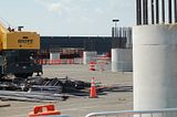
My starting point was the cell-phone waiting lot (corner of Rudder Rd and Autopilot) - mainly because it was easy and free to park, and I wanted to see what if anything could be seen from there. As it turns out, there are two pier shafts right in the middle of the parking lot. And in fact, once I spotted those, I spotted several others going off in the distance. Here is a view from the lot looking in a southwest direction:

Image

Forms for the pier heads are seen sitting in the background.

And looking northeast a couple more piers (the 2nd one in the background is still wrapped in black plastic):

Image

In a different corner of the parking lot, one can see the rebar being prepared for a pier head:

Image

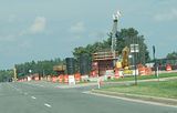
I went up Autopilot Dr, and there were many more piers - almost all the way up to Materials Rd.

Image

Image

Image

And finally this one - near Materials Rd:

Image

I drove around the other direction, and found many more piers that run parallel to Air Freight Ln. I could see that some piers had forms attached for the pier heads, and I presume that the concrete has already been poured. The pier that is furthest south is south of Package Court where Air Freight Lane ends in a large parking lot. None of the piers with heads had the forms removed yet, so I can only guess as to the final appearance of the piers.

There is no activity in the area where the airport station is, and so far I am not seeing any other piers being prepared between Air Freight Lane and the future station.

One thing that strikes me is that the piers seem closer together than with the piers on phase 1 - this leads me to suspect that they might not use trusses and post-tensioned segments to hold the actual track. But that's only a guess at this point.
  by Sand Box John
 
"JackRussell"
I went out to the airport earlier today, and found that much work has taken place since my last visit - some of it was in areas I didn't think to look the last time around. Many pier shafts have been poured, and work has begun on pier heads. And I am really starting to hate the lame road names out there...


It's an airport, what do you expect.

My starting point was the cell-phone waiting lot (corner of Rudder Rd and Autopilot) - mainly because it was easy and free to park, and I wanted to see what if anything could be seen from there. As it turns out, there are two pier shafts right in the middle of the parking lot. And in fact, once I spotted those, I spotted several others going off in the distance.

I have not been molested when parking off the pavement or in the lessor used crossovers along Autopilot Drive to take pictures. Also have also parked behind the orange and white construction barrels at Autopilot Drive and Materials Road.

I drove around the other direction, and found many more piers that run parallel to Air Freight Ln. I could see that some piers had forms attached for the pier heads, and I presume that the concrete has already been poured. The pier that is furthest south is south of Package Court where Air Freight Lane ends in a large parking lot. None of the piers with heads had the forms removed yet, so I can only guess as to the final appearance of the piers.

I had not realized one could access Air Freight Lane and Package Court, I was under the assumption those roads were in secured areas. Thanks for the heads up and the pictures.

There is no activity in the area where the airport station is, and so far I am not seeing any other piers being prepared between Air Freight Lane and the future station.

One thing that strikes me is that the piers seem closer together than with the piers on phase 1 - this leads me to suspect that they might not use trusses and post-tensioned segments to hold the actual track. But that's only a guess at this point.


The preliminary engineering drawings that were posted on the web for bid proposals showed the elevated spans as post-tensioned. The casting plant used to fabricate Tysons Corner post-tensioned segments along with the haul routes is also in the preliminary engineering drawings. The segments will range in height from 6' 9" along the station platform to 10' for spans greater then 125', spans under 125' use segments that are 8' high. The type of lifting gantry, if one is used at all, to the assemble the segments remains to be seen. If the same contractor that did the Tysons Corner elevated gets the contract, I would expect to see the same type of lifting gantries that were used in Tysons.

The design of the pear heads shown in the preliminary engineering drawing is slightly different compared to the ones in Tysons Corner. However based on that picture of the jig used to assemble pear head rebar cages they look like they will be closer to the Tysons Corner pear head design then the ones shown preliminary engineering drawings.
  by JackRussell
 
Sand Box John wrote: I have not been molested when parking off the pavement or in the lessor used crossovers along Autopilot Drive to take pictures. Also have also parked behind the orange and white construction barrels at Autopilot Drive and Materials Road.
There was some unusual police activity out there when I was there which spooked me a bit. But as I was leaving, I ran across 3 tour buses with multiple police motorcycle escorts that were entering along Materials Rd, and the police were stopping traffic and blocking off roads until the buses had gone past. Some sort of VIPs, I guess - I don't know who you need to be to get the special escort like that.
Sand Box John wrote: I had not realized one could access Air Freight Lane and Package Court, I was under the assumption those roads were in secured areas. Thanks for the heads up and the pictures.
The border fence between the secured and unsecured areas is right along Air Freight Lane, but there were no signs or barriers to prevent me from driving down Air Freight Lane. The southernmost pier appears to be just *inside* of the security perimeter when I look in Google Earth - I suspect they temporarily moved it to make room for construction.

As best I can tell, the short term plan is to continue building north - I can't find the PE documents, but my recollection is that the track remains elevated until it gets to the median of the Greenway. But I am not 100% sure of this, nor do I recall how much of the junction for the yard is to be built by the 1st contractor, and where the responsibility of the 2nd contractor (building the yard) begins.
  by Sand Box John
 
"JackRussell"

As best I can tell, the short term plan is to continue building north - I can't find the PE documents, but my recollection is that the track remains elevated until it gets to the median of the Greenway. But I am not 100% sure of this, nor do I recall how much of the junction for the yard is to be built by the 1st contractor, and where the responsibility of the 2nd contractor (building the yard) begins.


The preliminary engineering drawings are no longer at partners.myskanska.com presumably because all of the contracts have now been awarded. I downloaded everything for easy reference.

The main line continues on elevated to the median of the Greenway. The east yard lead branches off inbound track N1 north of curve that lines up the main line with the tangent of the median of the Greenway. The junctions of the west leads are at grade and flyover the at grade main line and the eastbound lanes Greenway. The east yard lead connect with Yard Lead 2 (outbound yard lead) about 4,400' east of the west end of the yard lead elevated abutment on the west bank of Horse Pen run.

See alinement of yard and yard leads in my post on 08 27 2014

I think it is safe to assume that all of the elevateds will be done by the same contractor.

The preliminary engineering drawings of the alignment on the airport property were prepared at different times, as you know, because of the location change to the airport station. The airport preliminary engineering drawings run from the west side of the Sully Road Dulles Toll Road interchange to about 150' south of Materials Road.
  • 1
  • 82
  • 83
  • 84
  • 85
  • 86
  • 126