• Need help with this old photo. Cansastota, NY?

  • Pertaining to all railroading subjects, past and present, in New York State.
Pertaining to all railroading subjects, past and present, in New York State.

Moderator: Otto Vondrak

  by NYCUticaSyracuse81
 
Hello, I recently found an old NYC mainline photo online and thought that maybe someone would be able to properly identify its exact location. I suspect that it is looking North towards the village of Canastota, NY just before the BeeBee bridge Rd crossing. I know that Canastota was probably the closest spot in central NY that the Erie Canal and West Shore/Third Rail came with the NYC mainline. Look at the photo very carefully on the right. It looks as though about half way down below the # 43 is the canal, and the electrified RR to the right looks like what is now part of the brief section of the Erie Canal Tow Path. The distances between the canal, the central, beebee brigde road, and the old West shore seem to be identical to this location today. Thanks to anyone who can help.
You do not have the required permissions to view the files attached to this post.
  by FarmallBob
 
I agree. A view EAST - not north - along the NYC main near Beebe Bridge Road is certainly plausible. The WS and what you believe is the original Erie Canal (now abandoned) would be correct for this location. This would then make the view from right around MP 272.

Incidentally one of my kids lives only a mile or so from the Beebe Bridge Rd grade crossing. I visit the spot almost every time I'm in Canastota.

...FB
  by NYCUticaSyracuse81
 
Yeah, I'm there quite a bit. Nice parking area to sit and watch trains, and I bike and hike there a lot on the tow path.

I meant to say East toward Canastota, not North. Must have been thinking North of the photo. Anyways, I can't think of any other place in central NY that this photo could be. It looks as if it were taken from an old signal bridge just before the curve west to Chittenango and around where the Erie Canal intersects with the mainline. Perhaps it was taken atop the old mainline bridge that crossed the Erie Canal during construction/maintenance? Both the canal and the West Shore were closest to the mainline in and around the village of Canastota, which is why I think this photo was likely taken there.
  by O-6-O
 
Wow!! What a find. I also concur It's an east facing shot. Looks like a headlight from something (trolley?) westbound on the elevated Shore. Signal bridge? .Very likely as the picture was taken right over the gap between tracks 3&4.
There is or was an old signal bridge base that is located between Main and Peterboro streets on the north side of what is now Railroad St in Canastota. That street of course was where the original tracks were before the realignment and crossing elimination project in 1959. The track was arrow straight from the curve west behind the photographer through Canastota, Wampsville and Oneida and didn't curve again till it got to Verona for it's run to Rome.
  by NYCUticaSyracuse81
 
So I bought the photo on ebay for a couple $$, but was unable to scan it in because the cardboard backing was very stiff and curved. However, I was able to get a great close up using my digital cam on a tripod. There's no doubt that it is indeed a photo of Beebe Bridge Rd. looking East towards the village of Canastota. Check out Bing maps for a birds-eye view.
You do not have the required permissions to view the files attached to this post.
  by U.V.#200 GE70 Tonner
 
One question,Brakemen or hobo on top of the boxcar? Just curious what everybody else thought.Thanks ,U.V.#200
  by FarmallBob
 
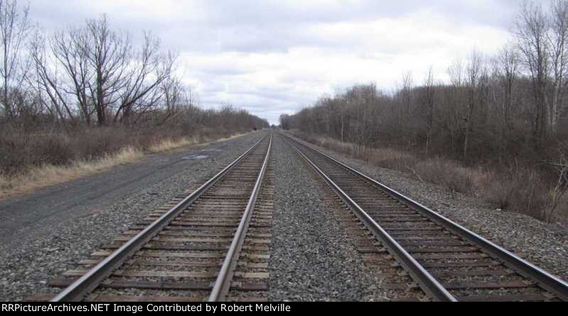
Here's what the view looks like today. It is looking east from a point about 1,500 ft west of Beebe Bridge Rd. (The relay shed for the Beebe Bridge Rd grade crossing protection is visible as ae dark spot to the left (north) side of track 1 in the distance.)

Tough to see in this photo, but the old Erie canal prism and the Westshore ROW are indeed in locations that match the original stereo photo.

You make the call!

...FB

Image
  by O-6-O
 
Yes you are right. That is the relay cabinet for Bee Bee bridge. The Westshore crossed Bee Bee on a bridge but any evidence of it today is long gone. The Shore west of

Bee Bee Rd is the Canal Park hiking path until you get to where the Shore crossed the original Erie. That bridge too is long gone and a large fill now occupies that location.

However the abutments for the original NYC Waterlevel crossing of the Erie is still there just 60 or so yards north. This must go back to the Syracuse& Utica days from the 1830's.

Also in that scanned enlargement at the extreme left you can make out what looks like a covered bridge taking the road over the canal. Cool or what? ( Is this BeeBee bridge?)
  by Alek9997
 
Amazing Old Photo you have there! Looks an infinity different now...Me and my Father used to watch CSX trains at that spot a lot. It's fun to take a pair of binoculars to that spot and watch the trains make the steep descent down the superelevated curves just West of the Village.

Great Find!

Alek S
  by charlie6017
 
Bob, usually a pretty busy place railfan-wise? Just curious.....

Thanks,
Charlie
  by FarmallBob
 
charlie6017 wrote:Bob, usually a pretty busy place railfan-wise? Just curious.....
Yes! The main is indeed busy - I'd estimate 40 - 50 trains per day.

My scanner picked up announcements from the detector at Oneida about 12 miles east. So there is plenty of advance warning for westbound traffic. Not sure the location of the closest detector to the west however - Kirkville perhaps? (My scanner heard nothing...)

There's no good spot to watch in town - the ROW is elevated throughout and pretty much cut off by trees. However the Beebe Bridge Rd crossing offers good views in both directions. And there's a rail trail parking lot conveniently located just south of the ROW here.

I posted a few of the images from the area here: http://www.rrpicturearchives.net/archiv ... x?id=76451

...FB
  by BR&P
 
Bob, re the photo of the unidentified caboose displayed at the ice cream stand, it's a Lehigh Valley for sure. If my info is correct that's the former LV 95047.
  by pumpers
 
Anyone want to venture a guess at the date? 1920-1930?
Is there anything like www.pennpilot.psu (which is for Pennsylvania) with old aerial photos for all of NY? Then you could look for the barn on the left, etc. JS
  by FarmallBob
 
BR&P wrote:Bob, re the photo of the unidentified caboose displayed at the ice cream stand, it's a Lehigh Valley for sure. If my info is correct that's the former LV 95047.
BR&P - Thanks....the caboose photo caption has been updated.

Incidentally my daughter and son in law report the ice cream sold near the caboose is excellent!

...FB