by CGRLCDR
How much is left of the Ashely Planes in PA? Does anyone have any map links of the area? Is it worth a 2 hour ride from New Jersey to visit the planes?
Railroad Forums
Moderator: Franklin Gowen
CGRLCDR wrote:How much is left of the Ashely Planes in PA? Does anyone have any map links of the area? Is it worth a 2 hour ride from New Jersey to visit the planes?Try: http://www.terraserver.com/imagery/imag ... er=1&t=pan
CGRLCDR wrote:We did catch a glimpse of what appeared to be an abondoned airport just west of 347 in the Glen Summit area. I can see it on Terraserver, also. Does anyone know what airport that was?(1) the airport was no longer needed when the planes were abandoned.
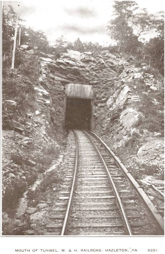
Also, I have a general question on the planes. How did they make money moving freight over the hill? It is so steep in that area that they must have been severely limited in the number of cars they could schlep over at one time. Surely the railroad must have been able to more efficiently use the back track for freight and passenger service.
CGRLCDR wrote:I guess the airport only looked abandoned from the raod. Here's the airport information.....It's not a public use airport and may have only the owner's plane so may well look abandoned. It is on the VFR navchart, though. Since it is private one only can land there with prior permission of the owner or in an emergency. Two short turf runways, one 1,800 the other 1,200 feet long. Even the public use turf airports are hard to spot from the air.
PA76 Rosenzweig Airport
Wilkes Barre, Pennsylvania
Location
Coordinates: 41-08-13.1800N/075-51-40.0000W ( 41.13699/ -75.86111)
Located 7 miles S of Wilkes Barre, Pennsylvania.
Estimated Elevation is 1930 feet MSL.
