• Mystery Railroads(?) in Whitneyville and Jonesboro ME

  • Pertaining to all railroading subjects, past and present, in New England
Pertaining to all railroading subjects, past and present, in New England

Moderators: MEC407, NHN503

  by trainsinmaine
 
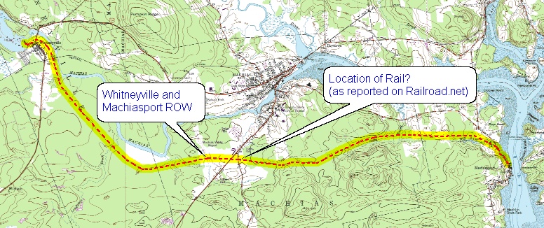
I was looking at Maptech's online topo map for Whitneyville, ME (near Machias) a few minutes ago and noticed something interesting --- broken lines that seem to indicate the existence of branch railroads off the MEC's old Washington County route, both of them in Whitneyville and one extending down toward Jonesboro. I am not speaking here of the roadbed of the Whitneyville and Machiasport Railroad, which extended through Machias to the sawmill and pier at Machiasport. I'm quite familiar with the W&M and the route it took. These are different. One leaves the MEC roadbed at its crossing with Route 1A between Machias and Whitneyville, and extends west-southwesterly for what appears to be a mile or so, toward the Machias River. The other, which is considerably longer, leaves the MEC a mile and a half southwest of Whitneyville at BM 72, near Arna Meadow Brook. It proceeds south for some distance, then makes a gentle S curve southwesterly toward the central part of Jonesboro, crossing Ebenezer Brook enroute.

I had never taken note of either of these before. Local logging railroads? Quarry railroads? I have no idea, and am wondering if some member of the Forum has.
  by ferroequinarchaeologist
 
trainsinmaine,

Do you have a copy of Michael W Zimmerman's The Sunrise Route? Page 186 shows a late 1800s map of Whitneyville, with a railroad running along the Machias River to the east of the village, beginning at a dam and mill complex at the point north of the village where the river makes an abrupt change of course, and running south to a connection with the Maine Central line south of the village, which suggests a very long siding to serve the mill and dam at Whitneyville.

PBM
  by Mikejf
 
That was the Whitneyville and Machiasport. http://www.catskillarchive.com/rrextra/wmme.Html This was one of the first railroads in Maine, and was there and gone before the Washington County Sunrise Route (Maine Central) was even built. It was a logging railroad that went from a mill to the sea at Machiasport.

I spent a couple days there a few years ago looking around. The Lion that is currently on display at the Maine State Museum in Augusta originally ran on this line.

This is a map one of my friends made a few years back.

http://www.spongeawareness.com/maps/RAIL05.JPG
  by Cosmo
 
I see a reference to "Location of rail? (as reported on RR.net)"
Can you tell me the post it's referencing and the forum, or provide a link?
Thanks! :-D
  by CarterB
 
I don't believe that is what trainsinmaine is referring to. On mapper.acme.com go to N 44.71150 W 67.54101 then look at what may be an abandoned rail line from that point on SSW to about N 44.67452 W 67.57534 (or perhaps beyond)
  by trainsinmaine
 
Precisely, CarterB. You've pinpointed the location. This is southwest of Whitneyville. As I said, it is not the ROW of the Whitneyville and Machiasport RR, which extends southeasterly out of the village, roughly parallels the Machias River, and goes smack-dab through the middle of the Machias Valley Airport. This ROW, whatever it is, heads toward Jonesboro, north of Route 1.
  by Mikejf
 
Ok. Now this must be where you are talking. That mapper site didn't show a thing. My settings are probably wrong.

https://www.google.com/maps/@44.7104978 ... a=!3m1!1e3

Looks like it may have been the old alignment, though I loose it when it gets into the cutting that has been done recently.

And I can not find where it would have joined the main line further west.
  by Mikejf
 
There are several locations they have realigned over the years all over the MEC system. I don't know why they would not have done it on the branch.