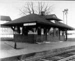
• Ferroequinology Questions in South Jersey

  • Pertaining to all railroading subjects, past and present, in New Jersey
Pertaining to all railroading subjects, past and present, in New Jersey

Moderator: David

  by CJPat
 
CTL10D wrote:Hi all-

CJPAT, you`d be amazed what a little regrading can do lol.....two similar and nearby examples i can think of include 1) where the Pemberton branch used to cross Shreve St (turns into Railroad Ave.) in Mount Holly. 2 guys I work with remember that x-ing having a huge hump up to get over it, and now the road has been "flattened" Its the same scenario as 537, just in reverse. The roadbed is a little higher now than the roadway. 2) Also, route 70 used to cross over the same line on a bridge, which has long since removed and filled in, but it doesnt appear high up enough to have gone over the RXR, they probably lowered that a little too. Take care -Chris
Chris - You Mention another interesting crossing. I never put much thought in the PRR crossing Rt 70. It was definitely out in the sticks back then so I would suppose it was probably a grade crossing? I haven't seen a lot of photos from that branch (at least via the internet). Looking at the ROW, even in the vicinity of Whiting, I have never noticed anything like rail embankments. Nothing but long stretches of white sand. When they pulled the rails, it looks like they made sure to wipe out all traces of it's existence.

  by David
 
CJPat wrote: Chris - You Mention another interesting crossing. I never put much thought in the PRR crossing Rt 70. It was definitely out in the sticks back then so I would suppose it was probably a grade crossing? I haven't seen a lot of photos from that branch (at least via the internet). Looking at the ROW, even in the vicinity of Whiting, I have never noticed anything like rail embankments. Nothing but long stretches of white sand. When they pulled the rails, it looks like they made sure to wipe out all traces of it's existence.
Definitely was a bridge at Rt 70. I used to ride my Ossa motorcycle under it. Parked the car in the Mount Misery Methodist retreat, about 500 yards from the ROW, and took the line to Whiting Jct., then to Toms River and back. It took most part of the day.

  by 1st Barnegat
 
CJPat wrote:...Did the bridge over the ROW on 537 have a flat grade, which means they removed the approach grades to the bridge (would have required a lot of soil removal) or did the bridge have a hump in the middle to provide the necessary clearance for the train?

I would guess that the soils from the bridge approach were used as the backfill in the "trench"
The Rte. 537 bridge over the Union Transportation RR had a hump in the middle to provide clearance for the trains below. Now of course the hump is smoothed out and the road repaved. You can still see the now abandoned railbed below the road about 6 ft down or so...

  by CJPat
 
David - Rt 70 now appears higher in elevation than the ROW property. Once they removed the RR bridge, they must have put alot of fill to fill in the roadway cut, or did I misunderstand you and Rt 70 had the bridge over the RR?

  by David
 
CJPat wrote:David - Rt 70 now appears higher in elevation than the ROW property. Once they removed the RR bridge, they must have put alot of fill to fill in the roadway cut, or did I misunderstand you and Rt 70 had the bridge over the RR?

Rt. 70 went over the railroad. It was a long bridge and looked at a distance like it was just a hill in the area that the road was just going up the hill.

  by GSC
 
Yup, a bridge went over Rt 70.

There was a lake right there my family liked to go to for picnics and swimming when I was a kid. Never saw a train on the line, at least when we were there, in the early 1960s I recall. White sand and scrub pine, lake water you could drink (almost), classic Pine Barrens.
  by MoonMix
 
folks...I realize this is an old thread...but (at least for CarterB), I found the section south of Pemberton-Browns Mills Rd., where it runs through Fenwick's Glen...the trestle remnants at the Rancocas (also mentioned in Beck's 2nd book)...& the grade/ROW of the Western wye curving toward New Lisbon.

What I haven't found...& which is plainly detailed on the 1876 atlas...is the almost straight run wye (Eastern wye, if you will) running into the NJ Southern. The grade should have eminated straight off the curved wye S of the Rancocas, but I'll be doggone if I passed it in the woods. I also hiked the NJS back Westward toward New Lisbon from Greenwood Bridge Rd., but could't find any grade forking off to the N. That leg remains a mystery (at least to me).

Mark Forman
WestJerseyRails.com
Last edited by MoonMix on Sat Feb 21, 2009 5:44 pm, edited 1 time in total.
  by Mr. Ed
 
Several years ago, we were driving north on 206 from Pemberton, to jump on the turnpike. One of my passengers was an older gentleman very versed in all of the old rail lines in the area since he used them all as a little boy. Every few minutes, he would call out the line that crossed 206 including the name of the operating railroad and where was going when he used that line (school, visiting family or friends, etc.). I was surprised at how many there were (if memory serves me, it was four or five.) But you must remember that back in early 20th century, you either traveled by horse and wagon or rail.

And the line of topic here is one of the three lines that were being considered to return rail service to the mega base at Ft. Dix/Macguire/Lakehurst.

Later!
Mr. Ed
  by CarterB
 
MoonMix wrote:folks...I realize this is an old thread...but (at least for CarterB), I found the section south of Pemberton-Browns Mills Rd., where it runs through Fenwick's Glen...the trestle remnants at the Rancocas (also mentioned in Beck's 2nd book)...& the grade/ROW of the Western wye curving toward New Lisbon.

What I haven't found...& which is plainly detailed on the 1876 atlas...is the almost straight run wye (Eastern wye, if you will) running into the NJ Southern. The grade should have eminated straight off the curved wye S of the Rancocas, but I'll be doggone if I passed it in the woods. I also hiked the NJS back Westward toward New Lisbon from Greenwood Bridge Rd., but could't find any grade forking off to the N. That leg remains a mystery (at least to me).

Mark Forman
WestJerseyRails.com
From best I can determine from modern vs. 19th century maps, the wye should have been just about where Mt. Misery Rd. turns slightly from E/W to heading SE between Lisbon Rd. and North Woods Rd.. ( N 39.95818 W 74.62481) Also, look at http://www.historicaerials.com/Default.aspx for New Lisbon, NJ, then zoom in to the Misery Rd / Woods Rd area and go to the 1931 version of the map. Shows some detail of the wye.

MoonMix, did you happen to take any pics of what you did find?
  by JimBoylan
 
The N.J. Rte. 70 grade crossing elimination bridge over the PRR line between South Pemberton and Toms River, etc. was on entirely flat land, so 2 massive piles of sand were needed for approaches to avoid an abrupt hump bridge. I don't know where it all went when the bridge was removed recently
  by MoonMix
 
CarterB...

Great link/site...but it won't zoom for me.

YES...I took a slew of digital shots...(which I'll post soon)...but all of the western (curved) wye...not the eastern straightaway wye.

I'm going back to find that eastern leg...w/ my new eTrex Legend GPS & the camera...[but...1st...I really should post my findings on the C&A's original stone sleeper railway section in Old Bridge at the former A-B beer plant (which I found today)...& their overgrown, neglected condition...(& w/ the Rails now gone)]...then I'll be back to the Kinkora.

thanks a bazillion,


Mark Forman
WestJerseyRails.com...[soon-to-be...JerseyRails.com]
  by CTL10D
 
Mark-
Funny you mention stone sleepers. There was another section of sleepers somewhere else on the Camden and Amboy, thats now been donated to the New Jersey Museum of Transportation (Pine Creek Railroad) in Allaire State Park. One of our members found out they wanted to get rid of them, and was able to arrange a donation. -Chris
  by MoonMix
 
thanks for that info Chris...

I was heading that way in a couple of days anyway...I'll check it out

thanks again,


MarkForman
JerseyRails.com
  by JimBoylan
 
When the last tracks were removed from Hightstown about 1990?, some stone ties were found under the ballast.