• Science Park Renaming / Boston Neighborhoods

  • Discussion relating to commuter rail, light rail, and subway operations of the MBTA.
Discussion relating to commuter rail, light rail, and subway operations of the MBTA.

Moderators: sery2831, CRail

  by sery2831
 
From MBTA.com: http://mbta.com/about_the_mbta/news_eve ... nth=&year=
‘WEST END’ ADDED TO SCIENCE PARK

Start Date: 01/21/2009 End Date: Email: [email protected]

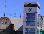
The Boston neighborhood which is served by Science Park Station will now be properly recognized with its name added to signs at the 50-year old Green Line Station. MBTA General Manager Dan Grabauskas was joined by city officials and representatives from the West End Civic Association for an informal dedication ceremony. Station signs reflecting the ‘secondary name’ have been posted at the Green Line station, which serves about 2,100 people on a typical weekday. "For many years the West End community lived in the shadows of some of the city's better known neighborhoods, but residents here have always realized its contributions to our history,” said Boston Mayor Thomas Menino. “Today is an important day for the West End, as many more people will now understand and recognize its place as a proud neighborhood of Boston."
And from Boston.com:

With new station name, Green Line now stops in West End
January 21, 2009 02:57 PM

By Andrew Ryan, Globe Staff

More than 50 years after bulldozers flattened the brick tenements of the West End, the neighborhood finally has its very own MBTA stop. New signs are being hung today at the Green Line trolley stop formally known as Science Park. The new name -- Science Park/West End. But that West End designation won't show up on any T maps. It is a symbolic local change that will only be visible in the 30 plus signs on the trolley platform and at the bottom of the green stairs that lead some 50 steps up to the station at the foot of the Charles River Dam. Nonetheless, defenders of the West End are delighted that the Massachusetts Bay Transportation Authority is making the nod to the neighborhood's original name.
Read the rest of the story here: http://www.boston.com/news/local/breaki ... tatio.html
  by TomNelligan
 
The irony is that Science Park station isn't even really in the old West End... it's on landfill in what used to be the Charles River channel. A true West End station would have been on the old viaduct south of the river's edge (or directly above the current underground Green Line layover tracks). But I guess that as examples of Massachusetts political correctness go, this one is fairly harmless.
  by 3rdrail
 
Yup - would be more appropriate at G-Center. (And even that's right on the brink, but look for it there in the near future.) This current reference to the West End may be more than sentimental as it's been made common knowledge that a new location for City Hall may be forthcoming. If that happens, the West End may make a repeat performance - not as a "neighborhood", but most likely a park/Commercial/Residential with multi-unit dwellings area. (Bet you see that, then Marginal Way/Tremont getting a "do".) Many persons, including myself, would like to see something(s) tastefully and artistically done there, as it really is a showpiece for the city, with it's proximity to Downtown and the Fanuel Hall Marketplace. I don't think that you are going to see a new version of Peachie d' la Rose or Candy Barr appearing at the "New" Howard, but a nice park and restaurants would be nice. :-D
  by Gerry6309
 
The West End name was appropriated by the famous street railway whose charter never included that neighborhood. Indeed only the Middlesex Street Railway (over trackage owned by a competitor) ever entered the neighborhood, using surface tracks along Leverett St. (Don't look for it - it ain't there! - Lomasney way comes nearest.) That was used by night cars only when the Lechmere Viaduct opebed in 1912. The only other service provided nearby was on Cambridge St. also abandoned at an early date. Science Park Station opened around 1955, just before the neighborhood was bulldozed. The Mass General Hospital had already formed a wall between Charles Station and the West End from the time that station opened in 1932.

(Edited to correct Charles date and clarify past operations - Gerry)
Last edited by Gerry6309 on Thu Jan 22, 2009 8:09 am, edited 1 time in total.
  by R36 Combine Coach
 
The Back Bay station also had a secondary subname of "South End", at least several years after the Southwest Corridor subway opened in 1987.
  by MBTA3247
 
Gerry6309 wrote:The West End name was appropriated by the famous street railway whose charter never included that neighborhood. Indeed only the Middlesex Street Railway ever entered the neighborhood, using surface tracks along Leverett St. (Don't look for it - it ain't there! - Lomasney way comes nearest.)
Curious, because I happen to have the 1865 street railway map for Boston and the 1892 West End Street Railway Map on my computer, and they would appear to contradict that claim. According to the former, the West End was served by the Middlesex St. Rwy., coming from City Square in Charlestown; the Cambridge St. Rwy., coming in from Cambridge on Leverett St and Cambridge Street; and the Metropolitan St. Rwy, which had it's own line to Causeway Street to serve the forebears of North Station and shared trackage with the Cambridge St. Rwy between there and Charles St (the map doesn't indicate who owned the tracks and who had trackage rights).

The 1892 map shows that most of that trackage was still around (indeed, the network had been expanded), and all of it was under West End control.
  by Gerry6309
 
Somerville was Middlesex territory, and that is where most of the service into the West End came from. Only the forebearer of the present day 69 bus was Cambridge Territory. I am referring to the charter territory of the West End (Back Bay/Brookline/Brighton) not what they acquired in the mergers.
  by StevieC48
 
Shoot since they are adding names and "renaming" Science Park, they should change the name of Lechemere to something more appropriate since the Lechmere stores no longer exist.. Mabe Cambride Side or East Cambridge. What other stope do you think need changing because of area changes etc.???
  by jonnhrr
 
Gerry6309 wrote:The West End name was appropriated by the famous street railway whose charter never included that neighborhood. Indeed only the Middlesex Street Railway ever entered the neighborhood, using surface tracks along Leverett St. (Don't look for it - it ain't there! - Lomasney way comes nearest.) That was used by night cars only when the Lechmere Viaduct opebed in 1912. The only other service provided nearby was on Cambridge St. also abandoned at an early date. Science Park Station opened around 1955, just before the neighborhood was bulldozed. The Mass General Hospital had already formed a wall between Charles Station and the West End from the time that station opened in 1922.
I'm sure it's just a typo, but Charles opened in 1932.

Jon
  by Gerry6309
 
StevieC48 wrote:Shoot since they are adding names and "renaming" Science Park, they should change the name of Lechemere to something more appropriate since the Lechmere stores no longer exist.. Mabe Cambride Side or East Cambridge. What other stope do you think need changing because of area changes etc.???
The store andstation were both named for the square, which was there before both ;).
  by Gerry6309
 
jonnhrr wrote:
I'm sure it's just a typo, but Charles opened in 1932.

Jon
Fixed, thanks.
  by Gerry6309
 
It should be noted that the West End was a very congested area around the turn of the 20th century. The present-day mess on either side of the Charles here didn't even exist. The Lechmere Viaduct took a shorter, more direct route to Leverett St. crossing two blocks diagonally, starting the land clearing tradition followed in the 1950s. In doing so it completely bypassed the neighborhood, leaving most transit service on the periphery of the West End. The surface tracks remained for some years, but the 1936 system map, the first to show individual routes, shows nothing in the area other than the viaduct. This was 20 years before "Urban Ruinall" struck.
  by Gerry6309
 
The map shows the influence of the underlying companies upon West End management. The main lines of the Boston Consolidated (Middlesex), Metropolitan and South Boston companies are all tied into this plan. The Cambridge RR is also included via Cambridge St., though the main line via the West Boston Bridge is not. The West End's pioneering electric line to Brookline and Brighton is ignored. Interestingly, the Cambridge main was the second to get electric cars! The omission of the West End's own main was corrected with the Boylston Street leg of the Tremont St. Subway as actually built.

A year later, another upstart company would put out a similar plan with better access to Cambridg, Somerville and South Boston. In four years it would also merge with its larger rival. That company was the Boston Elevated Railway.
  • 1
  • 2
  • 3
  • 4
  • 5
  • 7