• New Jersey Seashore Lines: was CNJ being cleard Woodmansie>N

  • Pertaining to all railroading subjects, past and present, in New Jersey
Pertaining to all railroading subjects, past and present, in New Jersey

Moderator: David

  by mdamico23
 
CJPat wrote:I am surprised it took Conrail 5+ years to figure out that the Southern Division was redundant. I wonder what changed to make them realize that. I thought there were only very few customers between Woodmansie and Winslow. Conrail was very quick to make those assessments elsewhere.

I think one reason why the Southern Division was retained for 2+ years after the startup of Conrail was its potential as a freight bypass around the Northeast Corridor. In the early years of CR, much traffic coming from Philadelphia and points south was still routed over the NEC towards North Jersey. When the Southern was taken out of service as a through route in 1978, the gradual shift was on away from the NEC to the former Reading and Lehigh Valley lines. 1978-79 was also around the same time that another through north-south through route, the old Camden & Amboy, was severed in the area of Jamesburg.

Not sure if this is true or not, but I also heard that the Southern was initially kept intact as a through route due to Earle NWS. Supposedly, Earle wanted rail access from both the north and south. Of course, even if the Southern was taken OOS south of Woodmansie, they would still have rail access from the south, using the former Pennsylvania RR branch from Freehold to Farmingdale. (Of course, this is now OOS as well).

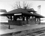
I have the USRA "Preliminary System Report" for the Southern issued in 1975. I will try to post it here in the next couple of days. It gives carloading info on the line in the mid-1970s. The Southern was doomed from the start under CR as it was "not recommended" for inclusion in the Conrail system, and the amount of customers between Woodmansie and Winslow were neglibile.

-Mike
  by rrbluesman
 
What customers were there between Winslow and Woodmansie? I have hiked the route from where it ends north of Elm through to Carranza, it doesn't seem like there was anything there by the mid-twentieth century.
  by mdamico23
 
rrbluesman wrote:What customers were there between Winslow and Woodmansie? I have hiked the route from where it ends north of Elm through to Carranza, it doesn't seem like there was anything there by the mid-twentieth century.
I think there was something in Chatsworth, but I'm not entirely sure. I will did out the 1975 USRA report over the weekend, as they listed car counts by "station."

-Mike
  by Hulka
 
It has been a long time since I have been out there but if I recall I think that the tracks cross the road 2 or 3 times to different abandoned building out there. (Just south of Rt. 72.)
  by David
 
There was some type of metal smelter on the right side of the tracks in Chatsworth heading towards Rt. 72. On the left side of the tracks was a chemical distribution business. Those tracks are still there and buried in the asphalt leading to the old buildings and back to the main line in Chatsworth. When I first saw the active tracks in 1970, there was a small rail yard in Chatsworth just before the main crossing on the opposite side of the fire house. Several small work sheds were there. About ten years ago, some metal "scrappers" took the tracks from the yard to several feet past the fire house. They were caught and there was a large pile of tracks left near-by. From what I was told, the men were dressed in Conrail uniforms when they were taking the rails. Someone, living in town was suspicious seeing that the men were doing this on a Sunday and call the authorities. Chatsworth is about two miles from Woodmansie.
  by TOMSTV
 
DAVID is right about the factory,the "West Jersey Chapter" CREW CALLER" May & June 1992 talk about the operation.you can see it on the historical ariel views 1936.
  by glennk419
 
Schmatzy wrote:Speaking to the timing issue and perhaps long term North/South considerations might be these improvements now set for the Delair Bridge.


http://www.philly.com/philly/news/new_j ... 0Up%20Call
Original link didn't work, see if this is better: http://www.philly.com/philly/news/new_j ... links.html
  by pumpers
 
glennk419 wrote:
Schmatzy wrote:Speaking to the timing issue and perhaps long term North/South considerations might be these improvements now set for the Delair Bridge.


http://www.philly.com/philly/news/new_j ... 0Up%20Call
Original link didn't work, see if this is better: http://www.philly.com/philly/news/new_j ... links.html
So the Delair is not now rated for the modern standard of 286,000 lbs, but will be fixed up for that? If so, great! I am a bit skeptical about 3500 port jobs though being created-- that's a lot!

JS
  by glennk419
 
pumpers wrote:
glennk419 wrote:
Schmatzy wrote:Speaking to the timing issue and perhaps long term North/South considerations might be these improvements now set for the Delair Bridge.


http://www.philly.com/philly/news/new_j ... 0Up%20Call
Original link didn't work, see if this is better: http://www.philly.com/philly/news/new_j ... links.html
So the Delair is not now rated for the modern standard of 286,000 lbs, but will be fixed up for that? If so, great! I am a bit skeptical about 3500 port jobs though being created-- that's a lot!

JS
The article said improvements were being made so the bridge could continue to carry 286,000 lb cars.
  by napp1111
 
So does this mean that Clayton will be running trains south and not on nj transit line
  by pumpers
 
glennk419 wrote: The article said improvements were being made so the bridge could continue to carry 286,000 lb cars.
Got it, thanks, JS
  by nomis
 
napp1111 wrote:So does this mean that Clayton will be running trains south and not on nj transit line
only if trains could fly ...
  by Schmatzy
 
Took these today as I was curious to see the improvement referenced at Savoy Blvd. some time back here. You should be able to view them as attachments. One shows the new crossing signs, the next the crossing upgrade to match both Diamond Road and Lacey. The last is what makes this whole deal so curious. That is a shot of the track looking north from the truck entrance to the so-called Hansen sand pit.
This is starting to remind me of the old Al Capp panels of Russia, where all the workers were hanging out of windows which looked like beautiful apartments but were just facades. So we have these grade improvments in between but if you look at the origin and anything north now of Wranglebrook Rd. to Crestwood Six it just has you scratching you head. Like building a bridge from the middle of the river.
I am writing this since I have made two trips now to Stop and Shop and each time the panic button set is clogging up the checkout. You want to see irresistible force meeting unmoveable object put a senior in a self checkout line. I saw one guy trying to scan his license.
Its a no'easter. It rains. The wind blows. Then its over.
Anyway thought you might want to see the finished product. There are several grade crossings just north of this one. Mt. Misery road for one which haven't been touched since they ran the brush clearing vehicle down it last year.
Next HAS to be Rt.539 and I'll be looking there next for any sign of life. May want to post a photo of what's there before that happens...after Frankenstorm
You do not have the required permissions to view the files attached to this post.
  • 1
  • 88
  • 89
  • 90
  • 91
  • 92
  • 124