pierrerabbit wrote:Chessie - No. This is across the river from neshanic (the white bridge). If you look at Google Maps, type in "Neshanic Station NJ", it will pinpoint the intersection of Elm, Mill Ln, and River Rd. Follow Mill Lane travelling East, and the map even shows where the tracks cross. There is an awesome photo oportunity of an NS freight travelling over the tunnel.I'll see how far I can walk today. It would be nice to get out there myself, not to mention, use some new glass...
Railroad Forums
Abandoned tracks in Hillsborough, NJ
- Pertaining to all railroading subjects, past and present, in New Jersey
Moderator: David
My son and I plan on going down there soon. 
Chessie GM50 wrote:Good luck with the winds out there!pierrerabbit wrote:Chessie - No. This is across the river from neshanic (the white bridge). If you look at Google Maps, type in "Neshanic Station NJ", it will pinpoint the intersection of Elm, Mill Ln, and River Rd. Follow Mill Lane travelling East, and the map even shows where the tracks cross. There is an awesome photo oportunity of an NS freight travelling over the tunnel.I'll see how far I can walk today. It would be nice to get out there myself, not to mention, use some new glass...
Moderator:NJT Rail
Windy? Yeah. Went to the tunnel today, here's some shots. Sorry, my timing was off, no NS trains going over the tunnel.
1. Eastbound shot of the ROW. Mother Nature has reclaimed it:

2. Westbound view:

3. Eastbound view:

If you visit, wear boots. The ROW has become a creek.
1. Eastbound shot of the ROW. Mother Nature has reclaimed it:
2. Westbound view:
3. Eastbound view:
If you visit, wear boots. The ROW has become a creek.
Wow nice shots I told ya it was windy!
Moderator:NJT Rail
pierrerabbit wrote:Windy? Yeah. Went to the tunnel today, here's some shots. Sorry, my timing was off, no NS trains going over the tunnel.Hmm, when were you there? If I went this afternoon, I'd have seen you... just a bit too windy for me.
1. Eastbound shot of the ROW. Mother Nature has reclaimed it:
2. Westbound view:
3. Eastbound view:
If you visit, wear boots. The ROW has become a creek.
We were there around 10-11 AM, dressed in many layers. If you go, it is somewhat rough back there, mud, sticker bushes, downed trees, lots of water, like I mentioned, the ROW has become a creek. One of the fascinating things we found was that some of the cut stones used for the walls were engraved with letters. Were theses the initials of the stone cutters?
pierrerabbit wrote:Not sure of the exact dates, but there were occasional freights on the branch into the 70's. My guess is the tracks between Somerville and Three Bridges were torn up around '75-'76.I moved into Neshanic Station in '79. The tracks were fully in place [albeit somewhat overgrown] from Three Bridges, past the Neshanic RR station, and over the bridge crossing the South Branch of the Raritan River well into 1980. I was 16 at the time and trying to build a track speeder to ride the route. I never finished it. I then got my driver's license and bought an old Pontiac to restore instead.
The fed gov't agency regulating RRs at the time forced abandonment of the branch in 1974 from Somerville to Flemington because the tracks were so bad and the only customer left was getting tank cars filled with chemicals. From that point on, the tanks came up from the other end from the BelDel.
The row thru the Duke estate has been obliterated and a paved road called "railroad street" built on top of it. I guess the Duke family bought the row when the CNJ was in bk.
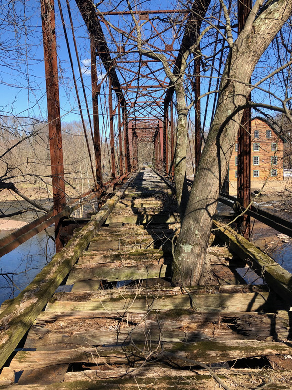
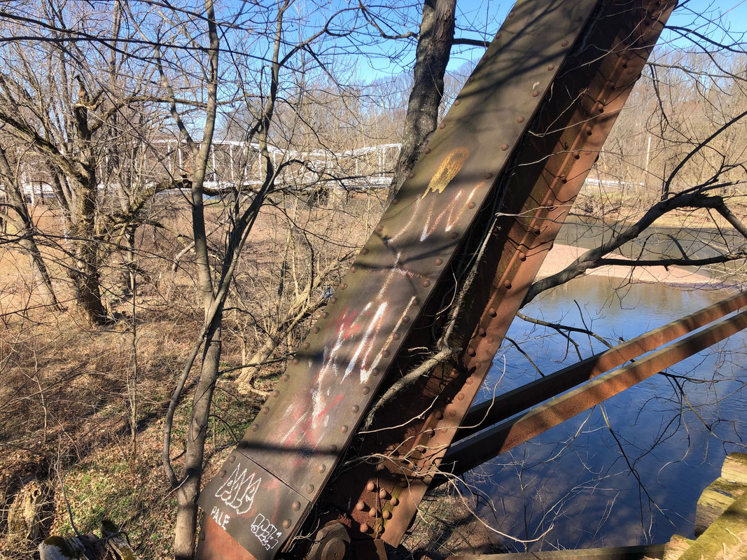
I can't imagine the shape of the bridge in the later years. Rumor is that the CNJ crews would put the loco in notch 1 and walk along side their train, fearing the bridge would collapse.
I think Neshanic Station is just what locals call the area around the old train station. The name of the town is actually Branchberg.
The row thru the Duke estate has been obliterated and a paved road called "railroad street" built on top of it. I guess the Duke family bought the row when the CNJ was in bk.
I can't imagine the shape of the bridge in the later years. Rumor is that the CNJ crews would put the loco in notch 1 and walk along side their train, fearing the bridge would collapse.
I think Neshanic Station is just what locals call the area around the old train station. The name of the town is actually Branchberg.
Still a supporting pier for the railroad bridge along the ROW to the south of Somerville.
Be well. Do good work.
Semperfidelis
Semperfidelis

The old ROW from Neshanic through to Somerville has a number of different owners. Somerset County and the towns were (are?) trying to acquire a greenway from Somerville to the county park at Woodfern. They have bits and pieces in place but have not been able to complete it:
- Black River & Western owns from Riverside to points west.
- Public vehicle ROW along Woodfern Road to Main Street in Neshanic owned by Township of Branchburg
- Private owner from Main Street to abandoned bridge
- County owns half of bridge and base of bridge across the river in Hillsborough
- Private owner from River Road across old ROW to Mill Lane/Riverside Drive (Hillsborough tried and failed to acquire this parcel a few years ago)
- Somerset County owns from Riverside Drive to the woods between the Drive and Conrail
- Private owners from that area to Beekman Lane near Flagtown
- PSE&G from Beekman Lane to Roycefield Road in Hillsborough
- Duke Farms Foundation from Roycefield Road through Duke Farms to 206
- Borough of Somerville and NJTransit to Somerville Rail Station
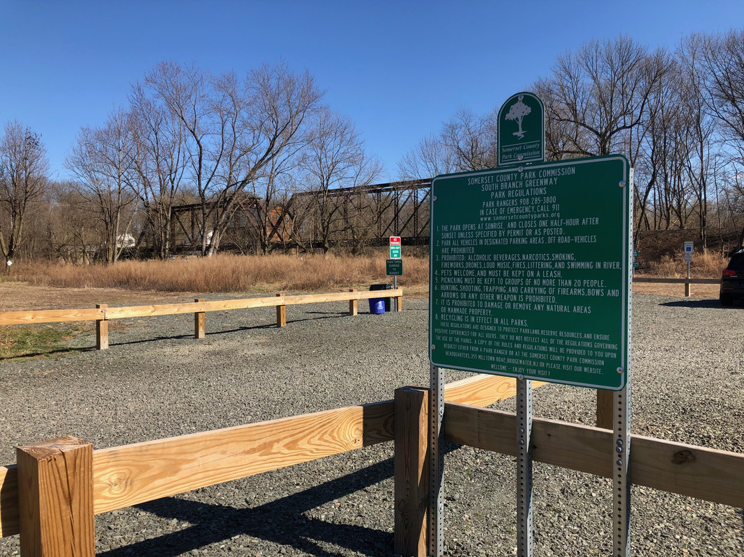
Took a bike ride to Neshanic Station to get some fresh air today and get away from the Corona virus panic for a while

1. is at the overpass the NS uses to cross over the old CNJ line. Too nmuddy to go any further than this
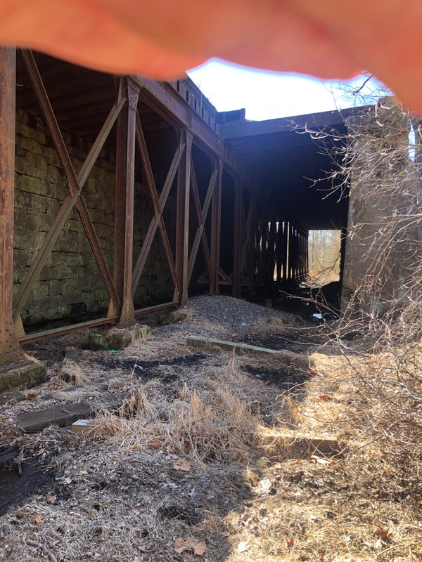
2. Then went down to the bridges. The county has turned this former flea market area into a park
This is a pretty big tree so my guess is not a train through here since at least 4/1/76?
3. Then a quick ride to the train station

Last passenger train through here (and over the bridge) was April of 1953, 67 years ago

4. Just west of the station beyond two new homes right next the ROW someone has been clearing the ROW of trees. No idea why.

1. is at the overpass the NS uses to cross over the old CNJ line. Too nmuddy to go any further than this
2. Then went down to the bridges. The county has turned this former flea market area into a park
This is a pretty big tree so my guess is not a train through here since at least 4/1/76?
3. Then a quick ride to the train station
Last passenger train through here (and over the bridge) was April of 1953, 67 years ago
4. Just west of the station beyond two new homes right next the ROW someone has been clearing the ROW of trees. No idea why.
Great pics havent been to the area in 20 years. Prob a lot of houses now. Last train was in 1974. STB forced line to be abandoned due to deteriorated track and bridge condition. I believe the track was in place until early 1980s.