MattAmity90 wrote: "...Babylon grade crossings before elimination..."[url]http://www.trainsarefun.com/lirr/crossi ... ns.htm[url]
Railroad Forums
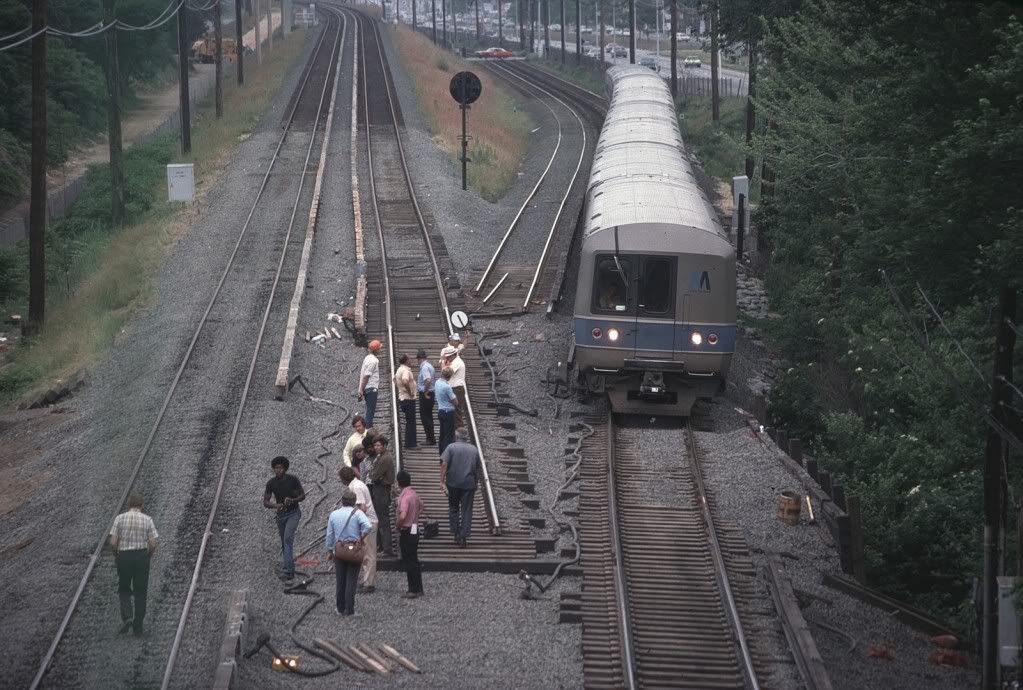
M-1s during Grade Crossing Elimination Project
- Discussion of the past and present operations of the Long Island Rail Road.
Moderator: Liquidcamphor
I believe they were "Block Line" phones,used to contact the nearest tower/block station, or the Dispatcher(204)
to get train orders/clearance cards. Radio transmission between towers and trains was not the greatest at the time
(still is not great nowadays as well).
Also to call the "Power Director" to kill/turn on 3rd rail power.
to get train orders/clearance cards. Radio transmission between towers and trains was not the greatest at the time
(still is not great nowadays as well).
Also to call the "Power Director" to kill/turn on 3rd rail power.
The Land of Enchantment is not Flyover country!
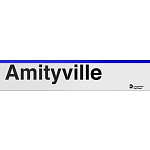
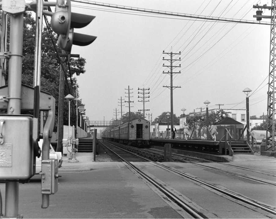
nyandw wrote:I have seen those photos, and I have seen some of Dave Keller's archived photos of stations along the Babylon Branch during elimination such as Amityville, Copiague, and Lindenhurst. However, for Amityville all but two photos is the temporary station being constructed with wood everywhere. I know the blueprints for the temps in the A/C/L segment were the same (High Platforms with 1 pedestrian overpass), but what I find odd is unlike MP, Bellmore, and Merrick, these three stations' pedestrian bridges had an angled staircase as you were crossing the tracks on the canopied platform (or Eastbound). It looks like it was a tight fit for the M1 trains, and I was wondering was there plenty of clearance between the trains and that angled staircase?MattAmity90 wrote: "...Babylon grade crossings before elimination..."[url]http://www.trainsarefun.com/lirr/crossi ... ns.htm[url]
Order of the photos:
Amityville Early 1968
Copiague 1971
Lindenhurst 1968/1969
I'm talking about the horizontal part of the walkway over the tracks on the I-Beam and then the angles steps as you approach the canopied platform. Bellmore, Merrick, and Massapequa Park's (2) walkovers did not have that.
This is the train to (NYC). Stopping at: Babylon, Lindenhurst, Copiague, Amityville, Massapequa Park, Massapequa, Seaford, Wantagh, Bellmore, Merrick, Freeport, Baldwin, Rockville Centre, Lynbrook, Valley Stream, Jamaica, Kew Gardens, Forest Hills, Woodside, Penn Station OR Grand Central.
The angled staircases at A/C/L must have been required due to tight clearance issues with construction areas. As far as close clearnace with trains, there's a General Order No. 107 (dated 24 AUG 66) to the May 22, 1966 Employee Timetable warning of close clearanace between Bellmore and Massapequa at pedestrian overhead foot bridges located at Wantagh and Seaford. I'm sure the same held true at A/C/L. Here's the first Merrick station with high platforms from 1968, before the temporary tracks were installed, built around the same time as A/C/L temporary stations with no canopies or angled staircase. When they put in high platforms at Merrick, the platforms were moved just west of Merrick Avenue in contrast to their previous location between Merrick and Hewlett Avenues as a low platform stop. The temporary station was opened 12/4/70 and was also located just west of Merrick Avenue. When the elevated Merrick Station opened, the station now sits about where it did originally, between Merrick and Hewlett Avenues.
Merrick Station JUL 1968 (in use about FEB 1968 to DEC 1970) Dave Keller Photo
http://www.trainsarefun.com/lirrphotos/ ... %20Sta.jpg
Merrick Station JUN 75 (in use Dec 1970 to JUN 1975) William Madden Photo
http://i1054.photobucket.com/albums/s48 ... lligan.jpg
Merrick Track Cut JUN 1975 (William Madden Photo)
http://i1054.photobucket.com/albums/s48 ... S60_57.jpg
I like the jumper cables on the third rail in the track cut photo. This also explains whey some trains ran on elevated track for a few days, while others still operated at grade level.
Ok, so due to the tight clearances in the A/C/L segment because they angled the staircase for the walkover bridges on the canopied platform they warned them, but were the M1's able to go under the angled staircases, or if they were able to, did they have to slow down? I've taken a look at photos, and compared them to the others, and it seems that when the photographer took the photo of a train, it lined up with the top of the canopy. I know Merrick did not have the angled stairs that ran over the tracks.
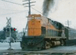
Like everyone has said, when the trains entered the construction zones, they posted a speed limit to slow the trains. At Massapequa Park it was 60 MPH, I'm pretty sure Merrick and Bellmore were also 60 MPH, I'm guessing Wantagh and Seaford were 50-55 since the M1 had not come out yet, Massapequa was 45, and I'm guessing the A/C/L was 50-55 MPH. Finally since Babylon is the termination point for electrics, the speed limit was always 15 MPH.
Like everyone has said, when the trains entered the construction zones, they posted a speed limit to slow the trains. At Massapequa Park it was 60 MPH, I'm pretty sure Merrick and Bellmore were also 60 MPH, I'm guessing Wantagh and Seaford were 50-55 since the M1 had not come out yet, Massapequa was 45, and I'm guessing the A/C/L was 50-55 MPH. Finally since Babylon is the termination point for electrics, the speed limit was always 15 MPH.
This is the train to (NYC). Stopping at: Babylon, Lindenhurst, Copiague, Amityville, Massapequa Park, Massapequa, Seaford, Wantagh, Bellmore, Merrick, Freeport, Baldwin, Rockville Centre, Lynbrook, Valley Stream, Jamaica, Kew Gardens, Forest Hills, Woodside, Penn Station OR Grand Central.
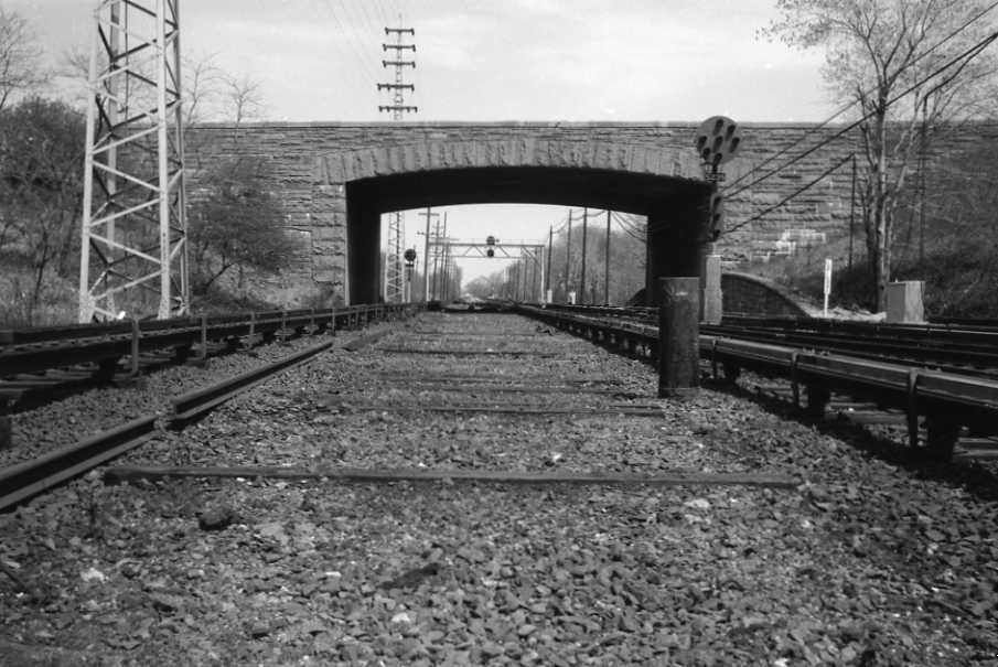
As far as close clearnace issues go, I'm not sure if a speed restriction is in order or if it is mainly a warning for employees to keep your arms, legs and head inside the train. Here's a close clearnace placard on the Meadowbrook Pkwy bridge (just right of the Position Light) while the Freeport Temporary tracks were in service. Back in the 1960's, Montauk Branch MAS was 55 between Hall and Babylon and 65 east of Babylon out to Y Cabin, while Mainline was 65 from Hall to Ronkonkoma.
Meadowbrook Pkwy Looking East FEB '59 (Dave Keller Archive, Trains are Fun Website)
http://www.trainsarefun.com/lirrphotos/ ... emoved.jpg
Meadowbrook Pkwy Looking East FEB '59 (Dave Keller Archive, Trains are Fun Website)
http://www.trainsarefun.com/lirrphotos/ ... emoved.jpg
Ok, so all the trains during the Babylon grade crossing elimination (MP75's, MP54's, M1's, and all diesel locomotives and fleet cars) were able to clear the pedestrian overpasses at the stations that had one. I'm guessing it would be a yes, because the construction crew had to know how high the steps had to be over the tracks for a safe clearance along with the height of all those trains. The stations that I know of that had them were Rockville Centre, Merrick, Bellmore, Wantagh, Seaford, Massapequa Park (which had 2), Amityville, Copiague, Lindenhurst, and Babylon. Maybe it's just a camera angle that makes it seem that it wouldn't fit under, it's juxtaposition compared to the photographer's location. Thank you for the clearance input.
This is the train to (NYC). Stopping at: Babylon, Lindenhurst, Copiague, Amityville, Massapequa Park, Massapequa, Seaford, Wantagh, Bellmore, Merrick, Freeport, Baldwin, Rockville Centre, Lynbrook, Valley Stream, Jamaica, Kew Gardens, Forest Hills, Woodside, Penn Station OR Grand Central.
http://i1054.photobucket.com/albums/s48 ... BMoreC.jpg
What was printed on the signal above the ped gates? The lights that usually say "No Left Turn", etc.
What was printed on the signal above the ped gates? The lights that usually say "No Left Turn", etc.
You got me, I always thought it was a red light; first time I was at Bedford Ave was 1972, and that light was gone by then. Probably too early for a second train warning, since they used a siren at the Park Blvd crossing (Massapequa Park) in the late 1970's to warn for second trains.
I grew up in Merrick in the 1960's/70's, and these photos have brought back great memories.
I always thought it was ironic how just after building the high level platforms in Merrick/Bellmore they then built the second set of platforms for the temporary tracks. Seemed like a waste, although I understand the bind the railroad was in. The railroad wanted to retire the older equipment, which meant high level platforms regardless of the fact that some platforms would be very temporary.
Stuart
The light at the end of the tunnel may be the headlight of an on-coming train.
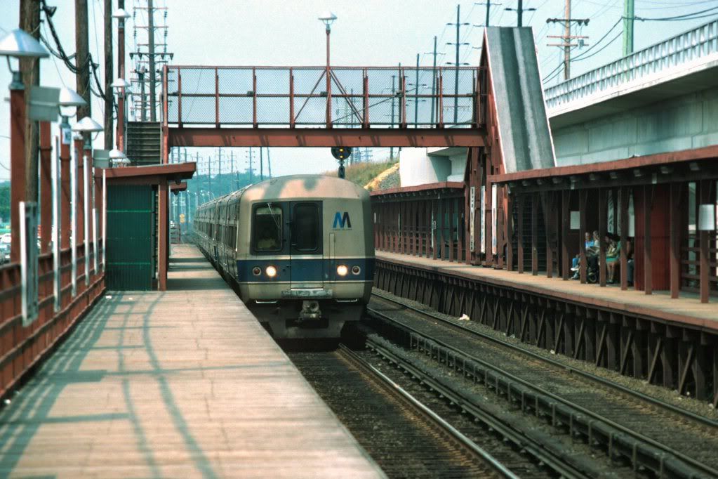
At most stations that first generation of high platforms made of wood, hastily built circa 1969, was replaced some years later with more permanent plarforms.
Yeah, the only wooden platforms left are the one's at Boland's Landing West of Jamaica. Is there anyone here from Amityville that saw the elimination from 1968-1973? What I'm trying to do is get as much info on the late stages of the A/C/L segment being elevated. I also found out from someone who took a photo of the current elevated Lindenhurst station, that when he was a kid and he saw the pieces coming together, that he and his buddies went to the temporary platforms and said just as everyone suspected, that both platforms were painted red, just like Bellmore, Merrick, and Massapequa Park. Also the A/C/L segment had the same blueprints not only for the design of their elevated stations, but their temporary facilities. So all stations with high platforms during elevation were painted red.
This is the train to (NYC). Stopping at: Babylon, Lindenhurst, Copiague, Amityville, Massapequa Park, Massapequa, Seaford, Wantagh, Bellmore, Merrick, Freeport, Baldwin, Rockville Centre, Lynbrook, Valley Stream, Jamaica, Kew Gardens, Forest Hills, Woodside, Penn Station OR Grand Central.
Head-end View wrote:Keyboardkat, maybe you can answer a question that no one else on these boards has been able to do, since you were a Floral Park resident during the crossing elimination project. Word is that your village and the LIRR were seriously at odds during/after the project and that Floral Park is still angry at the LIRR to this day 50 years later. And supposedly this is the reason that New Hyde Park and Mineola won't let the railroad elevate thru their villages, 'cause of whatever happened with Floral Park.Head end, let me correct a misimipression. I was never a Floral Park resident, at any time. When the Floral Park grade crossing elimination project was on, I was a junior and senior at Mineola High School. I lived in Roslyn Heights. Before getting my driver's license, I used to bicycle to Floral Park to watch trains, and later watch the project underway. I was totally unaware of local Floral Park politics.
So do you remember any of the local politics of that era and what the problems were that led to the village being so bitter at the LIRR? Seems to me the final product must be an improvement over those staggered grade crossings that existed at Tulip Ave. What's the story?
And my apologies if I may have asked you this before, and have forgotten whatever you might have told us......(chuckle!)
Sorry I can't be of much help. I wish I had taken more pictures.
Fairbanks-Morse forever!
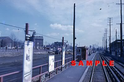
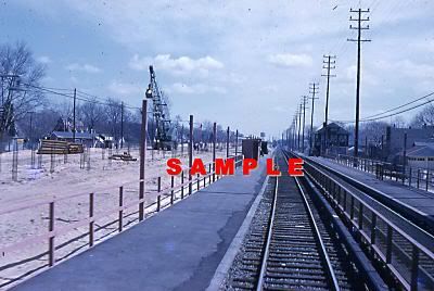
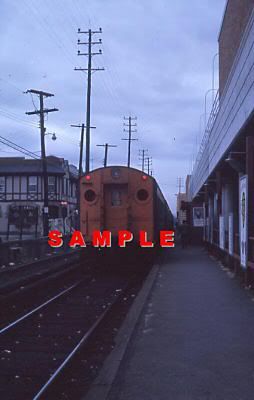
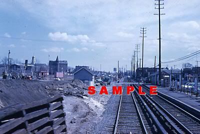
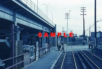
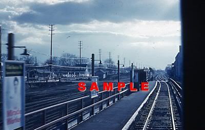
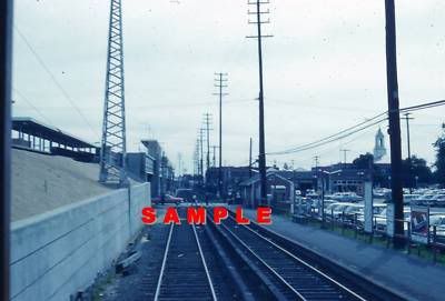
Here's some shots of Floral Park; some archived E-bay photos (they say "sample" on them) and two from the NYC Subway website. The Floral Park/Bellrose elimination followed on the heels of a major sewer installation that ripped up Floral Park pretty significantly from 1954-1957. As those wounds were beginning to heal, the LIRR began the major grade crossing elimination project that tore up the town again for 2-3 years, ending in 1962. The Hempstead Branch switch was moved from Floral Park to just west of Bellrose. 2-track system of Temporary tracks were laid both North (Main Line) and South (Hempstead Branch) of the existing right of way. Then the middle was torn up and the Elevated Railway construction began. So Floral Park was in a disrupted state for about six years, and I think the residents just had enough after the LIRR project.
Plainfield Ave
http://images.nycsubway.org/i43000/img_43393.jpg
Temporary Station
http://world.nycsubway.org/perl/show?67872
Floral Park 1961
http://i1054.photobucket.com/albums/s48 ... _1_0_1.jpg
Floral Park 1961
http://i1054.photobucket.com/albums/s48 ... _1_0_1.jpg
Floral Park 1962
http://i1054.photobucket.com/albums/s48 ... _1_0_1.jpg
Floral Park Spring 1961
http://i1054.photobucket.com/albums/s48 ... _1_0_1.jpg
Floral Park Spring 1962
http://i1054.photobucket.com/albums/s48 ... _1_0_1.jpg
Floral Park Spring 1961
http://i1054.photobucket.com/albums/s48 ... _1_0_1.jpg
Floral Park Summer 1962
http://i1054.photobucket.com/albums/s48 ... _1_0_1.jpg
Thanks Keyboardkat. You're right; sorry, I thought you meant you lived there during the construction; no problem.
L.B. very interesting photos! And thanks for the history. Yeah, I could see where having 2 separate sets of temporary railroad running thru there during construction, a few years after the sewer project could make a lot of people crazy. I wonder how many residents from that period still live in the area, though.
L.B. very interesting photos! And thanks for the history. Yeah, I could see where having 2 separate sets of temporary railroad running thru there during construction, a few years after the sewer project could make a lot of people crazy. I wonder how many residents from that period still live in the area, though.