by nyandw
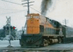
Eastbound in Diesel territory. Note: Far left center the apparent unit (no roofwalk) and perhaps a elevated crossing signal above it? The radio tower and an overpass in the distance behind the train may help us. Any ideas? 
Railroad Forums
Moderator: Liquidcamphor
MACTRAXX wrote:Steve:I'll have to concur. The Emery map of 1958 indicates a tank car connection (TCC) for the siding. The confusion I had was the turnout leading south with the unit parked with the elevated crossing signal behind it... But... The photo is 1959 and Emery's 1958 map doesn't reflect totally what we see in the photo. I'll have to work on the map for all to review. Thank you, as always.
I believe that this is on the Main Line west of Hicksville with the Wantagh Parkway bridge in the
background. This is one of the only locations that I can think of that makes sense...MACTRAXX
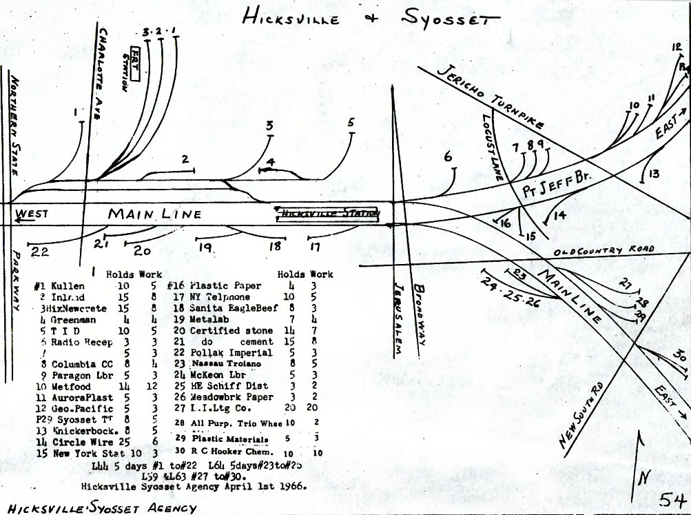
MattAmity90 wrote:Just a little side note: When Hicksville was elevated, they only elevated from about 1/2 mile West of the station to a mile East of the station on both the Ronkonkoma and Port Jefferson branches. Charlotte Avenue wasn't touched during the elevation. It wasn't until after the electrification to Hicksville and Huntington that they decided to eliminate the Charlotte Avenue crossing, which was completed in 1973, due to the increased volume of trains (mainly electrics) that would still fly by not at MAS but about 60-65 MPH.Thanks, Matt. Good stuff!
Head-end View wrote:The Charlotte Ave. crossing did have automatic flashers and gates at least from 1960 on. Not sure before that. There was a total of five tracks at that crossing. The two mainline tracks plus the siding pictured above. Then you had another track currently known as "the north side" and another freight yard track also.The LIRR 1966 map indicates your info.Thanks for pointing this out.