That makes sense, I think one day this weekend I'll take a trip up north and start exploring along the ROW. I'll see if I can get any pictures of anything.
Railroad Forums
CR on the Southern Secondary
- Pertaining to all railroading subjects, past and present, in New Jersey
Moderator: David
Other than some marker flags (apparently marking out AT&T cable along the ROW), there has been no work done between end of track at Okerson Rd and the southern in Farmingdale. That's as of this morning (4/19/2021) and includes Howell Rd which is getting repaved from rte 33 to the tracks, Fairfield rd, Yellowbrook Rd, county 524, Southard Ave, and Railroad Ave in Farmingdale.
The next logical step is a filling with the STB. Until that happens and is approved, don't expect much to change. I would venture a guess that C&D wanted, or needed, this funding in place to go forward with their plan.
I've been here since Railroad.Net 1.0
Somewhere in these threads I got the impression a filing with the STB is not required as the only real difference is putting a 2.6 mile stretch of track back in service. A filing not being necessary for change in operator due to prior agreement between NJT and Conrail giving rights to designate a different operator.
CharlieL if we are talking about the FIT, its pretty close to 5.5 miles of track. And there has been some encroachment over the years. I'm guessing letters will be going out first.?

I believe CharlieL is referring to the portion of the Southern OOS between South Lakewood and Lakehurst, about 2.6 miles.
Harry
CharlieL wrote: ↑Mon Apr 19, 2021 4:46 pm Other than some marker flags (apparently marking out AT&T cable along the ROW), there has been no work done between end of track at Okerson Rd and the southern in Farmingdale. That's as of this morning (4/19/2021) and includes Howell Rd which is getting repaved from rte 33 to the tracks, Fairfield rd, Yellowbrook Rd, county 524, Southard Ave, and Railroad Ave in Farmingdale.Every crossing you noted needs a re-build and crossing protection.
Harry
Tanker1497 wrote: ↑Tue Apr 20, 2021 1:51 pmBut!R&DB wrote: ↑Tue Apr 20, 2021 12:53 pm I believe CharlieL is referring to the portion of the Southern OOS between South Lakewood and Lakehurst, about 2.6 miles.Gotcha my bad!
From the runaround at Cross St to MP66 in lakehurst is over 5 miles
I have not measured it myself, but from what I can see from Google maps the distance from the south end of the Cross St run-around end of track to Lakehurst is less than 3 miles. I'm not positive as to where the actual end of track is located, but I believe it is near the intersection of Faraday Ave and Esti Cir.
The real question is why did Conrail ever build the Cross St run-around? Have the fuel savings over the past 10 years paid for the cost of construction? Probably not.
The real question is why did Conrail ever build the Cross St run-around? Have the fuel savings over the past 10 years paid for the cost of construction? Probably not.
Harry
R&DB wrote: ↑Wed Apr 21, 2021 9:56 am I have not measured it myself, but from what I can see from Google maps the distance from the south end of the Cross St run-around end of track to Lakehurst is less than 3 miles. I'm not positive as to where the actual end of track is located, but I believe it is near the intersection of Faraday Ave and Esti Cir.Cross St is MP61 and Clayton track starts at MP66 5 miles.
The real question is why did Conrail ever build the Cross St run-around? Have the fuel savings over the past 10 years paid for the cost of construction? Probably not.
I'm not sure that fuel was the reason, I thought it was crew duty day.
R&DB wrote: ↑Sun Apr 18, 2021 7:37 am CharlieL wrote:Having seen a train train under that bridge, to say the least if you put a yardstick on the top of the locomotive, it's gonna be half a yardstick on the other side. Not nearly enough room for Plate F unless the roadbed is lowered quite a few feet.Plate "F" would not work north of Eatontown due to low bridges, tho.I don't think there are any Plate F obstructions on the Southern. I believe the Tinton Avenue bride has sufficient clearance. The obstructions are the catenary on the Coast Line to the best of my knowledge. The other issue is the 263,999 lb limit on the Navesink River bridge at Red Bank. RE-routing freight traffic through Freehold overcomes these limitations. (Of course the NIMBYs in Jamesburg and Freehold may have fits) It appears the objects of the grant are to relieve Conrail from serving the FIT and the Southern and to get the freight off the Coastline between South Amboy and Red Bank.
Also the only possible customer north of Eatontown appears to be Lawes and they haven't had a siding since they stopped selling coal decades ago.
I think the Tinton Ave Bridge is in the funding process at NJDOT to get replaced. That bridge is LOW. The next problem is that the new River Drawbridge project does not address the problem of similar low bridges in Perth Amboy.
I've been here since Railroad.Net 1.0
Any info about SA31 running to the Southern today?
BE THE ONE to help prevent veteran suicides. Need to talk to someone? Call 9-8-8 all day, every day, 24/7. BeTheOne.org
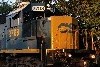
31/38 report:
Power today was 4432/4452
16 cars for WoodHaven
And yes there is a 38!
Power today was 4432/4452
16 cars for WoodHaven
And yes there is a 38!
Ryan Irwin