What is the name of the rail line that goes along Fresh Pond into Watertown and Waltham?
Railroad Forums
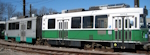
Watertown Branch (Guilford)
- Guilford Rail System changed its name to Pan Am Railways in 2006. Discussion relating to the current operations of the Boston & Maine, the Maine Central, and the Springfield Terminal railroads (as well as the Delaware & Hudson while it was under Guilford control until 1988). Official site can be found here: PANAMRAILWAYS.COM.
Moderator: MEC407
It's the Watertown Branch. It doesn't go into Waltham anymore; in fact, it doesn't even get all the way to Watertown Square now.
Thanks. I have walked on part of it an it would make a nice bike path, but I would prefer a High Speed line myself.
They poured a concrete foundation and ran electrical wiring (inactive and currently covered in traffic cones) for real crossing signals/gates on Fresh Pond Parkway about a year ago, but haven't erected the actual signals yet. Does that line really get enough traffic that it's worth it for them to do that...or have the laws recently changed making it mandatory to have signals at a thoroughfare as busy as Rte. 16? I thought they were getting along just fine having a flagman stop traffic the rare times that crossing is actually used.
There are some scary-looking rails on that spur. I'm not sure how a train even slowed to the barest crawl could stay on parts of those tracks. Out in the woods along the reservoir bike path, some of them are practically submerged by all the packed dirt between the tracks. There's even newer (well...straighter) rails lined up on the ground beside the tracks that have never been installed. I know they've been lying there for all of the 2 years I've lived in that neighborhood, and from the rust I suspect they've been there much longer. As wavy and bent as they look right along Route 16 when it snakes in plain-view front of the water treatment plant...they're in really deplorable shape after the line dips into the woods around the reservoir. I'd give anything to be walking on the reservoir path while a train is actually going through there just to see how the hell it manages to stay on the rails through that stretch.
There are some scary-looking rails on that spur. I'm not sure how a train even slowed to the barest crawl could stay on parts of those tracks. Out in the woods along the reservoir bike path, some of them are practically submerged by all the packed dirt between the tracks. There's even newer (well...straighter) rails lined up on the ground beside the tracks that have never been installed. I know they've been lying there for all of the 2 years I've lived in that neighborhood, and from the rust I suspect they've been there much longer. As wavy and bent as they look right along Route 16 when it snakes in plain-view front of the water treatment plant...they're in really deplorable shape after the line dips into the woods around the reservoir. I'd give anything to be walking on the reservoir path while a train is actually going through there just to see how the hell it manages to stay on the rails through that stretch.
Have you ever flagged a crossing?!? Most people do not want to stop for you...........and you really risk getting struck. I would hate to have to cross that crossing. (If I remember correctly either Guilford Police or Cambridge Police would assist the crew since it is such a major route......and let's not forget the fact that the little red building there blocks the view on the right heading west on Concord Ave most people can't see the train behind it!
As for how busy the line is, there's only one customer, Newlyweds. The Watertown Branch has it's own thread in the Guilford Forum.
As for how busy the line is, there's only one customer, Newlyweds. The Watertown Branch has it's own thread in the Guilford Forum.
That line gets maybe three trains a week for Newlywed Foods, mostly 4 or 5 hoppers of flour. And yes, they have to go like 3mph in order to keep the thing on the rails (and the rails make horrible noises as the train goes over them). And, they have to come all the way in from Ayer to get there, and I don't think there are any other customersleft on that entire line. Guilford would like nothing better than for Newlywed to pack up and move to Billerica or somewhere else easier to serve.
vanshnookenraggen wrote:Thanks. I have walked on part of it an it would make a nice bike path, but I would prefer a High Speed line myself.Is that red line on your Uber Map that you're using for a Watertown version of the Mattapan trolley. Such a line would be a great addition to the MBTA rail system.
Indeed it is. One reason I am walking these ROWs is because I want to know if my ideas are feasible. So far I think it would be but it would have to be a subway or elevated in parts.
#5 - Dyre Ave wrote:Not to be a wet blanket, but, I just don't see taht line as being very useful. It misses a lot of larger population areas, and also runs counter to the direction that most people would want to go. From Watertown (and you'd only be serving the very eastern tip...the ROW is gone before you even hit Arsenal St.) you'd have to go all the way north to Alewife, before changing to the Red Line anyways.vanshnookenraggen wrote:Thanks. I have walked on part of it an it would make a nice bike path, but I would prefer a High Speed line myself.Is that red line on your Uber Map that you're using for a Watertown version of the Mattapan trolley. Such a line would be a great addition to the MBTA rail system.
I usually don't push buses over rail, but enhancing the service on routes like the 71 and the 73 would better serve the Watertown/West Cambridge area. Similiarly, improvements to the 72, 74, 75, and 78 would better cover the remainder of the branches area.
To me, the 71 & 73 should be "BRT-ized." They are very heavy trunk routes with frequent service seven days a week. BRT improvements (bigger buses, stop consolidation, signal prioritization, exclusive bus lanes where possible) on those routes to Harvard would do far more than a light rail line up to Alewife, for less money.
Wondering if I'll see the Western Route double-tracking finished before I retire...
Photo: Melbourne W7 No. 1019 on Route 78, Bridge & Church Streets, Richmond, Victoria. 10/21/2010
Photo: Melbourne W7 No. 1019 on Route 78, Bridge & Church Streets, Richmond, Victoria. 10/21/2010
vanshnookenraggen wrote:Indeed it is. One reason I am walking these ROWs is because I want to know if my ideas are feasible. So far I think it would be but it would have to be a subway or elevated in parts.As for that question, I can add that there isn't much left of the Watertown branch. Once you get past Arlington St. in Watertown, there's really nothing left. By the time you get towards Arsenal St., there are buildings like Charles River Saab and Target built on the ROW. Patches of it are visible between there and Watertown Sq., but with much buildover. Its almost impossible to see the ROW through the Square area at all.
Sad to say, but this line is just not there west of Arlington St.
Wondering if I'll see the Western Route double-tracking finished before I retire...
Photo: Melbourne W7 No. 1019 on Route 78, Bridge & Church Streets, Richmond, Victoria. 10/21/2010
Photo: Melbourne W7 No. 1019 on Route 78, Bridge & Church Streets, Richmond, Victoria. 10/21/2010
I also don't see this as a useful passenger route. Much of it goes through non-residential areas.
Did you even look at the map I put up? It will go to Harvard. Anyway, it is just a pipedream, like most of my web site. I think the main idea behind the line is to catch people coming into Watertown Sq and get them to Harvard and Boston faster. It's not like the A branch is coming back, or at least all the way.
To take this thread back on topic, there was a train last winter that got stuck under a bridge in watertown because the track sunk in the mud, then the mud froze, they waited for a nice day (about a week) before even trying to get the engine out of the mud.


Click here for the thread on this topic
[photo credit:Jonelle DeFelice [rr.net sn: nellschoo)]
Click here for the thread on this topic
[photo credit:Jonelle DeFelice [rr.net sn: nellschoo)]
Moderator: Massachusetts Bay Transportation Authority, Brightline Trains
Avatar:3679A (since wrecked)/3623B (now in service as 3636B).
Avatar:3679A (since wrecked)/3623B (now in service as 3636B).
Yeah, I took photos of the sunken track. It blew my mind that they were still being used. I'll post them once I get around to finishing the entire walk.