Railroad Forums 

  • The NYC West Shore Thread

  • Pertaining to all railroading subjects, past and present, in New York State.
Pertaining to all railroading subjects, past and present, in New York State.

Moderator: Otto Vondrak

 #1327112  by NYCUticaSyracuse81
 
That looks to be an exact match to the one I found. Thanks a bunch guys! I can't wait until tomorrow, so I can go back and get it. Hopefully I'll be able to find where I left it without too much difficulty. I'll post some better pictures once I get it out of there.

-CNYrailroadnut
 #1327326  by NYCUticaSyracuse81
 
Here's a couple pics of the knuckle. It does have some markings on the face of it, but cannot make out what they are?

https://www.flickr.com/photos/97630304@N02/17041623368/" onclick="window.open(this.href);return false;

https://www.flickr.com/photos/97630304@N02/17227678252/" onclick="window.open(this.href);return false;
 #1328044  by sd80mac
 
[quote="NYCUticaSyracuse81"]

Hi-

Since I was late with the purchase of Trains May issue, I am surprised that no one mentioned about this, unless NOBODY reading this thread didn't get Trains magazine.

Train Magazine in May issue have article about the types of coupler...
 #1337981  by SST
 
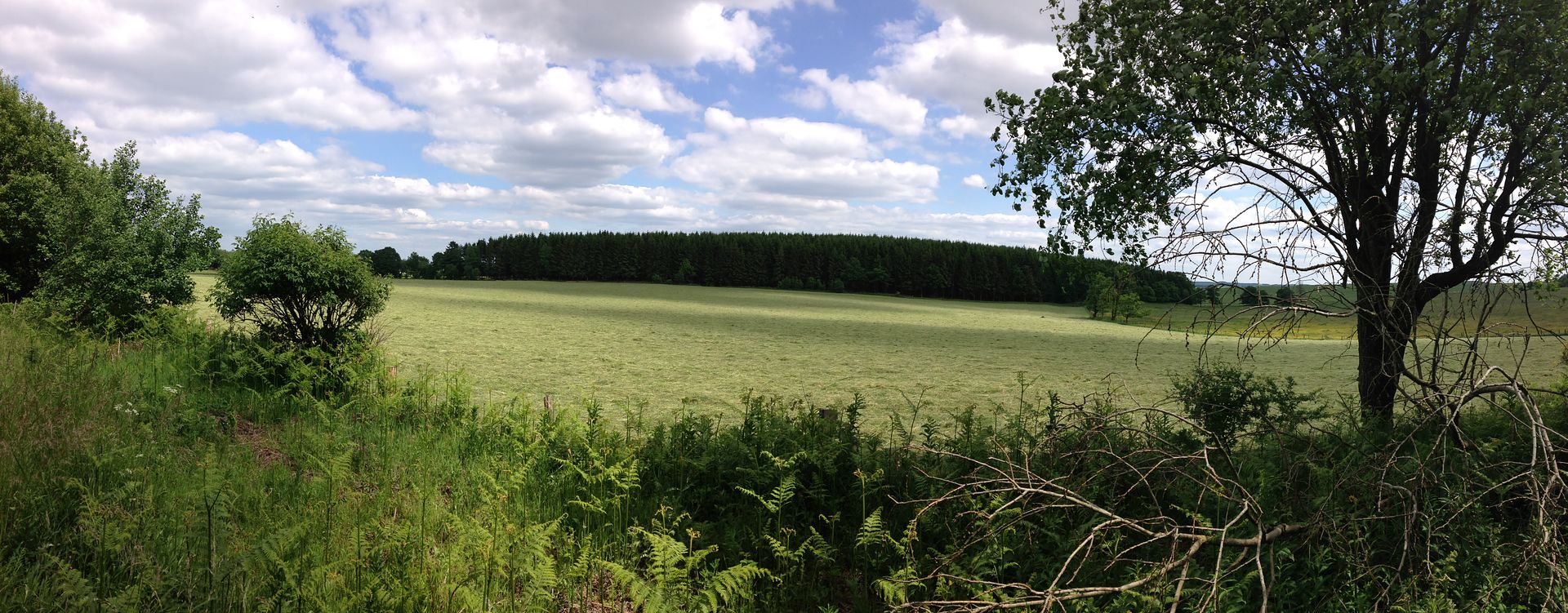
I was recently in Europe on a WWII tour. Best thing I ever did. While researching the places we were going to visit, I discovered an abandoned RR in Bastogne, Belgium. The hotel had bicycles to use so I took one and road the path. As I got further away from the city, it became wide open areas of rolling farm land. Just amazing. Here is one picture that I took from the ROW a few KM from town.

http://i1131.photobucket.com/albums/m55 ... kfmdjg.jpg" onclick="window.open(this.href);return false;


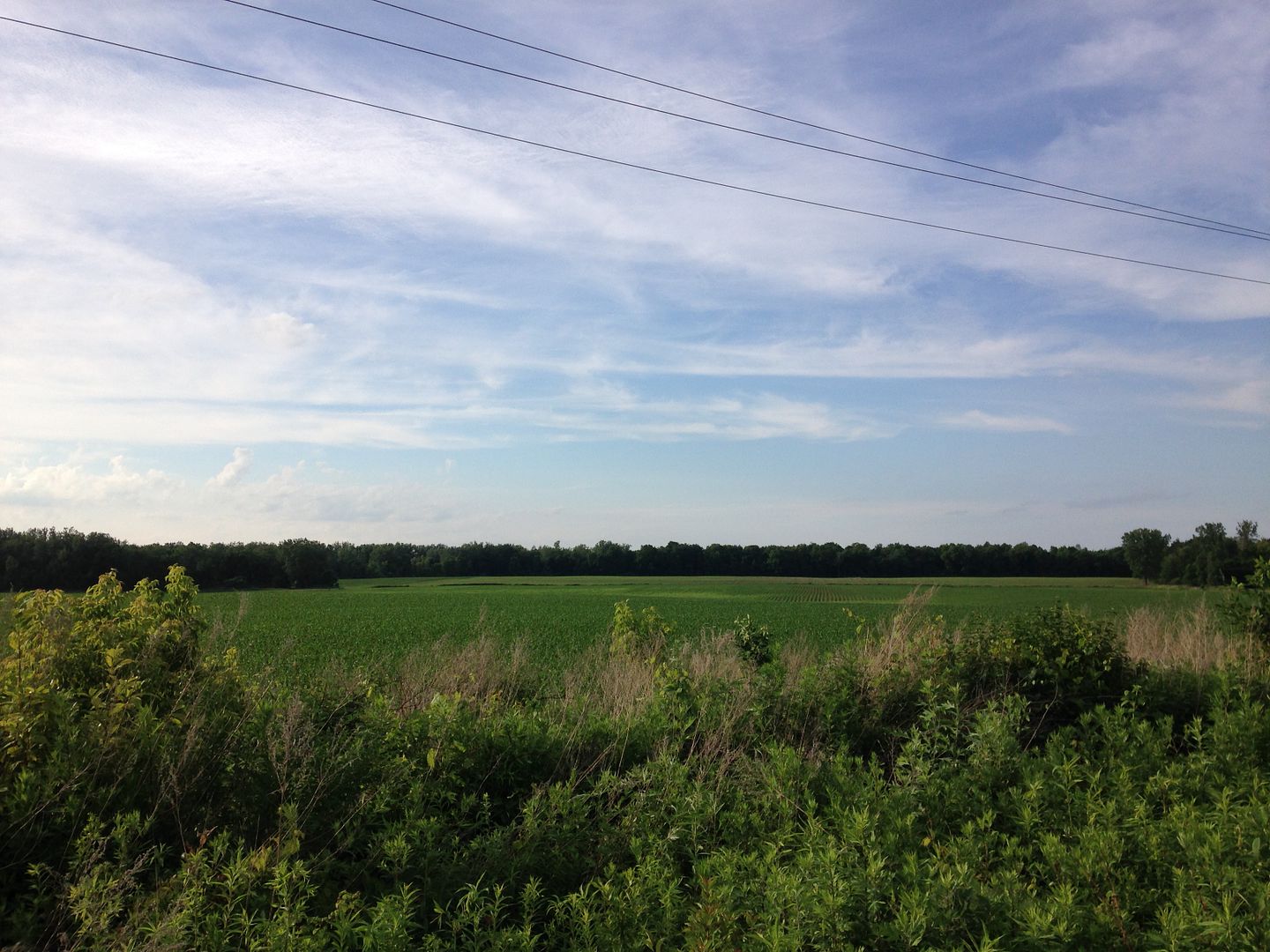
When I came home, getting back into the routine was difficult. The closest thing I could think of to duplicate the bike ride, was to ride the WS as far as possible. So I hopped on the bike at Wehrle Dr and and started riding. From Wehrle Dr all the way to Akron doesn't really have "open spaces" to view. Lots of trees and brush along side the ROW. The trail actually stops at Rt93 in Akron but the ROW is worn down enough to keep riding....so I did. A mile or more out of Akron [heading NE] the view started to open up with lots of farm land and looked very similar to Bastogne above.

Normal shot:
http://i1131.photobucket.com/albums/m55 ... 7ukici.jpg" onclick="window.open(this.href);return false;
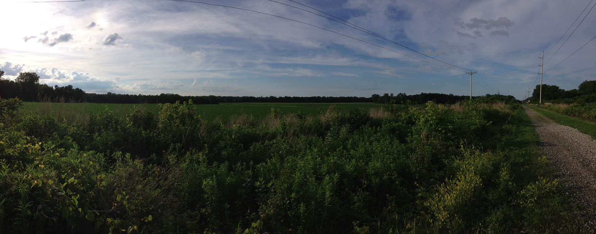
Pano shot:
http://i1131.photobucket.com/albums/m55 ... b9lnwc.jpg" onclick="window.open(this.href);return false;

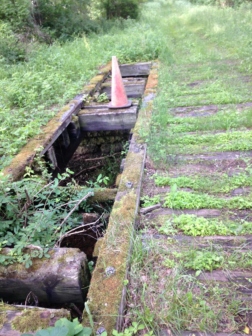
As I rode further in, I came upon a little bridge. Kinda beat up but still in use for off road vehicles.
http://i1131.photobucket.com/albums/m55 ... 5rdrmh.jpg" onclick="window.open(this.href);return false;

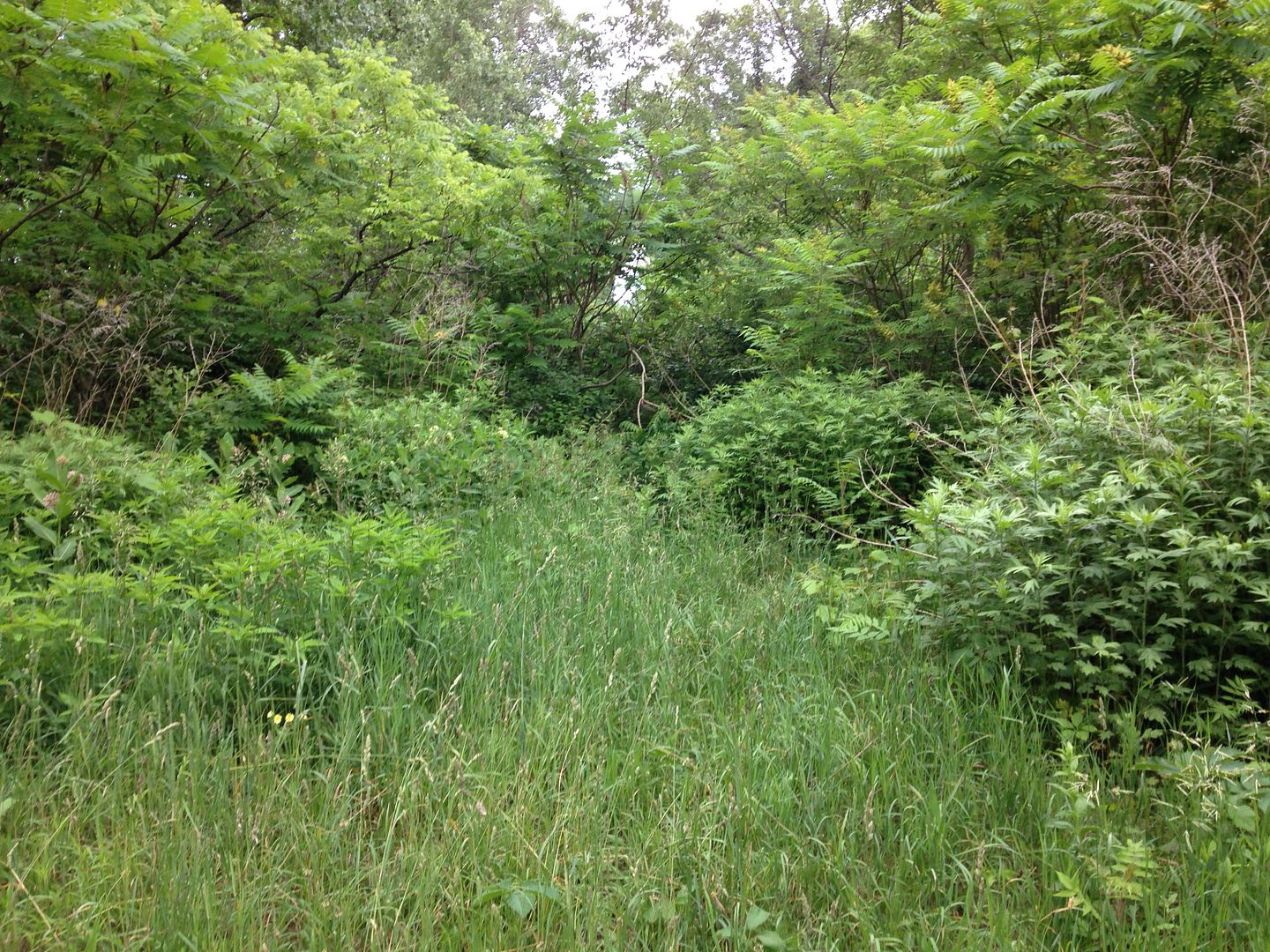
I was beginning to wonder how far this path would go but eventually the path came to an abrupt end. Heavy overgrowth. The path may have restarted further up as there was an open section of a farmers field. But it was getting late and it was around 14 miles back to the car. This picture is the "end of the line."

http://i1131.photobucket.com/albums/m55 ... l6nykx.jpg" onclick="window.open(this.href);return false;

I was just looking at "as the crow flies" to calculate the distance. I see in the SAT view that I was just 200 or so yards from Jan's Smoke House. I'll have to take a road trip to see what's on the other side.

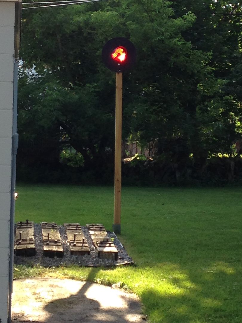
The following photo story begins in 2000. During the winter of 2000 it snowed heavily. Transit Rd in Clarence was deep in snow. So, when the plows came through, they had to raise the wing to push the snow further off to the side. One of the plows hit the crossing signals and knocked the search light portion of the signal into the ditch. That's a shame isn't it?

Fast forward to the end of winter in 2005. I'm x/c skiing the row and the snow is melting. I cross Transit rd. I look over and I see the signals. Hmmmmm, the mind starts cranking. Long story short, I acquired them. They were no longer attached to the property which was pretty much abandoned anyways.

This photo was taken a few days ago. I have rebuilt my full scale short line RR. The ties, plates and spikes are all WS given to me by R. J. Corman at the time they were pulling up rails. The signal during the day is powered by the sun alone. During the night, the solar light behind the lens is on all night.

http://i1131.photobucket.com/albums/m55 ... 4frcy7.jpg" onclick="window.open(this.href);return false;
 #1355412  by ut-1
 
Still standing: while hiking a new section of New Hartford's Rayhill Trail yesterday, I came upon this West Shore whistle post in the woods:
Attachments:
West Shore Rayhill 10-31 003.JPG
West Shore Rayhill 10-31 003.JPG (477.79 KiB) Viewed 5303 times
 #1361153  by RussNelson
 
WShore4Ever wrote:Milepost locations can be found on the valuation maps, available for download for $10 from http://home.comcast.net/~nmro/products-charts7.htm" onclick="window.open(this.href);return false;
They're now at http://nmro.org/" onclick="window.open(this.href);return false; . (which stands for National Militant Railfan Organization). Their mottoes:

"Nos Credete Quid Facemus Cognoscemus."-------Trust us, we know what we're doing.

"Kikio Fundus Et Kapio Nominus."-----------------Kick ass and take names.
 #1379244  by SST
 
Last year, my 96 Ford Bronco wouldn't pass emissions inspection [Obtained a waiver]. So I knew that the end was near. So on a really nice day, I went and followed the WSRR from Akron to Oakfield. Pretty neat. I remember checking Oakfield via Google Street View and the rails were still in the ground. But when I got there, no rails to be found. There were a couple of ties still in the ground though. I had a lot of fun driving on the row where access was easy. But eventually had to turn around due to gates preventing access, or in my case, exit.

This photo is east of Akron where the WS crosses over Rueben Rd at Bloomingdale Rd.
Image

This photo is at the Oakfield yard. No rails but a few ties still in the ground. Sadly, if you didn't know a RR was here, you wouldn't really be able to tell one exisited.
Image

After driving around town, I headed back west towards Akron and picked up a side street and gained access to the ROW. This section and all the way back into Oakfield is in great shape. I seem to recall that snowmobile trials are here and they keep it in shape. Nice job if that's true.
Image

Most of the better parts of the ROW are gated to prevent access or exit. I came upon this gate and had to turn around and head back to my entry point. I wanted to keep going but there was no way around it. Despite having to turn around, it was very much worth the ride.
Image

This last picture is further west. I believe I was on Gortion Rd where it crosses over the ROW. There is no bridge going over the ROW. As far as I can tell, it was backfilled in. Same as other streets that cross over the ROW. Not suitable for any transportation as each street blocks the ROW and lots and lots of water. Like a creek. The depth of the cut in this area is maybe 15 feet. Just a guess.'
Image

I didn't explore east of Oakfield. Maybe this year I'll do it.
 #1379264  by lvrr325
 
It appears the Schoharie Creek bridge has permanently been made a highway bridge after some rehab work, the last two times I was through you were routed back onto it and the original road has been blocked with grass and trees.
  • 1
  • 4
  • 5
  • 6
  • 7
  • 8