Railroad Forums 

  • Some recent Hojack Line pics around Niagara Falls area

  • Pertaining to all railroading subjects, past and present, in New York State.
Pertaining to all railroading subjects, past and present, in New York State.

Moderator: Otto Vondrak

 #1225351  by SST
 
With the weather changing, I decided to get out today and ride the bike. The original plan was to head to Allehgany State Park. Air traffic from the Asian countries normally fly over the park as it is a major arrival route. But winds aloft changed it and many flights were flying over Toronto and Lake Ontario. So I change my routing and dragged the bike out along the Niagara River and rode into Goat Island.

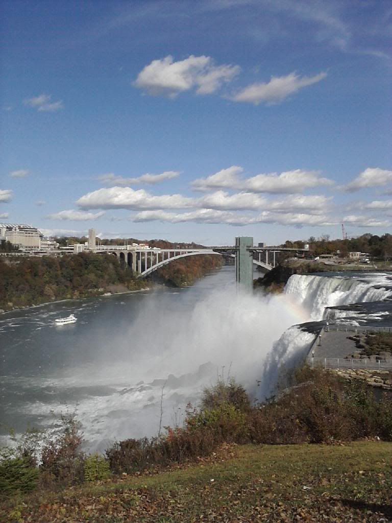
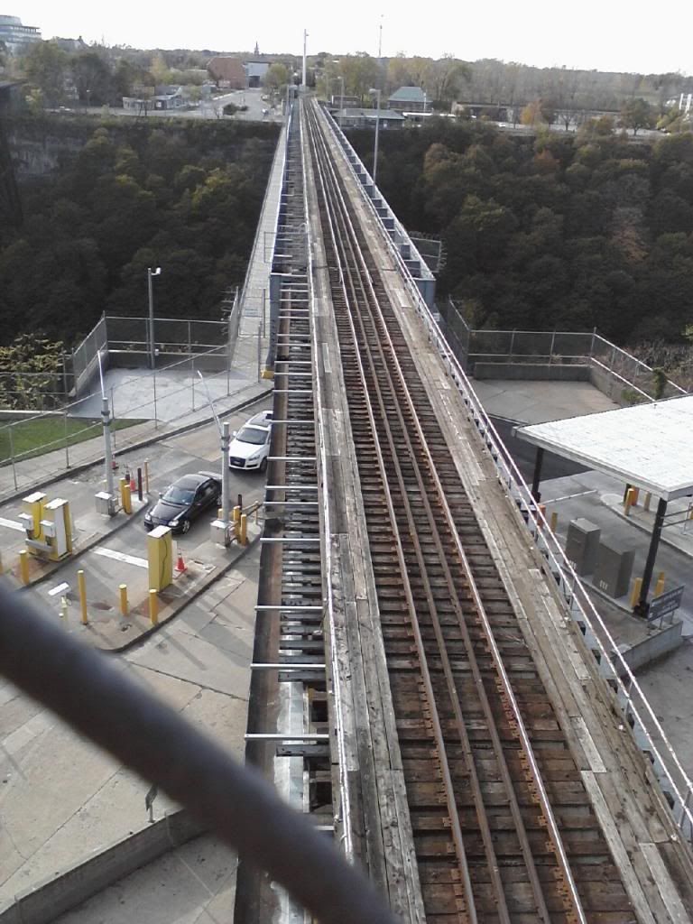
This picture was taken on Goat Island looking north. The Rainbow bridge is in view. One of the boats for the Maid of the Mist is viewable. Further up is the new Maid of the Mist off season storage dock. Too far away to get a picture.
Image

After trying to get a close up view of the new dockage, I headed north with no RR'ing on my mind. It was more like, lets just go up a little further and see what happens. I came upon the Nexus-only border crossing which shares the CN crossing. Then I headed into town. Really run down. Almost every store front was abandoned. Then I came upon the RR at 9th st and North. A good view of the track from the bridge. I looked east, towards the Niagara yard and I see the set of tracks that head north. I stood there kinda stumped becasue I thought everything north of Amtrak was abandoned [Hojak]. I spent the rest of the day finding out that's not true.

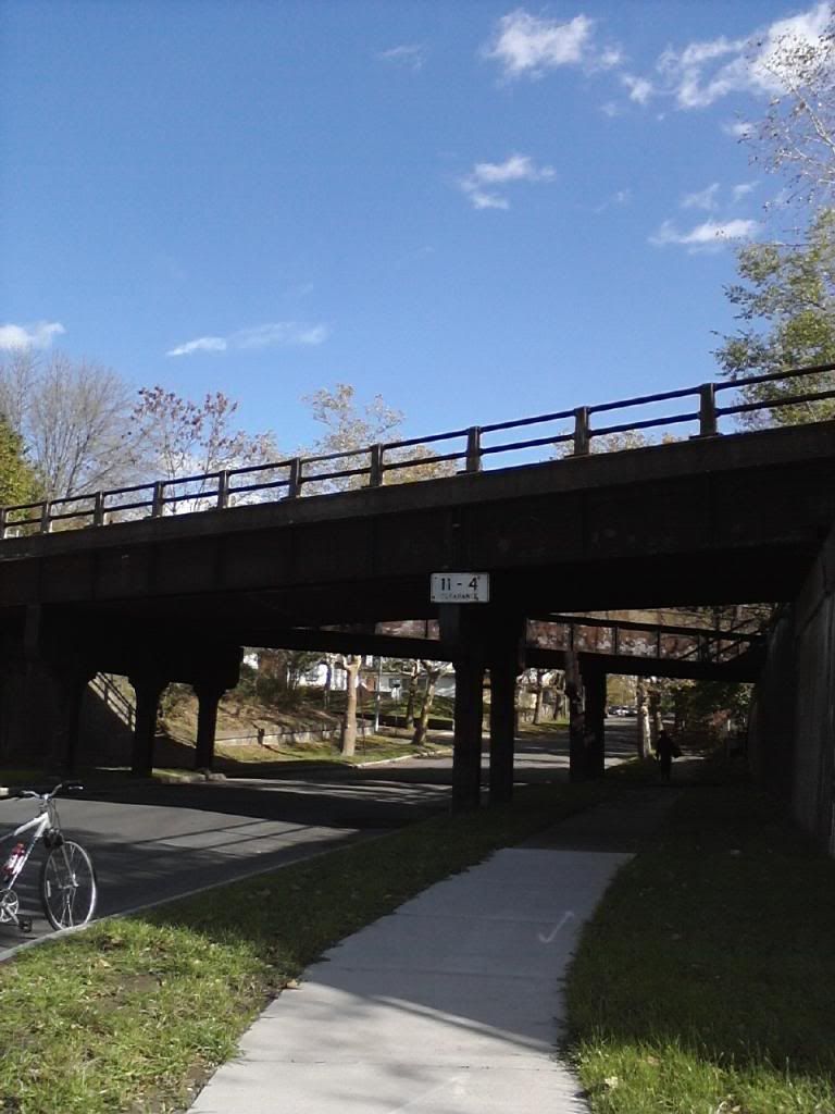
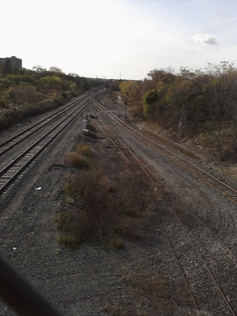
I made my way to Main St and Depot St and here I snapped a picture. This is what finally pushed me to keep going. Took me into some high quality neighborhoods.
Image

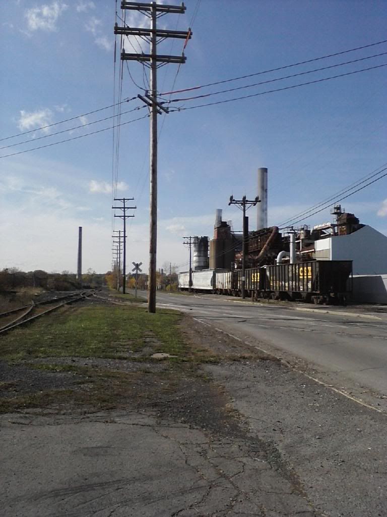
As I said, I thought this all was abandoned. I rode up Depot to 9th and headed north to follow the track. I came to the Garden Ave crossing [mp174.5?]. The rails were polished clean. Well this certainly isn't abandoned. If you need parts for your old TV, come here. Old Tv's laying everywere. I went back to 9th st where it crossed the line again and then to College St [NY31]. I followed 31 east and came upon the industrial zone. I have never been in the area before and was surprised to see it. I rode all the way to Hyde Park {NY61]. In this picture I am standing at the corner of Hyde Park and Collage looking westerly. The track on my left, crosses Hyde Park with a rubber mat but stops on the other side. There is a single signal with no cross bucks. There is a grain elevator to the left but out of view. The company on the right is Treibacher Schleifmittel [ http://www.treibacher-schleifm.com/fused.html" onclick="window.open(this.href);return false; } They are into abrasives.
Image

I was running out of time so I didn't explore north of here. But if I had known that Niagara University was just up the street I would have kept going. From the looks of Google street view, the Hojak line stops at Hyde Park in-between where I was and the University. I will likely go back later and check it out among other things.

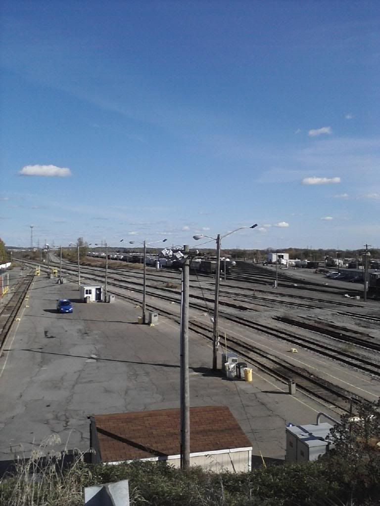
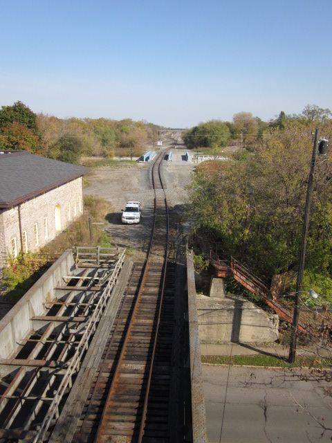
After that, I strayed around looking to get back to my car. A long ways away. Came up Hyde Park at Willard [Amtrak]. From this bridge gives a good view of the yard. I didn't realize how large it was. It appeared to be pretty full.
Image

Then I rode over to the Highland Ave overpass west of the yard looking west. All signals were solid red even though you can't see it in the pic.
Image

I then got back on the Robert Moses Pkwy and took some pictures of the RR crossings.
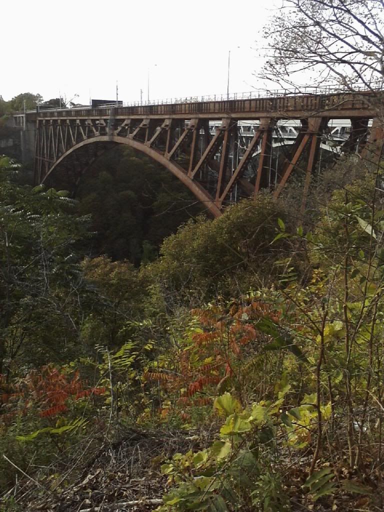
This is the abandoned bridge. Several blockades along with barbed wire. You won't make it across.
Image

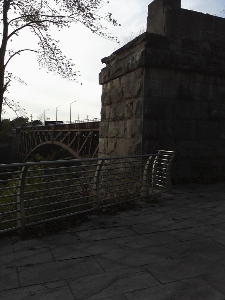
Original concrete abutment.
Image

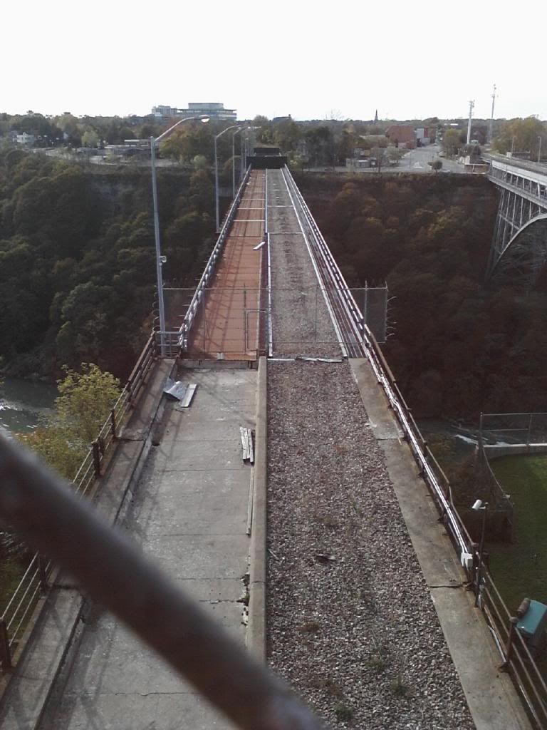
Abandoned RR crossing looking from above on Robert Moses Pkwy.
Image

This is the active RR crossing from Canada [CN]. Auto traffic beneath the RR. Nexus only.
Image

Long day of bike riding for me. I will sleep well. Back at it tomorrow.
 #1225366  by lvrr325
 
The track arrangement in that one industry is something else. There's a tail track with a wye and a diamond crossing in there. It appears they may be using an old self-propelled crane as a shifter.


When I found that same trackage by accident probably 10 years ago, the big brick factory that was south of the tracks still stood. That used to be a big customer with several sidings. The track itself used to go as far east as what I think is now a lumber yard, in a northeastern direction. There's a siding that runs south that appears unused into another factory complex, and a track that went straight west that just about looped around another industrial plant there. A lot of it can be seen on old aerials.

They also showed there used to be a roundhouse and turntable there, gone by 1960 - in the most recent photos, a mound of dirt was in about where that was and the entire yard was gone and hard to tell it was ever there.
 #1225398  by SST
 
In front of the covered hopper and on a seperate siding next to the cars was a winch and cable assembly. I don't think it has been used in a very long time. It wasn't connected to anything. There was a tracker trailer backed into the plant taking a load. I felt sorry for the truck driver. This must have been a nightmare backing his truck underneath the loading bin. He had to back across 2 tracks I think that were in horrible condition. Makes Ganson St look brand new. Why the trucks tires didn't shred or rip out the trucks suspension....amazing.

The weather is looking good again today so I will likely take advantage of it and check out other areas. I will look for the round house.
 #1225407  by SST
 
While looking for the roundhouse I came upon a site with aerial pictures. Some good stuff. But I couldn't find the area of Collage and Hyde Park. It seems that this whole industrial section was missed. I was surprised to see a small yard at the beginning of the Hojak line in Niagara Falls.

This is the address for the website: http://library.buffalo.edu/maps/buffalo ... .html#1928" onclick="window.open(this.href);return false;

This is one sample of Niagara Falls [1966]: http://library.buffalo.edu/maps/img/are ... ne1966.jpg" onclick="window.open(this.href);return false;
 #1225594  by SST
 
The sky cleared again today so I went back up. Gorgeous day. Here's what I found. The ROW for the Hojak line might be buried under Hyde park. The asphalt has that look about it. The industrial sidings [2] that came off the ROW that fed Treibacher [Seperate Location] is burried under ashphalt. I walked up to the fence but it was thick with overgrowth and therefore couldn't tell if rails existed. The next set of industrial track that actually crosses Hyde Park at Lafayette Ave looks like it is still in service. But not much. It was not anywhere near polished clean but it wasn't deeply corroded either. I didn't stop to inspect. The fence was open into the plant but that's all I could tell. No pics.

Here are the pics I did take:

This picture, I'm standing on the east side of Hyde Park looking westerly. The actual ROW of the Hojak line is to the right. You can see the split of the two sidings into Treibacher behind me.
Image

This is the same set of industrial track leading into Treibacher looking east. The Hojak ROW is to the left. You can see the rails protruding at the sidewalk.
Image

This picture, I'm still standing on the east side of Hyde Park but this track is on the west side. The Hojak ROW is to the right in the grass. This track leads to the industrial sidings.
Image

Still standing on the east side, this is what's left of the Hojak ROW. Overgrowth. But you can see the telegraph pole still standing.
Image

This photo is the actual ROW of the line at the Lafayette Ave crossing. All the RR crossing signs are in place. They all look kinda new but this section is no longer in use. This is looking Southwesterly and is blocked by overgrowth. Just the other side of the overgrowth is where the industial siding begins that parallels Lafayette then crosses Hyde Park [mentioned above].
Image

After this, I drove back down to the bridge crossing and snapped a few pics there again but different views.

This photo is looking west from North St. The bridge is Rt104 and the Pkwy. Beneath it, in this photo is the ROW of the Michigan Central Bridge [Abandoned]. To the right is a signal turned sideways. Beneath the signal is a yellow sign saying 10. Am I correct that this is a speed restriction? Beneath that is a stack of sectioned rail. About 5 high. The tower and light to the left is for watching illegals I guess. They won't get across due to barbed wire and it being blocked in 3 areas on the bridge.
Image

Now I'm standing on Rt104 looking east. This is the MC abandoned bridge. The signal turned sideways is to its left.
Image

Still on Rt 104, this is the CN active bridge. Comes with complimentary border crossing patrol. If you look further east, you can see the blue steel girders that go over Main St. This is where I was standing earlier looking west. This gave me a good view of the track on the bridge with my good binoculars. All the track is jointed. They look terrible! Those CN guys must really sweat when they come across hoping not to fall of the rail and go over the side. As I've said above, Ganson St looks brand new compared to this.
Image

I am now riding my bike north along the gorge. Got a great shot of the rapids on the north side of the bridges.
Image

When I was at the Hyde Park crossings, I actually went to Niagara U, before I went back to the bridges, and drove around campus. I just couldn't get my bearings where the line would come through the campus. So now I'm riding my bike back up to the campus and I found the ROW across the street from the campus. This photo shows a lot of garbage which may or may not be RR replated. To the right is what looks like an electrical box. Next to that maybe a cement pedistle [I'm just guessing]. To the left were two green painted steel I-beams pounded into the ground. There were many discarded RR ties. I didn't climb into this mess due to homes up against it. No need for trouble. The campus is to the left.
Image

Now that I had my bearings set on where the ROW should be, I storted up Vincentian Dr looking for anything RR related no matter how remote. I came to a building that had a display panel discussing its heritage. I looked at the pictures and couldn't believe that one contained a photo with the rails in it. Based on what the people are wearing, I'd guess somewhere in the 1950's.
Image

This last picture really took me by surprise. As I moved up the ROW, something caught my eye. I turned and found this tiny section of track right where the ROW is. They didn't forget. I also checked for time stamps. Not were visible. I'll assume these are timeless.
Image

A teacher approached me and asked what I was doing. I told him exploring the former RR. He was aware of it. He then spoke about a trail being made near the Power Authorities reservoir. I think he was trying to tell me that maybe the ROW north of the campus and along the reservior was being converted to a trail. I am not certain I got this right.

I will check it out another day.
 #1225598  by charlie6017
 
Nice photos Dan, I appreciate the legwork--always found the Hojack so interesting and always wondered
where the ROW went through the college.

That is indeed a 10 mph speed limit sign..........the tracks up and down the Hojack have been low-speed
since God was a baby. ;-)

Charlie
 #1233957  by SST
 
While using Google SAT/Maps, I followed the Hojack line out to Rt 425 just south of Wilson. With street view, I found a caboose on the property. So today, while looking for a former Nike Missle base that sits against the Hojack line, [closer to Lewiston] I went exploring.

After leaving Lockport, I headed out to Ft 425N. There is a Nike Missle base there I had almost forgot about. Not a whole lot there except a couple of building. Some in use, some not. Two pedistals for the radar dishes where still there. Neat to see. Then I proceeded to Wilson and sure enough, the caboose was still there.

This first picture is on the north side of the depot including the historical marker. The place is in pretty good shape but will need a paint job soon.
Image

This picture is on the southern side looking NE. There are 2 sets of RR ties in the ground. Mostly buried by grass. But you can see them as you walk around the property. I didn't explore the ROW on the east side of 425 due to pirvate property issues. Looks overgrown anyways.
Image

This picture is also on the soutern side of the deport looking SW towards Lewiston. The ROW is heavily buried in trees and brush. Even when you walk up to it, you can't see it. I walked to the end of the western edge of the property where a drainage area is and walked in a little bit. I could then see the ROW with a drainage tunnel underneath it. To thick with brush to gain access. Plus it was muddy!
Image

The next three picture are of the caboose. Fairly decent shape while it sits underneath a protective roof. Worth the ride out. I also climbed up and snapped a picture of the inside. It was locked so the pic was through the window.
Image

Image

Image

This is the time stamp of the rails that are holding up the caboose. I'm pretty sure that says 1899.
Image
 #1233965  by SST
 
After departing Wilson I headed west on Rt 18 thinking I would intercept Rt429. Oops. No can do but I did come to Porter Center Rd which is exactly where I wanted to be anyways. I headed south looking for the 2nd Nike Missle Base. If you look at the Acme link, you will see 2 markers A and B. To just about 1/8th of a mile north of marker A, you will see the launcher section of the Nike base. It's all under water. "They" have a sign that says something like nature preserve. On the west side of Porter Center rd is the control area. Heavily treed and fenced off. Some buildings and a radar pedistle are back there that can be seen if you zoom in.
http://mapper.acme.com/?ll=43.21270,-78 ... 0City%20NY" onclick="window.open(this.href);return false;

Also at Marker A is the Hojack crossing. Tons of overgrowth. But the ATV's are in there anyways. More like a tunnel than a path. This picture is on the western side of the ROW looking East. You can see the ROW on the right of the street. They dug a ditch for drainage so the line is kinda severed.
Image

This picture is still at Marker A but looking SW towards Lewiston. No path even for ATV's.
Image

Same position but looking NE towards Ransomville and Wilson. This has the tunnel of brush fit for an ATV. Still, it's thick.
Image

The next two pictures are at Marker B. I didn't realize how close I was to the split at Lewiston. Again, heavily overgrown. This picture is looking NE towards marker A.
Image

Same position but looking SW towards Lewiston. This section looks a little clearer than other areas. The split is about 3/4 miles down or so. You can see it in the ACME mapper link. I will explore that area when I get back up there.
Image

It turned out to be a nice little mini road trip. I shall return.
 #1562490  by Fireman43
 
Came across this thread while looking for information on the silo at the Lewiston docks that another recent thread mentioned that had been served by rail.
Thanks for doing all this legwork , great pics and narration.

I had finally gone to ACME mapper to find the old ROW to Lewiston and had forgotten about 7500 acre Lake Ontario Ordinance complex - that is a whole 'nother topic .

Anyway - the ROW branch to Lewiston, when would that have been abandoned?
thanks
Mark
 #1562657  by SST
 
Thanks for resurrecting this post. You won't be able to take pictures from 104 bridge anymore. No more open land where the new Amtrak is. No view of the RR bridges from the 104 overpass. This post turns out to be a good example of why we should "take a picture" cuz it may not be there tomorrow.

Fireman, sorry but I don't have the answer to your question. Hopefully somebody will pop up.
 #1562667  by Fireman43
 
SST thanks. Yes your take on pics is a good point of recording history.

I should probably post my question on that ROW to a new thread and look deeper into threads on this site as now I’m curious about rail serving the Lake Ontario Ordnance Works in the same area.

for instance 1941 - when the LOOW was initiated any use of rail serving that facility would rail shipments to the facility on the Hojack have come from Rochester AND ‘down the hill’ from Niagara Falls ?

I’ll start a new thread before I get all twisted up.

Mark
.
 #1562677  by Fireman43
 
Dan. Looking at your 104 pics you mentioned above On diff current overhead views I’m
Not seeing the new amtrac station.
I’ve never been able to determine these views as to date snapped. I know the station is fairly new but still ——-
Mark