Railroad Forums 

  • Saco Industrial Track

  • Guilford Rail System changed its name to Pan Am Railways in 2006. Discussion relating to the current operations of the Boston & Maine, the Maine Central, and the Springfield Terminal railroads (as well as the Delaware & Hudson while it was under Guilford control until 1988). Official site can be found here: PANAMRAILWAYS.COM.
Guilford Rail System changed its name to Pan Am Railways in 2006. Discussion relating to the current operations of the Boston & Maine, the Maine Central, and the Springfield Terminal railroads (as well as the Delaware & Hudson while it was under Guilford control until 1988). Official site can be found here: PANAMRAILWAYS.COM.

Moderator: MEC407

 #526878  by Hamhock
 
Curious if anyone can tell me about a seldom-used freight line in Saco that travels directly behind my condo building. The track splits off from the shared Downeaster line about a mile or two south of us in Biddeford, then meanders for another couple of miles through Saco and abruptly ends in the Industrial Park area.

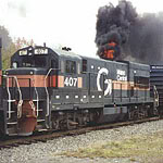
Everyone in the building enjoys seeing the freight when it sporadically passes by. Our building is an old converted shoe factory built in the early 1900s, so the train really ties in well from that aspect; I assume long ago that cargo was once loaded/unloaded from the factory building, since it's only 50 feet from the tracks.

It's usually only 2 or 3 cars at most, and traveling very slowly, as 500 feet north of us it needs to cross a busy street at grade without a barrier (someone jumps down and waits for traffic to clear, then gives the go-ahead to the engineer to proceed across the street; pretty awesome to see at night or during a snowfall!)

Here's an overhead view of where I'm talking about:
http://maps.google.com/maps?ie=UTF8&hl= ... 3&t=h&z=18

Anyway, just an odd question from a quasi-yuppie who would like to see the tracks near his home used *more* often.

 #526912  by cpf354
 
Called variously the "Old Eastern", or the Saco Industrial Track. Its' junction with the main line is at a location called "AR", which is the site of the now gone B&M AR Tower. AR Tower controlled the junction when the Eastern was a parallel main line that ran to Portland. The initial portion of the branch from AR into Saco is over the Eastern main line ROW, and the remaining portion that swings to the west into the industrial park was built later for that purpose.
Up until 1944, the B&M's Portland Division had two main lines out of Portland to Boston, the Eastern and Western. The DE and the PAR Freight Main operate on the Western. The Eastern from Rigby to North Berwick was abandoned in 1944, except for the portion you see in Saco, and a portion in North Berwick that served a quarry. That track has been gone for some time I believe. The Eastern from North Berwick to Kittery was abandoned in 1952. In 1965, or so, passenger service from Portsmouth to Boston ceased, and a drawbridge at Newburyport was opened, and never closed, severing the Eastern there and creating an isolated branch from the Portsmouth/Kittery area, which has now been cut back all the way to Hampton. The remaining portion of the Eastern still is active from Newburyport to Boston as an MBTA commuter rail route.
A switcher from Rigby serves the Saco Industrial Track, I believe. Several customers are listed on the Northern New England Railfan web site, but I haven't been up there watching trains in some time.
Hope this helps. Sure there are others with more information as well.

 #526947  by NaugMOW
 
cpf354 covered it pretty well. Looking down from North Street towards Saco Brick/German Auto, the track curves very sharply left (North). This is where the old Eastern used to travel straight. This can be traced pretty easily I would add that you can see the roadbed of the Old Eastern in quite a few places. It crosses the turnpike spur right near the Main Street interchange, as well as where it crosses Moody Street, and Route 1. Where it crosses the Scarborough Marsh it has been turned into a nature trail.

The two present customers are Wood Structures on Industrial Park Road and the team track a few hundred feet away. Wood Structures receives a few carloads on centerbeams. The team track (between Industrial Park Road and the toll booth) sees occasional steel shipments, I assume for Casco Bay Steel and an occasional center flow hopper, I'm not sure who for. There used to be a customer off of Lund Road (the switch is near the Mini Self-Storage) that would receive 8-12 tankers. The scrapyard near the turnpike spur also used to receive several gons for scrap steel. The city now owns the property.

The Industrial Park track was a City of Saco project back in the 80's (if I recall correctly). It was done in several phases.

Casco Bay Steel at the end of the line has expressed some interest in shipping by rail, however does not want to fund the track extension estimated at $30,000.

Photos:
http://tinyurl.com/53joqj

 #527086  by cpf354
 
My recollection was the tanks went to Johns Manville, which is no longer there. I think NGB Barriers is at that location now.

 #527268  by Hamhock
 
Awesome. Thanks for the info, everyone!

 #527458  by BM6569
 
On a related topic, are any remains left from the branch to Kennebunkport?

 #528660  by cpf354
 
Not a scrap of iron, although the ROW is still largely intact. That was abandoned back in the 1920's I think.

 #528706  by Gerry6309
 
On Route ME-9 after you cross the Mousam River going east the right-of-way crosses the road and is visible as a roughly parallel embankment through the marsh for some distance. Its very prominent.

 #528746  by jonnhrr
 
On a related note there is a track that I see often when driving up to Maine, going through Portsmouth you cross it on I-95 just before the exit for the Portsmouth rotary. At first I thought it might be a remmnant of the Eastern track, but following it on Google Maps I see it veers west then intersects the Boston Portland main in Rockingham. What is this track called and is it still used?

Jon

 #528783  by Gerry6309
 
jonnhrr wrote:On a related note there is a track that I see often when driving up to Maine, going through Portsmouth you cross it on I-95 just before the exit for the Portsmouth rotary. At first I thought it might be a remmnant of the Eastern track, but following it on Google Maps I see it veers west then intersects the Boston Portland main in Rockingham. What is this track called and is it still used?

Jon
That is the Portsmouth Branch off the Western Route. It is the only acces to the isolated section of the Eastern between Hampton and Kittery. There is a thread regarding activity there and another regarding the "hope" of restoring service from Newburyport.
 #595781  by scoopernicus_in_Maine
 
I was on my lunchtime walk through Saco where at the corner of Lincoln and Maple were the railroad grade is, I saw this Pan Am engine hauling a couple of cars:
Image

Being a dilletante in the world of railfanning, I don't know what line this is, but I was pretty sure that it wasn't being used anymore. I've seen engines pulling the same short consist before on that line. Are they just doing some low level maintainence on it, or are there plans to use it again?

Here's a shot of the same train crossing Lincoln:
Image
 #595811  by MEC407
 
That is the Saco Industrial Track, and what you saw is actually a very common sight (well, by "common" I mean it happens anywhere from once to three or four times a month). They use it to serve customers in the Saco Industrial Park. The Saco I.T. uses the right-of-way of what was once the B&M's Eastern Division, and before that, the Eastern Railroad. It connects with the mainline at milepost 213.5 in Biddeford. For more details, check out http://web.archive.org/web/200409031004 ... rs_mp2.htm
 #595812  by trainsinmaine
 
This is what's left in the Biddeford-Saco area of the roadbed of the Eastern Railroad, which was absorbed into the B&M in the late 19th century and became the latter's alternate route between Boston and Portland. If you can locate a copy of DeLorme's Maine Atlas and Gazetteer, begin at Jewett, a few miles north of Eliot, and you can trace the entire right-of-way into South Portland (it appears as a broken black line).

Passenger and (mostly local) freight service was abandoned between Saco and South Portland in 1944 and from Kittery to North Berwick in 1952. There are many vestiges of the railroad to be seen ---an interesting way to spend an afternoon.
 #595829  by MEC407
 
Are you talking about the bridge that crosses the Saco River? If so, then yes, they do use that bridge... it's the only way for them to get across the river and get to/from the point where the Industrial Track connects with the mainline.