Railroad Forums 

Discussion relating to the PRR, up to 1968. Visit the PRR Technical & Historical Society for more information.
 #643822  by Bethlehem_Branch
 
I need information about the location of stations on the above-mentioned PRR(not-RDG) line. Particularly, I would like to know if anyone has images of the the Shawmont Station. I am interested in determining how people accessed the station from Nixon St.

Maps of the line in general would be appreciated as well. Thanks in advance.
 #644156  by CarterB
 
Here's a web page for you: (albeit on the Philadelphia, Germantown and Norristown Railroad)

It would appear to me that the PRR station would have been accessed by Shawmont Ave.

http://philanet.com/Philadelphia/railro ... ation.html

"The oldest train station in the United States, dating to 1834 is Shawmont station (see photo) in the Shawmont section of Roxborough and is along the line used to Norristown. It represents a time when the train station was the home of the person responsible for tending it (Stationmaster). It had a waiting room, baggage room, post office and living quarters. One could get something to eat there as well. Many of the early stations functioned that way. With little parking and a short platform, the station was closed in 1990; however, the train still goes by as it did in 1835, and stops at nearby adjacent stations (Ivy Ridge and Miquon). Just imagine-over 1,500,000 trains have passed by Shawmont station.

The stagecoach-style passenger coach eventually became an enclosed coach with a wood-burning stove. The wood burning engine became a coal-burning engine and the 30-lb. rails were enlarged to 50 pound to accommodate larger, heavier and faster engines. "

Also: http://www.west2k.com/papix/shawmontstation.jpg
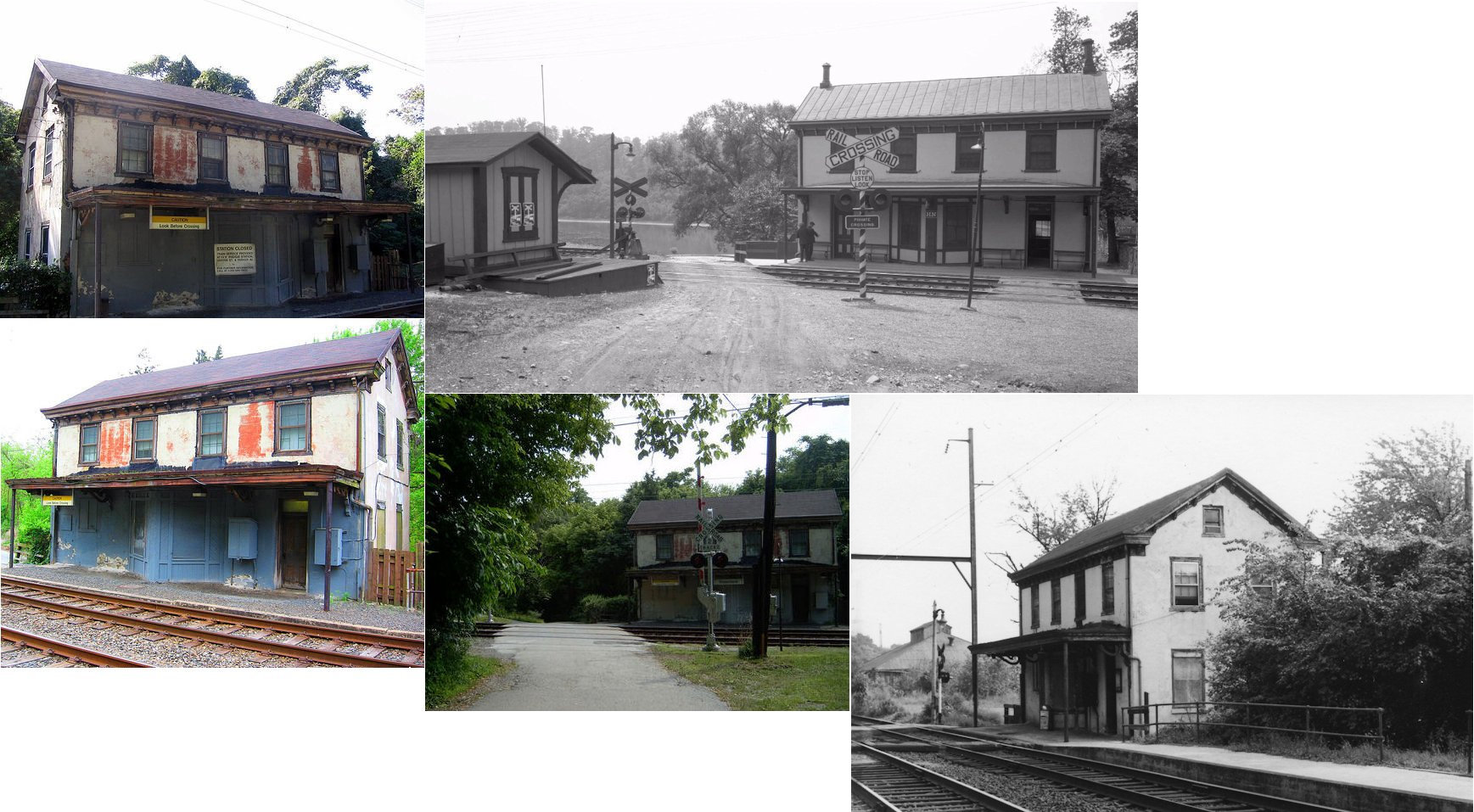
 #652728  by Hal
 
I need information about the location of stations on the above-mentioned PRR(not-RDG) line.
Particularly, I would like to know if anyone has images of the the Shawmont Station.
I am interested in determining how people accessed the station from Nixon St.
Good question-
check out
http://www.philageohistory.org

The city land use maps from the 1940s and 1960s show the station on the northeast side of Nixon.

I don't know of any images

Hal
 #808174  by John Johnstone
 
Specifically, the PRR station for Shawmont from 1884 was just southeast of where Port Royal Ave. crossed the tracks right by where the current bike trail starts and Nixon Street ends. I remember seeing a little delapadated wooden shelter on the outbound side during the late 60's, when I rode in the car, near that crossing. The inbound station was already gone by then, but would have also been accessible where Nixon Steet meets Port Royal Ave.
 #808187  by CarterB
 
According to the 1903 and 1910 Philly land use maps, the station would have been on the city bound side about 100 yards NW of the Shawmont Ave. underpass. (Right about where a home has a trailer parked in the back yard) N 40.04585 W 75.25126
 #808357  by John Johnstone
 
That sounds right - about 300 yards or so from the underpass to Port Royal Ave. The shelter I saw would have served passengers going to Norristown. At that time, the inbound station was long gone (around 1969). I believe passenger service beyond Manayunk ended around 1960.