AnthonyB wrote:...Heading south right before the South Amboy station a spur heads off to the right. The tracks look used and they appeared to have catenary overhead. Does any one know where the lines go and what it is/was used for? Thanks.
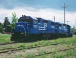
OCtrainguy wrote:Based on your description, that track you saw would be the Amboy Secondary, where it meets the NJCL. The trackage is used by Conrail Shared Assets to/from Browns Yard in Sayerville.
henry6 wrote:....this the same track or row that comprised the Camden and Amboy?
Yes, that is the ConRail Shared Assets’ Amboy Secondary, former PRR, former Camden and Amboy Railroad.
OCtrainguy wrote:This trackage was former PRR, thus the catenary poles that you saw.
PRR later electrified that route from Monmouth Jct. (Midway) on what is now the Northeast Corridor so that electric-powered coal drags could reach the coal dumpers at South Amboy without an engine change.
henry6 wrote:....And, by the way, is there an "original C&A" track piece with memorial sign near Jamesburg? Remember one back in the 50s but don't know if it still exists or not today, and, if so,k where? Got an old b&w of it.
There is a sign about the C&A adjacent to the CSAO Amboy Secondary on County route 527 just south of Spotswood and the Rte. 18 overpass. There is another sign on Rte. 133 where it crosses the C&A ROW north of Hightstown.
More on the Camden and Amboy at:
1. Gerald's Railroads of New Jersey:
http://www.geocities.com/transit383/ashist.html ,
2.
http://jcrhs.org/camden&amboy.html , and
3.
http://en.wikipedia.org/wiki/Camden_and_Amboy_Railroad