F40CFan wrote: ↑Wed Mar 08, 2023 3:02 pm
MACTRAXX wrote: ↑Tue Mar 07, 2023 5:24 pm
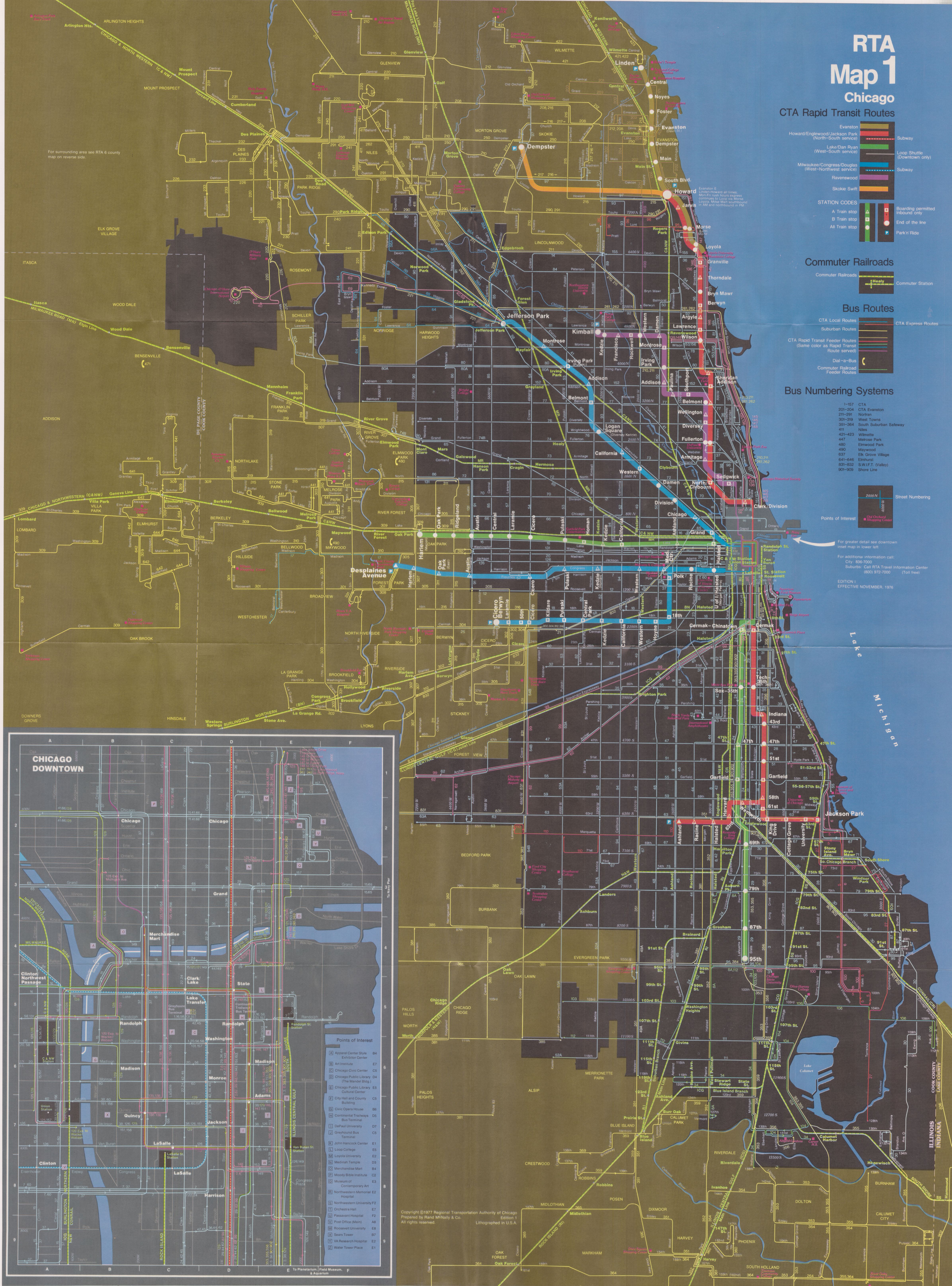
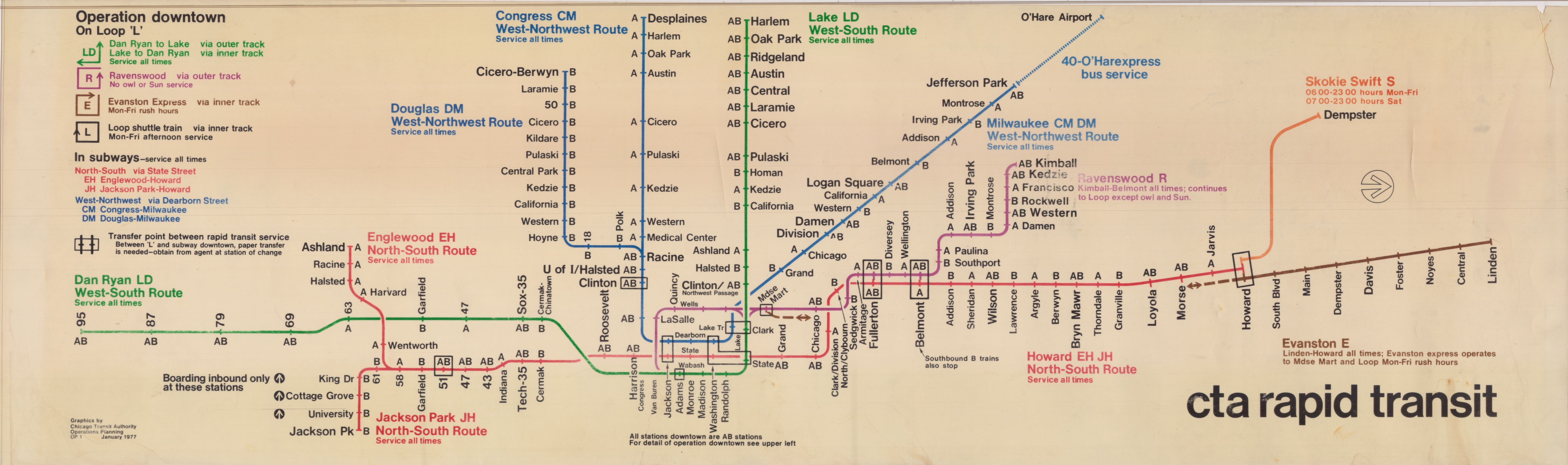
CTA Rapid Transit Lines and their RTA map color coding:
RED: Howard-Englewood-Jackson Park
BLUE: Congress-Douglas-Milwaukee
GREEN: Lake-Dan Ryan
PURPLE: Ravenswood
BROWN: Evanston Express/Local
ORANGE: Skokie Swift
Actually the Ravenswood became the brown line and the Evanston Express became the purple line.
F40C: You obviously did NOT read my entire post - This was the ORIGINAL use of color coding
on a folded map to denote CTA Rapid Transit routes back in *1978* - 45 years ago - which eventually
evolved with changes and additions to the 1993 implementation of the CTA color route naming.
"1978-1979 RTA Map of Northeastern Illinois" is the map title which is printed on glossy paper.
The two maps - City of Chicago and Chicago Suburbs - have a black background print making
the coloring used for rail and bus routes stand out vividly with the contrast - in short a well -
prepared first effort from the RTA which then was a huge change as compared to CTA maps from
those years which only used one or two base colors from the 1970s into the first half of the 1980s.
Upon further review of this map there is an RTA copyright dated 1977-1978 - Second Edition
Effective June 1978 - Prepared by Rand McNally & Co. (a well-known map-making and map
design company) for the Regional Transportation Authority. Both sides of this map are here:
http://irm-cta.org/RouteMaps/RTA/FullMa ... hicago.jpg
http://irm-cta.org/RouteMaps/RTA/FullMa ... uburbs.jpg
(Thanks, JL

) MACTRAXX
EXPRESS TRAIN TO NEW YORK PENN STATION-NO JAMAICA ON THIS TRAIN-PLEASE STAND CLEAR OF THE CLOSING TRAIN DOORS