Railroad Forums 

  • Marina Bay/Squantum Trolley

  • Discussion relating to commuter rail, light rail, and subway operations of the MBTA.
Discussion relating to commuter rail, light rail, and subway operations of the MBTA.

Moderators: sery2831, CRail

 #670151  by $teve25
 
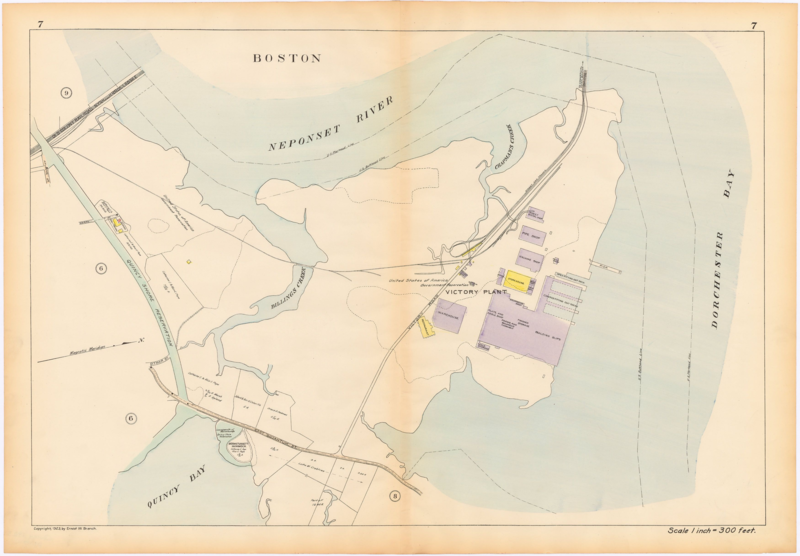
http://www.wardmaps.com/viewasset.php?aid=2893

It seems there was a military base where Marina Bay is today. It was served by a trolley line that connects to Boston via a bridge over the Neponset to Commercial Point( where the big gas tank is). Does anyone know or have any pictures of the bridge and to what purpose the trolley line was for and when and why it was discontinued?
 #670245  by MBTA3247
 
The 1921 BERy map shows that trolley line. It branched off the Neponset line and followed Victory Road over a bridge into Quincy. It does not show up in the maps for 1916 and 1925, so I would guess it only existed to serve the shipyard (which is what that base looks to be) there during WWI.
 #670973  by atsf sp
 
I believe the base existed for WWII too because it was air force and used as a target range. Don't know about the trolley line.
 #671136  by jonnhrr
 
atsf sp wrote:I believe the base existed for WWII too because it was air force and used as a target range. Don't know about the trolley line.
Actually a Naval Air Station (Squantum NAS). The infrastructure still existed in the 1960's when I lived in Dorchester but the base had been decommisioned. The airfield was closed in the early 1950's due to its proximity to Logan and the inability to expand its runways to handle modern aircraft.

Found this web site with some information:

http://www.airfields-freeman.com/MA/Air ... on_SE.html

"The U.S. Navy came along in 1917 & purchased this area for WW1 aviation training purposes & to build a major shipbuilding facility.
The Bethlehem Steel Company built the Victory Plant Shipyard on the northern side of the property,
and built 35 destroyers between 1918-1920.

Post WW1 the area was used for the establishment of Naval Air Reserve Base Squantum in 1923.
The earliest depiction of the Squantum "Naval Reserve" Seaplane Base which has been located
was on the 1929 Rand-McNally Air Trails Map of Massachusetts (courtesy of Chris Kennedy)."

No mention of the trolley line however, suspect it was long gone by then.

Jon
 #672050  by A320
 
The large building on the site now was built as a central warehouse by Jordan Marsh in the late 60's to serve its several New England stores.

I don't know who owns it or for what it is used these days.
 #672693  by MBTA3247
 
A friend just passed me some more information about this line:
Information compiled by William Werner in 1973 shows the opening date of the line as January 11, 1918. The new trackage ran from Neponset Avenue to Squantum via Victory Road, including a temporary bridge across the mouth of the Neponset River. It was paid for by the U.S. Government to serve the Victory Plant. The line was operated as part of the Boston Elevated's surface car system. Werner's list does not show what service was operated on this line originally, but does say that on September 7, 1920 regular service was replaced by a single car shuttling between Fields Corner and Squantum. This operation was abandoned February 1, 1924.
 #1544305  by The EGE
 
Reviving this very old topic because I stumbled across some photos. They were taken on May 7, 1919 and are credited to the American Electric Railway Association. Click on any to go to the file page and see the full-size version.

Tracks on the Victory Road bridge (Victory Bridge). The bridge was constructed in ten weeks at a cost of $300,000 (equal to $5 million in 2020 dollars) and included a draw span on the Dorchester end.
Image

The bridge viewed from the Squantum end. The channel for the drawbridge is visible at left.
Image

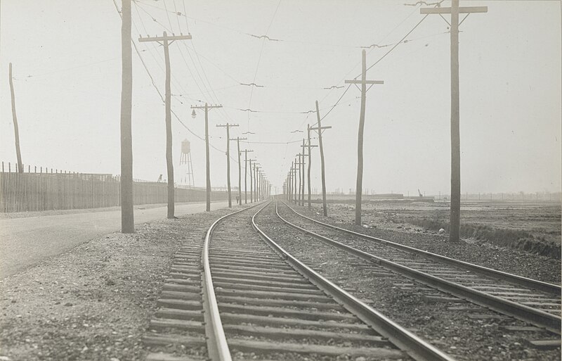
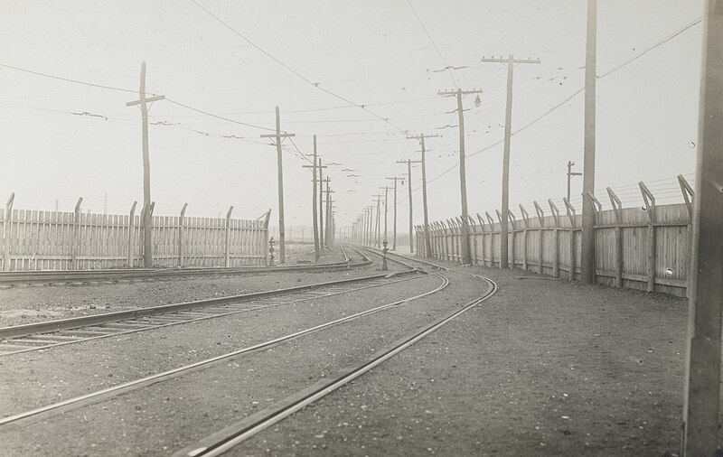
Tracks alongside Victory Road in Squantum. The fence at left was to hide the destroyer plant.
Image

Approaching the loop:
Image

Reverse of the previous shot, viewed from the platform:
Image

The small shelter and a streetcar. This is #4006, a "two-rooms-and-a-bath" articulated car built in 1913 from two 1890s 20-foot streetcars. They weren't the best cars, but they provided badly needed capacity while the center-entrance cars were under construction.
Image

An overview of the loop. Note that you can see railroad cars behind the loop - this was the Victory Branch of the New Haven Railroad.
Image

A 1923 map showing both lines:
Image
 #1544307  by The EGE
 
I almost forgot - a small section of the Victory Road bridge is still extant. It's slowly rotting away in the Dorchester Shores Reservation, on Victory Road just east of the Exit 13 off-ramp from the I-93. I saw it in March 2017:

Image
 #1544356  by MBTA3247
 
Looking at the maps, I believe the New Haven's Victory Branch is now Commander Shea Blvd.
 #1544365  by The EGE
 
From the mainline to about Airport Road, yes. North of there, Shea is a bit to the west of the former branch.