Railroad Forums 

  • working on north jersey historic and current railroad map, need suggestions

  • Discussion related to New Jersey Transit rail and light rail operations.
Discussion related to New Jersey Transit rail and light rail operations.

Moderators: lensovet, Kaback9, nick11a

 #1526521  by kennj123
 
I've been working on a map of north jersey railroads:
https://www.google.com/maps/d/embed?mid ... Cq7roR2jua

it shows historic and current railroad infrastructure. there are several layers, there is an outline on the left with a treeview you can toggle them on and off. basically is shows the original lines from the 1ate 1900s, places, current commuter lines, current freight lines, and obsolete tracks.
I use a light grey color to mark 'ghost' objects that were demolished but likely still have some foundation work showing.

I'm really interested in showing the huge infrastructure on the west hudsonduring in the late 1800s. its really interesting how the raillines 100+ years ago made north and central new jersey population centers what they are today (the jersey shore too).

I do a lot of meetups where we hike and bike in the area and I've been interested in figuring out what I'm looking at.

a couple things I discovered:
the lackawanna station in Hoboken has a near identical twin in Scranton PA.
the Erie mainline used to go though Rutherford, Passaic, Paterson and explains the high housing desnity in that area.
Cental NJ R's main line went from Somerville to Elizabeth and explains that dense corridor.
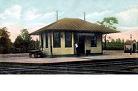
the cutest railstation in NJ is at montclair, here: https://goo.gl/maps/ETcDVmxybaX6Mdq79 . and the architect for it couldnt attend the opening because he died on the Titantic.
I'm especially looking for old signage like this: https://goo.gl/maps/7m7i5PCbMwCmVuPY7, still up on the old Broad Street CNJ station. (the Montclair station has Lackawanna on it)
Sunday I'm going to Jersey City to stop by where the entrance to the Erie Cut, Bergen Tunnel are to see if there is a good vantage point to easily view it, as shown here; https://en.wikipedia.org/wiki/Long_Dock ... img013.jpg

anyway, just thought I'd show the map to some of the experts in the field and looking for any helpful hints.
 #1526869  by sullivan1985
 
I have been working on one myself. Its about a year old an still growing. The goal is to cover New Jersey and parts of CT, NY, PA, DE, MD that were influential to NJ rail traffic.

https://drive.google.com/open?id=1v-L17 ... sp=sharing
 #1526985  by kennj123
 
sullivan1985 wrote: Tue Dec 03, 2019 5:32 pm I have been working on one myself. Its about a year old an still growing. The goal is to cover New Jersey and parts of CT, NY, PA, DE, MD that were influential to NJ rail traffic.

https://drive.google.com/open?id=1v-L17 ... sp=sharing
boy, its like a work of art. are you doing it in google earth and exporting to google mymaps? I ask because even with my low amount of lines googlemymaps is crashing, Not sure if its number of lines or number of points in a line thats a problem though.

I will be going though yours and incorporating it in mine. will give you attribution where possible. and won't copy directly. Also, I don't really need a super level of detail for mine.

just curious, do you work for RR?
 #1526990  by Ken W2KB
 
tomk62 wrote: Wed Dec 04, 2019 2:34 pm Raritan River Railroad - South Amboy to New Brunswick
Somerville - Flemington - Lambertville - was this CNJ?
Phillipsburg - Lambertville
Freehold - Jamesburg into the NE Corridor (PRR)
Somerville to Flemington was CNJ. Flemington to Lambertville was PRR.
 #1527104  by kennj123
 
R&DB wrote: Wed Dec 04, 2019 9:28 am kennj123 » Fri Nov 29, 2019 8:42 pm

Nice work. Here are some to add:
CNJ Oak Island Yard to Elizabethport
CNJ Southern Division
CNJ Long Branch to Sandy Hook
PRR Monmouth Junction to Manasquan
Reading Bound Brook to Philly
>> CNJ Oak Island Yard to Elizabethport
In now, I was aware of it but that area was getting complicated and was avoiding it untill I had time. what i put in is good enough for now

>>CNJ Southern Division
Its got a confusing history, but given its the basies for Henry Hudson rail trail and sandy hook, I put it it. Anything rail route that is open to the public I'm putting in to its possible to see how it fits in the big picture.

>>CNJ Long Branch to Sandy Hook
done, see above.

>>PRR Monmouth Junction to Manasquan
done, Alaire and Edgar Felix are on this route to it makes my cut.

.>>Reading Bound Brook to Philly
in now, just wasnt sure where it went.
 #1527162  by kennj123
 
CarterB wrote: Thu Dec 05, 2019 3:25 pm Erie Railroad ( NY&GL) went on from Ringwood thru Hewitt to Sterling Forest on Greenwood Lake.
I'm following this map pretty closely. https://collections.leventhalmap.org/se ... :cj82km075
on the map it looks like its follwing the blue line that appears to be the Wanaque River, which looks like it comes out of Greenwood lake and goes south. that makes sense as a good line to follow grade wise.
 #1527164  by kennj123
 
tomk62 wrote: Wed Dec 04, 2019 2:34 pm Raritan River Railroad - South Amboy to New Brunswick
Somerville - Flemington - Lambertville - was this CNJ?
Phillipsburg - Lambertville
Freehold - Jamesburg into the NE Corridor (PRR)
>>Raritan River Railroad - South Amboy to New Brunswick
I looked at it, and I'm not putting it on the map at this time. it too small of a line and not noteworthy enough. if it had some infrastructure on the line like a nice station, bridge or pier, I'd put it on. I just have to cut the line somewhere. I could put a marker on it somewhere so I can put a link to the Wikipedia article about it that is pretty good.

>>Somerville - Flemington - Lambertville - was this CNJ?
done, Flemington was a real hub, CNJ, LVRR, PRR all wanted to go there.

>>Phillipsburg - Lambertville
done, started at Belvidere and went to Trenton (PRR)

>>Freehold - Jamesburg into the NE Corridor (PRR)
done, went from Monmouth Jct to Manasquan
 #1527257  by kennj123
 
MickD wrote: Thu Dec 05, 2019 1:13 pm NYS&W Paterson City Branch from just south of Broadway & Madison Ave.to Straight street
between 16th Ave. & Pearl...I walked the right of way one afternoon back in mid 80's..
Not much of a trace left now..
you can see that spur? on the Sully2019 map here:
https://www.google.com/maps/d/viewer?mi ... 50956&z=16

I'm avoiding spurs or branches that aren't noteworthy so this one isn't makeing the cut. I put greenwood on because it was an important early line that went all the way to Jersey City and went to ore mines in the greenwood area.
 #1527373  by kennj123
 
somebody pointed out Tenafly train station as one of the prettiest stations in NJ. I'll probably put it on my list, but I'm really interested in finding signage that identifies it as an Erie railroad station. here's a closeup of the windvane on the roof: https://goo.gl/maps/Mm7nzXPJ5jkwzTP28 . Does the ''E" and star mean its an Erie Station by any chance?
 #1527396  by CarterB
 
The original Erie main went through Monroe, Chester, Goshen and Middletown. The line you show came later, the Graham bypass.
The NYS&W Paterson City Branch from just south of Broadway & Madison Ave.to Straight street
between 16th Ave. & Pearl was actually the most significant for passenger service, far more trains on that branch than what ran to Butler.
 #1527414  by kennj123
 
CarterB wrote: Sat Dec 07, 2019 9:59 pm The original Erie main went through Monroe, Chester, Goshen and Middletown. The line you show came later, the Graham bypass.
The NYS&W Paterson City Branch from just south of Broadway & Madison Ave.to Straight street
between 16th Ave. & Pearl was actually the most significant for passenger service, far more trains on that branch than what ran to Butler.
both are fixed. for both, instead of creating a new line, I pulled a loop off the existing line to reduce the total number of lines.

the old erie route is particularily interesting because its a rail trail now. I'll mark it as converted.