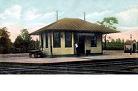
I posted to the "ErieLack" group, and they confirmed the location where Newark/Harrison - Jersey City turnpike crossed the DL&W. DL&W called the location "Sanford's", not "Sandford's". They pointed me to their archives and a bunch of photos came up of the construction of the overpass to eliminate the grade crossing. In the following 4 links, you will see a description of some photos, with a link to a page which has thumbnails of photos, and you can then click on them individually to open them up. They are very big files and might take a while to download.
Pictures X1610.jpg thru X1612.jpg are during construction, Aug. 21, 1920
http://lists.railfan.net/erielack-diges ... 00131.html" onclick="window.open(this.href);return false;
X1610 part is the new overpass close to completed, and X1612 is one of my favorites. Looking NW. The streetcar bridge on the right, the new bridge on the left, and the plank road in the middle is I believe the orignal Newark -Jersey City Turnpike, looking in the direction from Jersey City to Newark. So the crossing must have been where the building is going on, where the DL&W crosses.
Pictures X1656.jpg thru X 1660.jpg are construction shots. Nov. 11, 1920
http://lists.railfan.net/erielack-diges ... 00248.html" onclick="window.open(this.href);return false;
In X1657 you see the pre-existing streetcar bridge - the truss section is the part spanning the DL&W.
X1715.jpg
http://lists.railfan.net/erielack-diges ... 00005.html" onclick="window.open(this.href);return false;
and X1716.jpg thru X1719.jpg
http://lists.railfan.net/erielack-diges ... 00017.html" onclick="window.open(this.href);return false;
are mostly the finished product. THey are not dated but in 1921 I suppose. Note you still see semaphore signals - this is just before the new signalling projects with signal lamps in the Railway Age article of November 1922 described a few posts ago. Compare X1719 to the "eastward view" in the railway age building. YOu see the same "church-like" building on the right, and the streetcar trestle behind the bridge. This shows up in a lot of the photos and can help you get oriented. In think the original crossing was just in the foreground of X1718 (westward view), before the bridge. The small road you see on the left (south) of tracks (also in X1716) is still there on modern maps, going to the NJ transit Meadows Maintenance Yard, and is a dead-end coming off the Newark Turnpike (and labeled Newark Turnpike or Harrison TUrnpike on modern maps, depending which one you look at). You also see it on the right side (looking eastward, the other way ) in X1717 and X1719.