I have a map to show and a photo.
The first is a map that shows the location of the original West Mt. Vernon passenger station, located where the New York & Harlem ran in the right-of-way east of the later (and current) post-electrification location. I marked the current station location with a red circle.
What's especially interesting to me is, the tracks were west of Railroad Avenue. As those of us from the area know, today Railroad Avenue (renamed MacQuesten Parkway) is a two-way street with a median separating the northbound and southbound roadways. In the area near Mt. Vernon Avenue the southbound roadway is at a lower elevation than the northbound roadway. So apparently, as I long suspected, the southbound roadway is located on the grade of the old Harlem Railroad line.

The map is undated but I can narrow it down a bit. It's labeled New York Central & Hudson River. This railroad came into being in 1869 and took on the old New York & Harlem by 400-year lease in 1873. So I would guess it's after 1873 and before 1910.
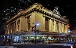
Here's another great photo which I found on a forum site that discusses the history of Yonkers in great detail. They said they had no problem with me posting it here (for which I thank them).

This was shot looking west on Mt. Vernon Avenue in about 1951. The driveway to the West Mount Vernon train station on the left, an MU train on the overpass and two Yonkers Railroad No. 7 cars underneath. The one on the right headed for Yonkers and the other inbound to Mt. Vernon.
Here's a
link to the thread on the site from which this image was borrowed.