TomNelligan wrote:Also three foot gage was the West River RR in Vermont, which became the Central Vermont's Brattleboro-South Londonderry branch.
Ridgefielder wrote:That leaves Suffield, Watertown, Rockville and Colchester, CT; Hope, RI; and Southbridge, Williamsburgh, and Turner's Falls, MA, on the NYNH&H.
From personal experience from back when there were tracks, it's not Suffield, Watertown, or Turner's Falls, unless the look of things changed an awful lot by the 1960s. The hills don't look big enough for Williamsburgh, and I believe that the Southbridge branch ended in a mill complex (as did both the B&M and NH branches to Turner's Falls).
So, using the old USGS maps at historical.mytopo and Google street views, I can *positively* say it is not Colchester (station is wrong), Rockville (town was very built up even in Victorian days, judging by the architecture), or Chapinville (hills are wrong) on the New Haven. South Londonderry, VT on the West River RR is also out-- once again, the station is still standing and looks nothing like the building pictured. I'm *fairly* sure it's not Hope, RI (too built up) or Readsboro, VT on the Hoosac Tunnel & Wilmington (once again, the hills are too gentle.)
So that leaves the top photo as-- what? Could this be one of the B&M's branches in southern New Hampshire? The trees (elms and maples) and the architecture of the buildings in the background make me 95% certain this is somewhere in New England.
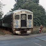
It also strikes me as odd how lifeless the top photo is. There are no cars, horses or people on the road in the background, there's nothing on the station platform, the track is in rough shape. Could this be one of the towns that was flooded out when they built the Quabbin Reservoir in the '30s?