Railroad Forums 

  • Photo Location Help? (Bryn Mawr Park, Putnam Division)

  • Discussion relating to the NYC and subsidiaries, up to 1968. Visit the NYCS Historical Society for more information.
Discussion relating to the NYC and subsidiaries, up to 1968. Visit the NYCS Historical Society for more information.

Moderator: Otto Vondrak

 #1285136  by Tommy Meehan
 
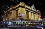
This a "Flashback" feature that was published in the Yonkers Herald-Statesman almost thirty-nine years ago. It's not a very good photo but I find it interesting because I think it's the same photo as the eBay photo posted by scoostraw. That locomotive looks like one of the old 4-4-0s that lasted in Putnam Division passenger service long after they were retired from most other Central routes.

Image

Btw Paul Carey mentioned conductor Pete Flood. A Central employee who worked occasionally at the BN yard in the Bronx in the summers of 1960-61 recalls Pete Flood coming to BN Tower in early mornings to call the dispatcher and get orders to operate over the Put that day on the freight train that went to Eastview and back. The engineer was usually Ted Washburn. Another former NYC retiree told me Pete Flood probably worked close to fifty years on the Put. When Flood retired from the railroad in the early 1960s he got a job as a messenger on Wall Street. I guess he liked to stay busy. :wink:
 #1285158  by Tommy Meehan
 
scoostraw wrote:...It would be interesting to see a "now" shot taken from this same location.

Image
I took this photo with my cell phone this morning from roughly the same location. The trees have grown out quite a bit in forty-seven years. In the upper right you can see the roof of the replica station.

Image
 #1285604  by Tommy Meehan
 
Image

Had a question about the location of the original Bryn Mawr Park station. In the bottom photo you can see the rooftop of today's replica station. Is it in the right spot? In the top photo, the one taken in 1967, is that open area -- in between the car (is that a Dodge Charger?) and the top of the Ebay box -- is that where the station was before it was taken down? The location where the station was moved to during the Palmer Road grade crossing elimination project, that is.

Maybe Paul Carey remembers. :wink:
 #1285667  by R Paul Carey
 
Tommy,

In the 1967 photo, the "footprint" of the station would have been opposite the engine, between the cab and the long hood (approximately). In its post-1938 location, the station actually "straddled" the original Palmer Road r-o-w.

In your most recent photo, you can see a paved trail, toward the east or lower left. This would appear to be a walkway that connects the trail to the stub of Palmer Road which was at one time closed by a wooden barricade, opposite the station.

As to the structure that is there today, you probably know it was built by a person who was a huge fan of the Put. Inside, he had an enlargement of the c.1934 picture on display. His building appears to be substantially within the footprint of the relocated stone station, but it is only a "replica" to the extent one's imagination runs free. The profile of the metal roof does echo the shape of the original. The rectangular footprint is not correct, however, as the east end (waiting room) had a bay window shape, with three windows, two of which were on the corner angles. The agents bay and baggage room were at the west end, with a cut-out corner on the track side, supported by a stone pillar.

Very few photos of this station exist and, of those that do, these details are inscrutable in the shadow of the roof overhang.

Paul.
 #1285830  by Tommy Meehan
 
Thanks Paul. Yes I was aware the replica station is not a duplicate but I did wonder if it was in the footprint of the old station. Btw I was there Saturday morning, I turned around in front of today's station; it was closed up tight.

Paul you also might be interested to know: I'm not sure what the stucco building visible behind the auto shop bay was used for in 1967, I think it might've been part of the auto shop. In the Disco 70s it was the Blue Dahlia Disco. Today the bay is used as a hand car wash and the stucco building is a realtor's office.
 #1285945  by R Paul Carey
 
Tommy, the garage in the 1967 photo was part of an Amoco gas station, locally known as "Lou and Pat's". The bay inside was used for repairs. About 1961, they repaired a cracked block on my mother's '57 Chevy there. The post-1938 Bryn Mawr Park team track was adjacent there; the switch was opposite the garage. Prior to 1938, the team track was located off the siding, just west of the original station site. The adjacent two story stucco building housed a shop in the 1950s ("Tony's") that sold newspapers, candy, and cigarettes at $.25 a pack to any and all. In the mid-1960s, a restaurant opened there, but there's little I know about it except to recall my parents regarded it as a "sketchy" place, to be avoided. 'Nuff said!
 #1286073  by Tommy Meehan
 
Thanks again Paul.

I saw mention of a 10-car siding at Bryn Mawr Park in an 1905 ETT and a 7-car siding at Bryn Mawr Park in an ETT from 1942. Were there ever freight cars there that you saw? I'm guessing they didn't use the siding for meets. There was a passing siding they used at Dunwoodie the next station east. There's a photo in the Gallo-Kramer book on page 31 of two motor cars meeting at Dunwoodie in the summer of 1937. But that's before our time!
 #1286148  by R Paul Carey
 
Tommy, the siding at Bryn Mawr Park was 7 cars, west of the station and on the south side of the Main track, used for occasional meets that were advanced from Dunwoodie or Nepperhan. This siding was retired in the late 1950s.

The team track only held two cars, at most. There was no "regular" business that I can recall, by the mid-50s, or later. In 1963, Con Edison had a transformer delivered for its substation (less than a mile away). The team track had also been retired (in the 1950s) and the depressed-center flat car was unloaded from the main track over a weekend (as I recall). Sadly, this was the event that triggered the demolition of the station.

BTW, I'm amazed (and pleased) to see that a thread relating to Bryn Mawr Park has drawn so many views here!

Paul.
 #1286295  by Tommy Meehan
 
Thanks again Paul. I saw something in the Yonkers Herald-Statesman news archive about Con Ed using the Bryn Mawr Park station in the time period of the 1960s. Either they needed some kind of permit from the City of Yonkers or possibly just a mention that the station area was little used except occasionally by Con Ed. I didn't bother to save a copy and now I can't find it.

Did Central have to tear down the station to unload the transformer?
 #1286398  by R Paul Carey
 
Tommy, my belief is the station had been sold (or less likely, leased) to Con Edison and it was their contractor who would have handled the demolition. The demolition provided the necessary space for their crane (outrigger placement, etc.) to unload. This was a one-time shipment. It would have been useful to Con Ed if they had others, so it does make sense that the story in the Herald Statesman would reflect such a possibility.

Paul.
 #1286578  by Tommy Meehan
 
I still can't find the Herald-Statesman article but I think it might've stated that the only use the station site had was that it was occasionally used -- or could be used -- by Con Ed. That there was no other activity. The time period was between the end of passenger service and the start of Penn Central. That the utility was able to demolish a historic station for what was a one-time use could never happen today I don't think. Of course some people would say that's a bad thing. :-)

I agree with Paul; I'm surprised the way this thread has taken off too. I have learned a ton of stuff about the Bryn Mawr Park area in the month this thread has been up. More than I had learned in the past forty years! Especially about the Mile Square Road grade crossing. It was only a year or two ago that, when looking at a map, I realized the Put crossed MSR between Dunwoodie and Bryn Mawr Park. When I drove through the area on Mile Square Rd I realized the South County Trailway crossed Mile Square where the crossing had been. Absolutely no sign of a previous bridge or underpass. Thanks to Paul I have actually learned something about it when it was in operation.

A Nepperhan Turn stalled there one day on plowed snow. Fascinating! I wish you had been home too.
 #1287065  by scoostraw
 
Tommy Meehan wrote:I took this photo with my cell phone this morning from roughly the same location. The trees have grown out quite a bit in forty-seven years. In the upper right you can see the roof of the replica station.
Thanks for taking the time to take that shot Tommy. Just a few changes... wow.
 #1327826  by Tommy Meehan
 
Tommy Meehan wrote:I'll go back this winter when the leaves are off the trees and take another shot.
This past winter was pretty brutal and getting back to the Palmer Road overpass was a bit difficult. Parking nearby, amidst the piles of snow, was difficult and the sidewalk on the overpass was often icy and snow-covered. Today I went back and found most of the trees did not have much growth yet.

The facsimile stationhouse is visible at right (along with part of the home-built and nonoperational caboose).

Image