Getting to the West Portal is difficult, but possible.
Starting from the center of North Adams, take either 8A south (Ashland St or Church St). Ashland Street will merge into Church street after the mainline crosses both roads. After the merge, look for a blue industrial facility on the right called Morrison Berkshire Inc.. Just after this facility on the other side of 8A is a narrow, hidden dirt trail leading up the hill. The trail does have a gate, but the last time I was there, it was open. This trail will wind a bit upwards, and come to a small clearing near a little pond. The tracks are directly in front.
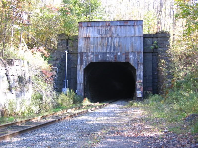
The portal is still to the east, so you can walk along a dirt trail which crosses a bridge over the pond paralleling the tracks to the portal. While this portion may look good for a vehicle, I believe the bridge is too narrow and possible not strong enouge. Additionally, the trail becomes very rough later on. Continue up the trail. Eventually you will see the portal. You will be in a safe location, but up a hill from the tunnel, whose view will be obscured by trees.
If you want to get close to the portal, continue a bit past the portal and walk to the top of the portal. The portal has retaining walls that form steps that you can use to descend to track level. There is enough space to be in a relatively safe position from oncoming trains.
Alternatively, you can walk from where you parked straght ahead to the tracks, then walk alongside them to the portal. However, in some areas you may come closer to the tracks than you want to be.
Here is a picture of the portal I snapped on my last visit:
I cannot confirm that the trail beyond 8A is public property, and
it most likely does belong to the railroad. Beware.
http://maps.google.com/maps?oi=map&q=North+Adams,+MA
This is a map of North Adams provided by Google Maps. Switch to Hybrid view, and follow 8A south, watching for the small pond along side the tracks not far from the portal. If you hit the Southview Cemetery, you're too far.