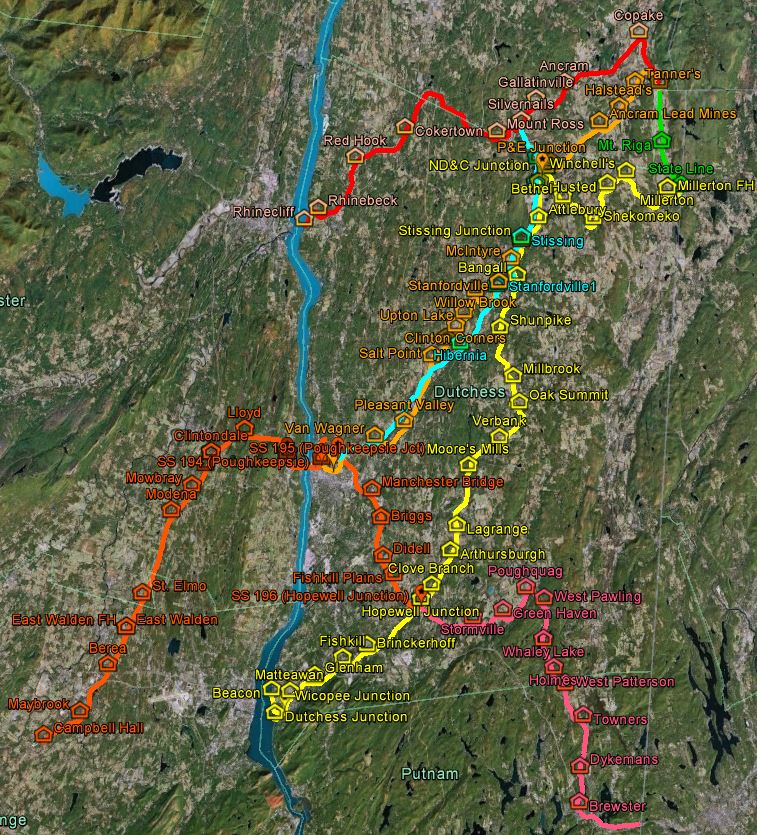
I've put together a Google Earth overlay with my best effort at documenting the various lines and stations of the CNE and NY&NE in the state of New York. (This is inspired by the excellent Connecticut track map and I have used their conventions where possible.) I started by wanting to sort out all of the various trackage in Poughkeepsie, and it kind of ballooned from there  This map relies quite heavily on already available data, including:
Official Guides (1907 and 1910 consulted)
ICC valuation maps (primarily the big 1915 set)
Various information graciously published on the Internet (particularly this website, run by Bernie Rudberg, but also some others)
USGS maps, historical and current
Historical and current aerial imagery
However, to my knowledge, one map with this level of detail has not been produced before.
A couple of caveats and disclaimers:
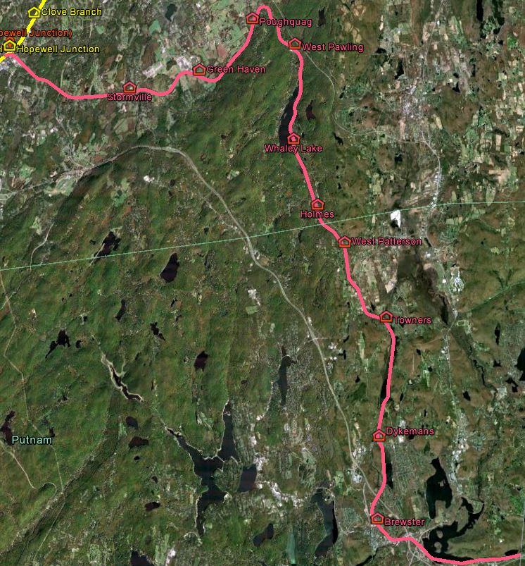
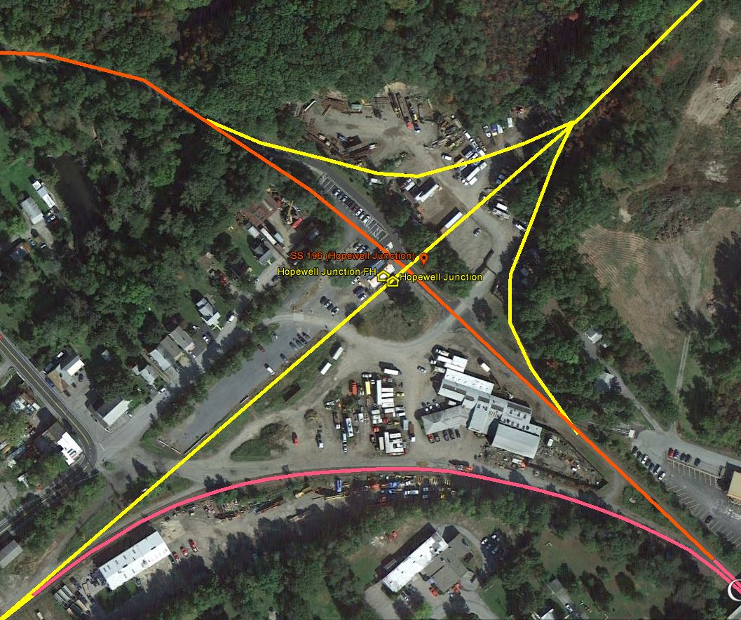
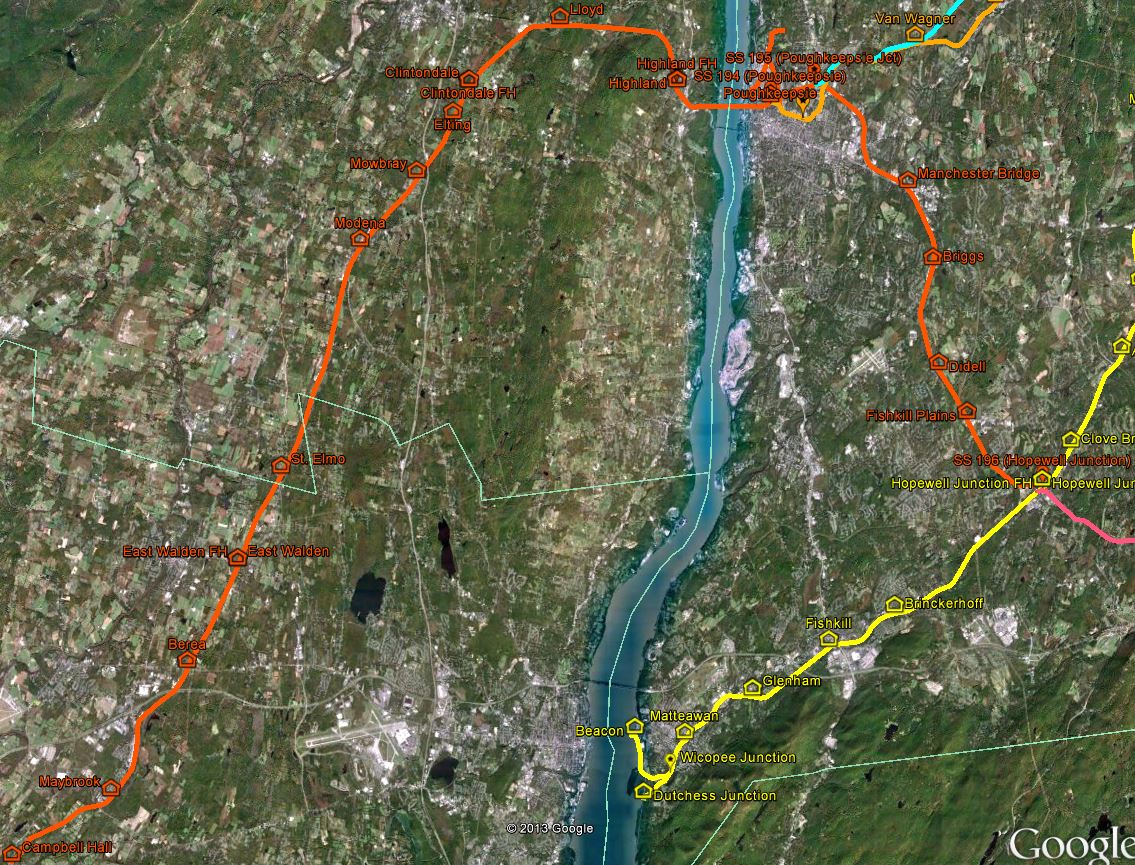
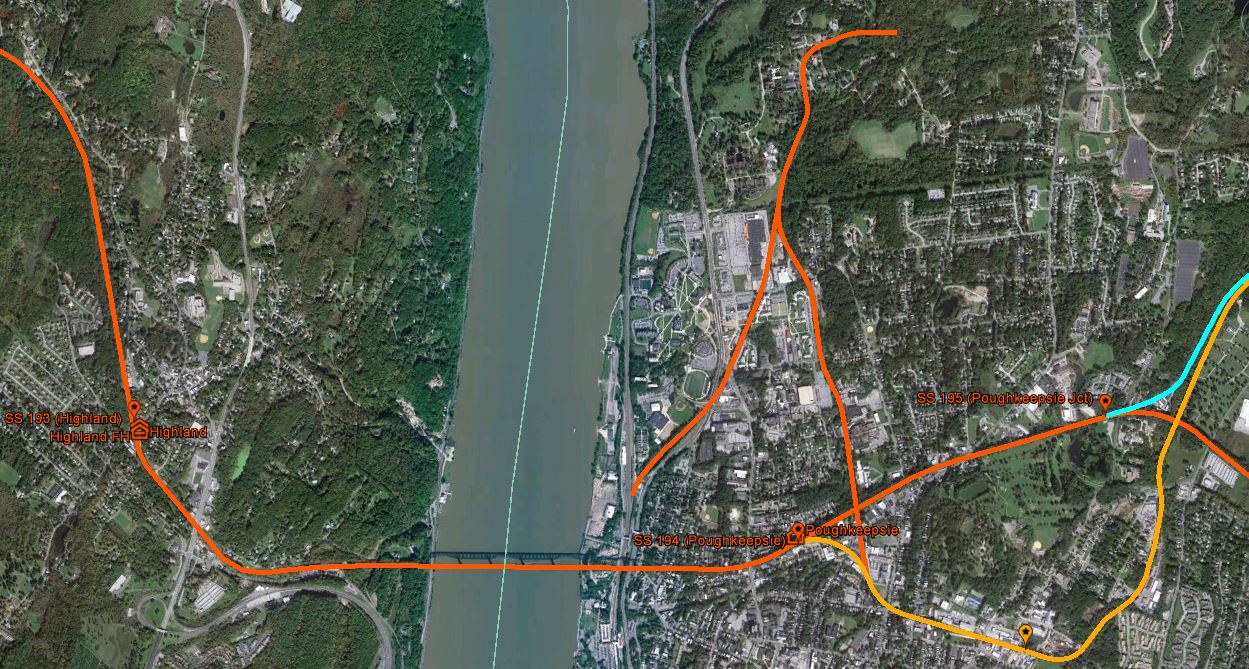
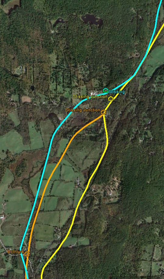
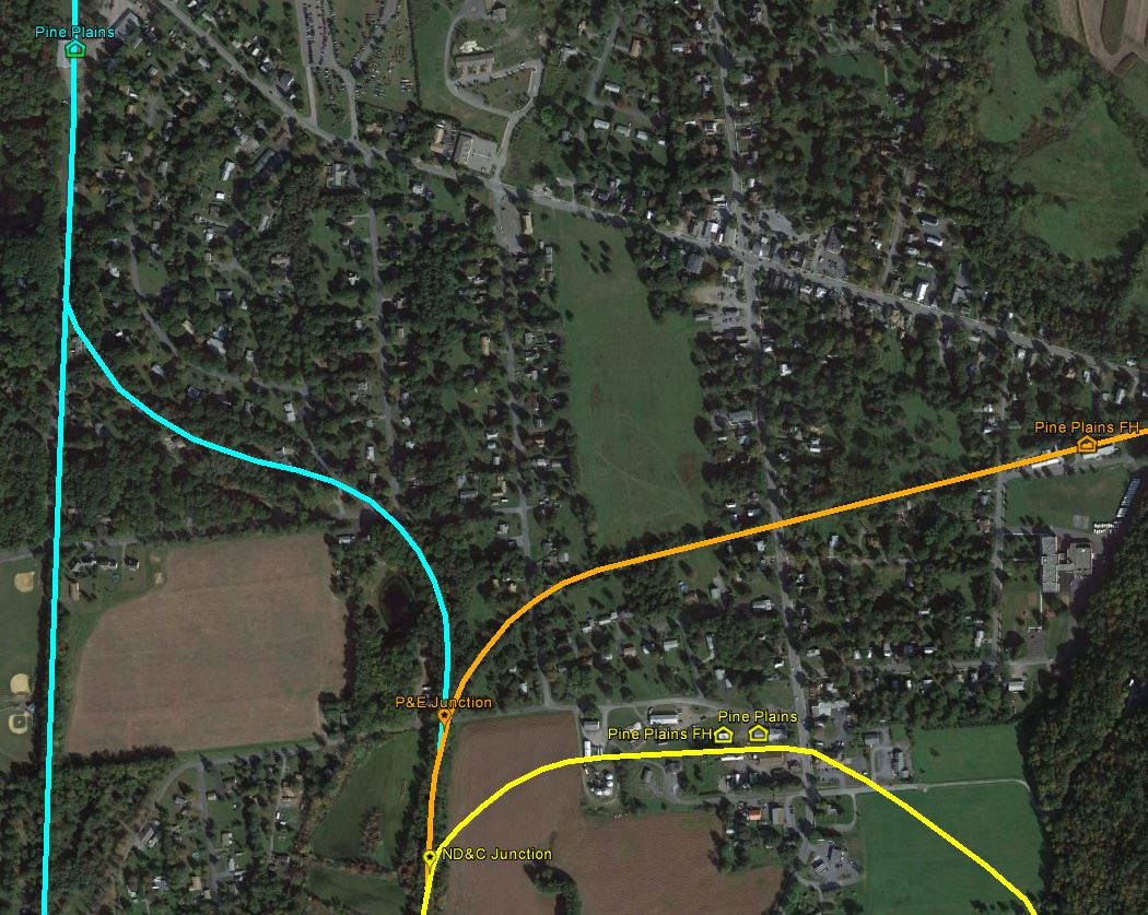
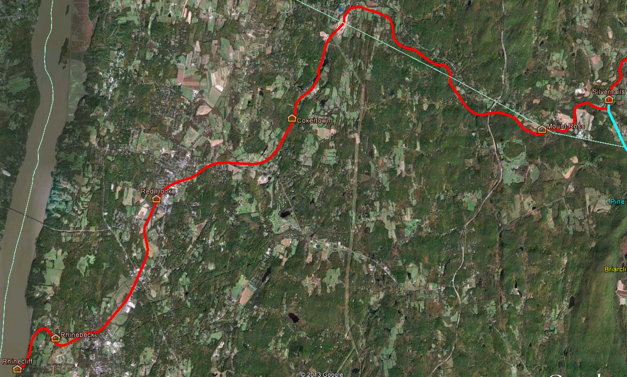
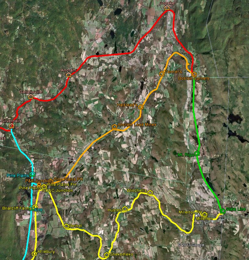
- Each line has a different color, to help distinguish the many intersections and junctions (dark orange for the bridge company, light orange for P&E, cyan for P&C, red for R&C, pink for NY&NE, yellow for ND&C, and light green for H&CW)
- I ran into a number of mileage discrepancies between public and employee timetables and ETTs, and even between several public timetables of different eras. In a couple of locations I had to get very creative with allocating mileage, so some locations may be off (usually by less than half a mile). I have attempted to make note of this where possible.
- Some stations and other such buildings could not be accurately placed, so I guessed, e.g. by putting them on a likely-sounding grade crossing
- No Clove Branch
The map itself is attached, and I have also attached a preview image to illustrate the style I used. Any and all feedback is quite welcome - this is the first Google Earth overlay I've ever done, and I was definitely learning as I was going.
Official Guides (1907 and 1910 consulted)
ICC valuation maps (primarily the big 1915 set)
Various information graciously published on the Internet (particularly this website, run by Bernie Rudberg, but also some others)
USGS maps, historical and current
Historical and current aerial imagery
However, to my knowledge, one map with this level of detail has not been produced before.
A couple of caveats and disclaimers:
- Each line has a different color, to help distinguish the many intersections and junctions (dark orange for the bridge company, light orange for P&E, cyan for P&C, red for R&C, pink for NY&NE, yellow for ND&C, and light green for H&CW)
- I ran into a number of mileage discrepancies between public and employee timetables and ETTs, and even between several public timetables of different eras. In a couple of locations I had to get very creative with allocating mileage, so some locations may be off (usually by less than half a mile). I have attempted to make note of this where possible.
- Some stations and other such buildings could not be accurately placed, so I guessed, e.g. by putting them on a likely-sounding grade crossing
- No Clove Branch
The map itself is attached, and I have also attached a preview image to illustrate the style I used. Any and all feedback is quite welcome - this is the first Google Earth overlay I've ever done, and I was definitely learning as I was going.
Attachments:
preview.JPG (88.7 KiB) Viewed 14352 times
Attachments:
(77.48 KiB) Downloaded 359 times
Welcome to New York Penn Station. You are in a maze of twisty little passages, all alike.

