Attached are two pictures my Father took on this date. Can somebody tell me the location of both please?
Thanks,
Martin Baumann
Thanks,
Martin Baumann
Railroad Forums
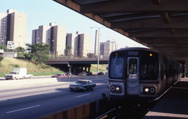
sipes23 wrote:The first is somewhere on the Red Line between Chinatown and 95th along the Dan Ryan. For some reason (and my memory is fuzzy this far back), I think the first one could be near Comiskey Park.Yes, the top photo is most definitely looking southeast from the platform at Sox-35th. The dead giveaway is the Stateway Gardens housing projects in the background. These buildings had a different appearance than their Robert Taylor neighbors to the south.
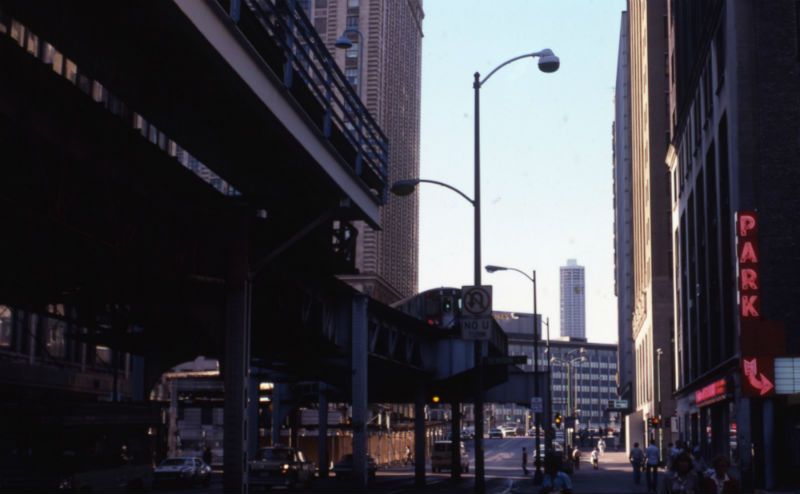
The second is obviously downtown. My memory here is not good, but I'd be unsurprised to find out that this is just south of Washington and Wabash looking north. The building just across the river looks like the old Sun-Times building.
EricL wrote:Yes, the top photo is most definitely looking southeast from the platform at Sox-35th. The dead giveaway is the Stateway Gardens housing projects in the background. These buildings had a different appearance than their Robert Taylor neighbors to the south.It's one of those things. Stateway Gardens haven't been gone all that long (seven years according to Wikipedia), but the memory fades. I suppose it also doesn't help that I didn't really start using the L to 35th until about 2002. There were years I didn't go to many Sox games due to living away, and my dad always drove when I was a kid.
sipes23 wrote:Here I go, veering way off of the topic of rail transit!EricL wrote:Yes, the top photo is most definitely looking southeast from the platform at Sox-35th. The dead giveaway is the Stateway Gardens housing projects in the background. These buildings had a different appearance than their Robert Taylor neighbors to the south.It's one of those things. Stateway Gardens haven't been gone all that long (seven years according to Wikipedia), but the memory fades. I suppose it also doesn't help that I didn't really start using the L to 35th until about 2002. There were years I didn't go to many Sox games due to living away, and my dad always drove when I was a kid.