This morning I was looking at some aerial photo planning for a future trip. I started by looking at Newark Penn station. I realized I have never spent any time on PATH. I decided to follow their line in both directions form the station using the photos. Based on those photos I have some questions:
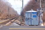
First to the south (or west) of the station I see what looks like a multi-track RR bridge spanning all the Amtk/Transit mains cut off on each end. What railroad was that and where was it coming from and going? South of this bridge the PATH track jump over the Amtk/Transit but look like they just end. Not really a yard just two tracks that end. Is this the extent of storage in Newark? In the jump over area is does look like a PATH train on the lower level but I can't tell for sure?
As I moved toward NYC following he line I found the Journal station and then a yard. The tracks seemed to disappear in this area. Going back and making a second and third pass it looks like the PATH might drop down into a tunnel with a large building over the top. If not it is a maintenance building with two tracks at one end only. What am I seeing?
Is the jct. with the Hoboken line underground?
After this point is the rest of PATH underground? With the exception of the WTC station? Anything open in or around Hoboken?