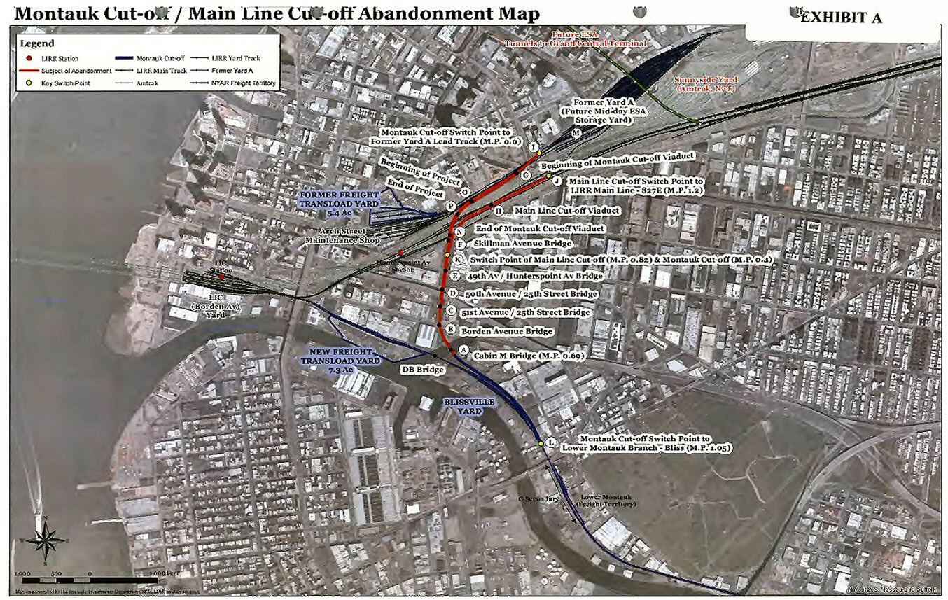
I've been up on them and grass and small trees and whatnot are growing up between the rails. Walked along to verify where these rails go — they connect the main LIRR tracks to the old Montauk line tracks without having to pull into Long Island City and turn around the other direction. So presumably they date back to when there were passenger trains that still ran on the old tracks (Penny Bridge, Glendale, and all those stations that got eliminated when they put in the new bi-level diesels).
Anyone know when they were last used, and if there was any regular scheduled passenger service that would have taken that route, or if it was just for emergency / convenience or something?
Also, this abandoned track divides right as it gets to this bridge over the main tracks: one track is still intact and descends down a long path until it merges with tracks from Penn Station and/or Hunterspoint — or would if it weren't blocked off by an "X" of railroad ties down at ground level. The other track appears to have been demolished somewhat recently; it now ends in mid-air. I see one of the internet mapping sites (Bing Maps, or MapQuest maps, forget which) still shows the demolished part intact (hence my statement that it was removed recently) — it descends to ground level farther to the north than the other track does, closer to Court St.
pix attached:
IMG_1893 = bridge from Hunterspoint Ave platform
IMG_1856 = on trestle/bridge facing north towards Court Sq
IMG_1861 = on trestle/bridge facing other direction towards old Montauk line tracks