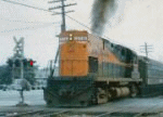
• Island Park - Barnums Channel or Hog Creek?

  • Discussion of the past and present operations of the Long Island Rail Road.
Discussion of the past and present operations of the Long Island Rail Road.

Moderator: Liquidcamphor

  by nyandw
 
http://www.trainsarefun.com/lirr/longbe ... _viewS.jpg" onclick="window.open(this.href);return false;

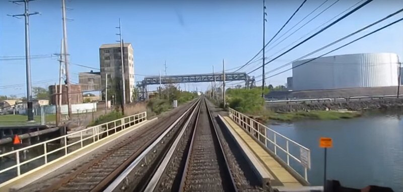
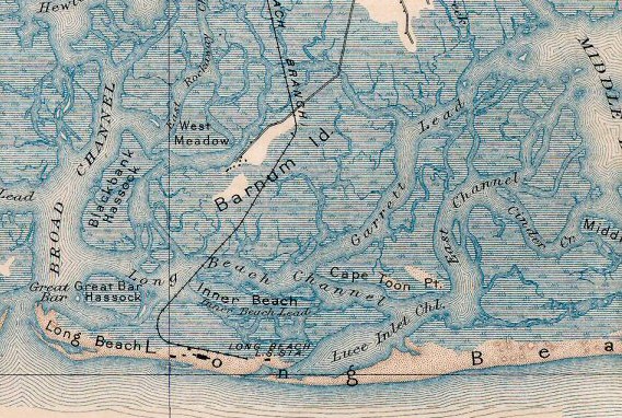
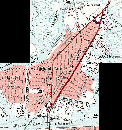
View S LILCO plant on left entering Island Park. Some maps (Emery, for example) have Hog Creek, others USGS have Barnums Channel.

Which one or both? What did the LIRR guys refer to it as? Thanks. :-)
  by LB
 
As you proceed south of Oceanside, there were 2 crossings over water shown on a 1960 and 1976 Hagstrom Atlas. One was Barnum's Island Channel, the other was Hog Island Channel (the two merged east and west of a small island). Looking at later maps, the southern crossing appears to have been filled, eliminating the island. West of the location the channel was called Hog Island Channel, and east it was called Barnum's Island Channel. Looking at the alignment of things, my guess would be Barnum's Island Channel (although since there is no longer an island, maybe just Barnum's Channel). Be interesting to know when after 1976? they filled in the waterway making the island part of the larger Island Park area.
  by krispy
 
Steve look for posts from JJ and Laocoon in the past regarding the bridges along the LB branch. I recall some interesting posts regarding that, but can't recall when. What confuses things is how many times names have changed in the area over time. For example, Hog Island and Barnum's Island have had the same names over time if you scan the historical nautical charts. In the 1845 chart it's Hog Island, but by the 1911 chart it's Barnum Is, and the only mention of Hog Island is the passageway in the picture that runs W-E. Now, Hog Island Channel runs N-S, starting just west of Lead Tower and hugs the shoreline of Island park until you get to the fish docks in Oceanside by Oil City. At some point they built the power plant, and dredged out the now extant Hog Island Island Channel and developed the shoreline as you see it. The old Hog Island channel was closed to boat traffic and was impassable to even a kayak even before 9/11. If there's an issue to the train crews, the operator at Lead or Valley would identify it as the first undergrade bridge east of Oceanside or first west of Island Park depending on which way they are going.
  by nyandw
 
Real nice info, Folks. :-)
Here's my resolution: Nassau County 01/1899 US Geological Topographic Survey Map close-up insert
http://www.trainsarefun.com/lirr/longbe ... _1899-.jpg" onclick="window.open(this.href);return false; and

1979 US Geological Topographic Survey Map close-up insert (80 years later)
http://www.trainsarefun.com/lirr/longbe ... p20-22.jpg" onclick="window.open(this.href);return false;

The photos (current Mapcarta and Google Maps) I posted under the Island Park section 25% down the page are current: http://www.trainsarefun.com/lirr/longbe ... branch.htm

1. Barnums has been in use for over a century. For future reference this will be the location name I leave in place.
2. I'll note in this web site section referred to as Hog Creek/Channel at one time; as per Emery Map 1958.