Railroad Forums 

  • Locos idling for days @ Shawnee OK

  • Discussion related to BNSF operations. Official site: BNSF.COM
Discussion related to BNSF operations. Official site: BNSF.COM

Moderator: Komachi

 #1389753  by Arlington
 
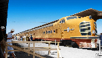
I have seen the same 2 locomotives (SF 3174 and a BNSF) idling [throbbing and the occasional hiss] with about 8 covered hopper cars for the last 36 hours (9pm Mon to 9am Wed) Is this standard practice? This is southbound at I-40 in Shawnee OK Why left running (daytime highs 95deg, nightly lows 75), and why here for so long?
 #1389849  by Backshophoss
 
Believe that's a Shortline using BNSF power near Shawnee,if both units have bad batteries,you don't turn'em off!
It's not easy to "jump start" loco's.
 #1389932  by Arlington
 
Makes perfect sense! (bad batteries and shortline consist) Thanks! BTW, they spent more than 36 hrs but less than 48 hrs there.
 #1389956  by Backshophoss
 
Believe that's the former Rock Island Mainline from Memphis that I-40 tends to follow
2 different Shortlines in OK operate on the remains,one east of OKC,the other west of OKC.
 #1390088  by Arlington
 
This was on a single track line running compass North-South at Shawnee and perpendicular to I-40's east-west. The line looks like the ballst is well groomed but the ties look somewhat bleached and tired, so maybe some other short line?
 #1390099  by Backshophoss
 
It was at some point an industrial track ATSF reached via MK&T,still believe this is ex - RI as the route twist and turns along
I-40. The "reach - in" was from Flynn,off the (Amtrak)BNSF OKC Flyer route.

Not sure who got what trackage from the RI when Bankruptcy trustee "sold off" parts of the Memphis-Tucumcari Mainline.
 #1390396  by Arlington
 
Location was just north of I-40 and just south of the square-ish pond visible here:
https://goo.gl/maps/jxamuAFt2Km" onclick="window.open(this.href);return false;
 #1390404  by John_Perkowski
 
Based on the stated location, and looking at the Oklahoma State Railroad Map, this is a BNSF branchline off a UP line.

The Oklahoma DOT State Railroad Map

The actual map in detail, in pdf