Railroad Forums 

  • Train vs. car in Winterport — 09-15-2015

  • Discussion of present-day CM&Q operations, as well as discussion of predecessors Montreal, Maine & Atlantic Railway (MMA) and Bangor & Aroostook Railroad (BAR).
Discussion of present-day CM&Q operations, as well as discussion of predecessors Montreal, Maine & Atlantic Railway (MMA) and Bangor & Aroostook Railroad (BAR).

Moderator: MEC407

 #1349126  by MEC407
 
This crossing is on the Searsport Branch. A fairly busy branch, historically anyway. How frequently does CMQ operate on this branch?
 #1349155  by NHV 669
 
MEC407 wrote:A fairly busy branch, historically anyway.
which makes me ask, as I honestly don't know:

Are lighted/LED signals required for specifically rated roads/population centers/high danger areas,etc., or just upon agreements between the RR and town?
 #1349163  by MEC407
 
I'm just guessing, but I believe the traffic of the road and the traffic of the railroad are both taken into account. For example, Pan Am's Saco Industrial Track crosses Route 112 in Saco, which is a VERY busy road. But because Pan Am only uses that track once a week or less, and only at 5 MPH, they do not have any active warning devices in place; just crossbucks, advance warning signs, and pavement markings. And the crews do a stop-and-flag before going across.

Another example, which is somewhat dated but still relevant, is the ex-B&M mainline in ME and NH as it existed before the 2001 Downeaster rehab. Granted the de facto track speed was only 25 back then, but the timetable speed was 40, and it was busy with 8 freights a day plus several locals. They crossed quite a few backwoods roads, private drives, camp roads, etc., with only crossbucks, and they did so without slowing down and without stopping/protecting, so in those cases the lack of road traffic made up for the heavy rail traffic and allowed those crossings to exist without active protection. (Once the Downeaster came along, however, all of those crossings got lights and bells at a minimum, and some even got gates.)
 #1349255  by Watchman318
 
There's a rather complicated formula for it, involving train frequency and speed, amount of road traffic and the road speed limit, sight distance, etc. A crossing that's at an angle other than 90° to the roadway might get funded for upgrading before one that has similar conditions, but is at or closer to a "square" 90°.

I tried looking up the stats for the Meadow Rd. crossing on the FRA inventory when this story first appeared, but the site is messed up. I reported the problem, and the FRA Office of Safety Data is "looking into it."
 #1349260  by MEC407
 
The FRA's database is rather error-filled and outdated, unfortunately. A couple of years ago I was looking up a few crossings in southern Maine and the data in their database was at least 15 years out of date, and there were several errors and omissions.
 #1349291  by KSmitty
 
If we're looking at crossings with poor markings I'd make the case for Libby Ave in Lewiston, ME
https://goo.gl/maps/GXxy2zGPfan" onclick="window.open(this.href);return false;
Which has only the round yellow RXR sign on the approach from the main road. The other side is markerless. No crossbucks, no pavement lines, no gates, flashers, bells or advanced warning signs...

Searsport is 3-4 each way a week currently, with more run as needed for windmill trains.

I thought standard practice for crossing protection (at least on lines with Maine rail traffic densities) was that whatever is currently in place is ample protection until the town/city/state decide otherwise. At which point the government making that decision will upgrade the crossing to their preferences, and the railroad will maintain it thereafter.
 #1349294  by Watchman318
 
Yeah, they rely on the track owners to update the information. I don't know if there's any standard for how often it has to be reviewed. I think MDOT has one guy who takes care of the data for all the state-owned lines. Depending on the size of the owning company, there are probably only a handful of people at any railroad who know who's supposed to take care of it. Most people would probably say "The feds assign the numbers, so they handle all that stuff."

A lot of the latitude/longitude info is really cockeyed, probably from the days when the GPS satellites were still under "Selective Availability." Then there are the occasional errors that creep in during data entry, like a crossing up in Unity that's listed as being in Sagadahoc County. (837035R)
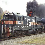
Last week, the database was showing 70 open at-grade crossings (public and private) in Waldo County, but nothing could be viewed beyond the first page of records. Today I was able to view the other three pages, but there only seems to be B&ML and ST lines in the records, and nothing under Winterport.

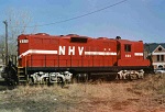
Side note: I just discovered that the FRA has maps available online, a GIS thingie. It shows "Freight Stations" (Mosquito Mtn.? Cape Jct.?) and RR mileposts along the various lines, RR owner, any trackage rights, and a bunch of other info. The data collection dates for a couple of the places I looked at were 2010 and 2004, so it still shows "MMA" for the Searsport line.

Yes, I do have too much free time these days. :-D

Looks like Smitty typed faster than I did. (I kind of went down a rabbit hole looking at the GIS maps.)
KSmitty wrote:I thought standard practice for crossing protection (at least on lines with Maine rail traffic densities) was that whatever is currently in place is ample protection until the town/city/state decide otherwise. At which point the government making that decision will upgrade the crossing to their preferences, and the railroad will maintain it thereafter.
As I understood it, there are federal funds distributed to the states, and the states make the decision about what crossings need upgrading based on the formula I mentioned above.
I could be mistaken on that, because I'm most familiar with the Rockland Branch, which MDOT would be funding anyway. I think it was 2010 when one street in Thomaston was closed, and two others that had been crossbucks-only got lights and gates. Another crossing in Woolwich got lights and gates around that time. Its "Smallest Crossing Angle" (item 7 under Physical Characteristics on the inventory form) is 30°-59°, so maybe it was deemed to need an upgrade more than other crossings on the line.

The Libby Ave. crossing is listed as private (365096B). In my experience, those generally get a W10-1 with a stop sign over it, and a "PRIVATE CROSSING" placard at the bottom. Again, that's just from what I've seen most often, on the Rockland Branch. I agree, it really could use a little more signage, on both sides. The inventory form doesn't show any traffic control devices there, not even that one lone W10-1.

I try not to use the term "crossing protection," because as an old railroader once said, it doesn't really "protect" anything unless people observe the warnings.
 #1349419  by cvrr5809
 
This crossing doesn't warrant signals. Many of the crossings on the Searsport Branch are just like this and have more traffic over them daily than this one. I have pics from nearly every angle here, and it's a wide open view from both sides of the crossing in each direction. It's on the North end of a straightaway that begins at the town line with Frankfort over a mile South and continues about a 1/4 mile to the North. Both sides have been kept trimmed way down nearly every year and you'd seriously have to be totally ignoring your sight and hearing to miss a train here(with or without signals). There are crossbucks, but the average person just thinks they look cute and mean nothing. Trains lay on the horns here due to the allowed speed. A railroad shouldn't have to go above and beyond the requirements just because someone else is daydreaming or trying to run the crossing ahead of it. Then again, this is what has become of our country. The driver was lucky, and the crew should lose little sleep over this.