Railroad Forums 

  • NY Station Photos

  • Discussion related to the Lehigh Valley Railroad and predecessors for the period 1846-1976. Originally incorporated as the Delaware, Lehigh, Schuylkill and Susquehanna Railroad Company.
Discussion related to the Lehigh Valley Railroad and predecessors for the period 1846-1976. Originally incorporated as the Delaware, Lehigh, Schuylkill and Susquehanna Railroad Company.

Moderator: scottychaos

 #876446  by frank754
 
Thanks, jrs, great pictures, I always enjoy history from upstate NY. I have one somewhere from Cuyler or DeRuyter (old O&W territory), but can't find it, just one old abutment in Cuyler over a private home driveway:

Quote:
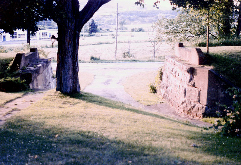
Passing through Cuyler / DeRuyter, NY was an old Lehigh Valley RR line to Cortland which
was abandoned in the 1960's. In fact, this was originally an NYO&W line built much earlier.
I can't find any additional photos I may have of the line, but just west of Cuyler, these
abutments of the line still existed as of June, 1985 across the driveway of a private home,
and may still be there today. Let me know if anyone else has noticed this "fossil".
I knew the folks that lived there at the time, Craig & Lavone Youngs.

Image

Also, if you have any NEPA pix (as I now live in Wilkes-Barre), would be interested in those as well.
 #876527  by lvrr325
 
I'm not sure those are still there. The ROW is pretty hard to spot other than where someone uses a bit of it as a driveway. The line from Deruyter north was built by LV predecessor roads, but I have a nice map showing there was a spur up the old O&W for quite a few years after it became part of the LV. Canastota to Cortland was abandoned in Dec. 1967 -
 #877195  by RussNelson
 
There's some SERIOUS evidence of that ROW, at least the LV anyway. Here's a bridge south of Sheds:
The O&W station in Deruyter:
http://www.flickr.com/photos/russnelson ... otostream/
A bridge on the north side of Deruyter:
http://www.flickr.com/photos/russnelson ... otostream/
An O&W fill east of DeRuyter:
http://www.flickr.com/photos/russnelson ... otostream/
Another bit of O&W fill further east:
http://www.flickr.com/photos/russnelson ... otostream/
The station in New Woodstock:
http://www.flickr.com/photos/russnelson ... otostream/
And I have a bunch of photos that I took at Rippleton Cross:
http://www.flickr.com/photos/russnelson ... 877640801/
And while riding the Gorge Trail, of the Cazenovia Station:
http://www.flickr.com/photos/russnelson ... otostream/
 #877531  by lvrr325
 
I was referring to the general area of DeRyuter itself. The section between Cortland and Canastota can in many places only be discerned from the darker streak across farm fields in sattelite photos, as it has been plowed under, including a long stretch just north of DeRuyter, sections between there and Cortland, and sections around the X-lattice bridge that's south of New Woodstock. In fact the same goes for a large section between Freeville and Cortland as well.