Railroad Forums 

  • Abandoned right of way in Gresham, OR?

  • Discussion related to railroading activities past and present in the American Pacific Northwest (including Northern California, Oregon, Washington, and southern British Columbia).
Discussion related to railroading activities past and present in the American Pacific Northwest (including Northern California, Oregon, Washington, and southern British Columbia).

Moderator: lbshelby

 #592877  by Otto Vondrak
 
There's an abandoned right of way near my cousin's house in Gresham, he lives out towards Damascus. I was told it was an old UP branch? It's a jogging trail now. Any idea what it could be?

-=otto-
 #592902  by lbshelby
 
Golden Arm beat me to it.

It's the old Springwater Division of the Portland Traction. In modern times it ran from SE Portland near OMSI to Gresham and terminated in Boring, where there was a lumber mill. There was a second small brach that took off from the main to serve some industries in Gresham on what is now the MAX alignment. There was also a branch from SE Portland near Sellwood to Oregon City.

Most of it become a biking trail after it was abandoned in the early '90s.

Portland Traction was 50% UP, 50% SP owned after 1961 if memory holds. In the 1970s, the UP did talk about rebuilding the PTC's long abandoned Troutdale Branch and then a route along I-205 to the SP main near Clackamas, in order to make a bypass with the PTC of the terminals in Portland, but this never came to pass.
 #593059  by ScatterMew
 
Does anyone have a map of these abandoned ROWs? Especially one that includes what's around them now so I know where I'm looking at? lol

Thanks,
Catie
 #593068  by lbshelby
 
ScatterMew wrote:Does anyone have a map of these abandoned ROWs? Especially one that includes what's around them now so I know where I'm looking at? lol

Thanks,
Catie
You want a map of the PTC Springwater Division, or a map of abandoned rights-of-way in Portland in general?
 #593189  by westr
 
ScatterMew wrote:Does anyone have a map of these abandoned ROWs? Especially one that includes what's around them now so I know where I'm looking at? lol

Thanks,
Catie
Here are some links to some online sources I know of.

In addition to maps on the page of Brian McCamish's site that Golden-Arm referred to that show the abandoned line from Boring on, he also has maps on http://www.oregonpacificrr.com/eastportlandbranch.html that show the section from Milwaukie to Boring that is now the Springwater Trail. Craig Bass also has some detail maps of this line from 1981 at http://www.craigsrailroadpages.com/ptc/plans.htm.

A lot of the ROW for the Sellwood-Oregon City line still exists. Part of it is supposed to become a trail; there's a map of the proposed trail at http://www.metro-region.org/index.cfm/go/by.web/id/1925. From the north end of the proposed trail the line went through the Waverly Country Club to Golf Jct. in Sellwood. To the south it continued down Abernethy Lane and Portland Avenue into Gladstone, crossed the Clackamas River on the bridge that's still there, and went down Main Street in Oregon City.

There are also some historical maps at http://pdxhistory.com/html/interurbans.html. You can also use the National Map Viewer at http://nmviewogc.cr.usgs.gov/viewer.htm; turn on the US Railroad layers under Transportation and it will show both active and former lines.
 #616029  by SteelWheels21
 
A couple of things I can add..there was a branch off the Springwater line at Linneman Jct. that went north through Gresham and eventually connected with the UP. The station at the Jct. still exists and is a museum. You can trace the line as it crosses Powell Blvd and Division St. and it eventually becomes the TriMet MAX car yard at Ruby Jct (rusty rails still in place well past where the light rail yard ends).

The bridge for the Oregon City branch isn't there anymore, but the abutments and pilings are easily seen as you travel on I-205 south and cross the river.

Also noteworthy, and maybe someone here has more info, is a string of Bi-Level commuter cars that are in storage on a spur over in Milwaukie a little before the P&W splits from UP. I've only seen them at night and plan on investigating as soon as all this snow melts. I'd be willing to bet the guy who runs the little shortline on the old PTC tracks owns them as he is an equipment collector, but I'd be curious to know what the plans are for them.
 #616068  by westr
 
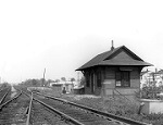
SteelWheels21 wrote:A couple of things I can add..there was a branch off the Springwater line at Linneman Jct. that went north through Gresham and eventually connected with the UP. The station at the Jct. still exists and is a museum. You can trace the line as it crosses Powell Blvd and Division St. and it eventually becomes the TriMet MAX car yard at Ruby Jct (rusty rails still in place well past where the light rail yard ends).

The bridge for the Oregon City branch isn't there anymore, but the abutments and pilings are easily seen as you travel on I-205 south and cross the river.

Also noteworthy, and maybe someone here has more info, is a string of Bi-Level commuter cars that are in storage on a spur over in Milwaukie a little before the P&W splits from UP. I've only seen them at night and plan on investigating as soon as all this snow melts. I'd be willing to bet the guy who runs the little shortline on the old PTC tracks owns them as he is an equipment collector, but I'd be curious to know what the plans are for them.
I didn't know about any remaining traces of the Gresham line in the city, so thanks.

If you're talking about the bridge remains by High Rocks, that is an old Southern Pacific bridge that was replaced by the current SP bridge on the other side of I-205. The old Portland Traction interurban bridge is this one a little further downstream, in line with Portland Avenue and parallel to the power lines. There are a surprising number of bridges crossing the Clackamas River in that area, so its easy to mix them up.

Those bilevel cars in Milwaukie were pulled by Reading 4-8-4 #2100 when it was running up in Tacoma. I think that defunct operation leased them, so they are probably just being stored by the owner. They have MTDX reporting marks, which is Midwest Transportation and Development Company. The official page seems to be http://www.cl.ais.net/~dbehr/. If Dick Samuels owned them, he'd store them on his own railroad instead of on someone else's. Despite its proximity, the Oregon Pacific Railroad (former Portland Traction) has no access to that siding (and never did) and would have to go through the UP, interchanging at East Portland. The siding is actually just south of the UP/PNWR connection and is thus only connected to PNWR.
 #616103  by SteelWheels21
 
I had no idea that bridge still existed, I always thought the abutments were the old PTC. Good info.

If you take 202nd ave between Burnside and Division in the early spring when there is little ground cover you can easily see the ROW with the rails extend south beyond the TriMet yard and Car shops. I live over near Ruby Junction and have looked at that track many times. I'm curious about the ROW going past Ruby...I know the one (eastbound) branch followed the present Max line to Cleveland ave and it looks like the other (northbound) branch is now a bike trail/power line easement. It goes from Burnside to at least Glisan, but where it went from there I haven't been able to determine. I think the line wound up in Troutdale, did it follow what is now Halsey Ave? Did it somehow share the UP ROW?

As for those cars, it makes sense that he'd store them on his property I guess. I can't figure out why with all the trackage in the Tacoma area that they wound up down here for storage, but there must be a pretty good reason. I was a conductor/switchman with UP for a couple of years and worked a job out of Brooklyn that swapped cars with OP.
 #616241  by westr
 
SteelWheels21 wrote:If you take 202nd ave between Burnside and Division in the early spring when there is little ground cover you can easily see the ROW with the rails extend south beyond the TriMet yard and Car shops. I live over near Ruby Junction and have looked at that track many times. I'm curious about the ROW going past Ruby...I know the one (eastbound) branch followed the present Max line to Cleveland ave and it looks like the other (northbound) branch is now a bike trail/power line easement. It goes from Burnside to at least Glisan, but where it went from there I haven't been able to determine. I think the line wound up in Troutdale, did it follow what is now Halsey Ave? Did it somehow share the UP ROW?
I think the Troutdale line was abandoned back in 1927 so there wouldn't be much left, but after looking at the aerial imagery from Google Maps, it looks like the line continued north to Halsey, where it started into a curve to turn west. The bike path ends at Halsey. Through the curve the ROW is intermittantly occupied by Wistful Vista Drive (confirmed by some Fairview City Council Minutes.) From the direction of the Wistful Vista Drive segments, it looks like the line probably ran alongside Halsey from 223rd to Troutdale, and the existance of powerlines along Halsey seems to support this. Maps at http://pdxhistory.com/html/interurbans.html show that the Troutdale interurban line was separate from the UP line.

As for those gallery cars, I don't know why they ended up down here, but its probably a combination of accessibility, security and storage cost.