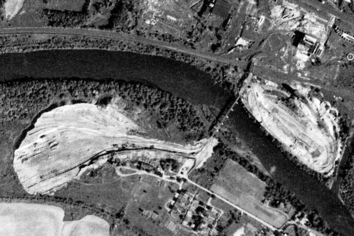
From what I understand, the bridge was used by Eastern Steel to access an area across the river where they dumped some by-product of their production (slag?) - I don't know anything about the iron business so I can't even hazard a guess here. I believe that the bridge was accessed from their property (using their own locos?), not from the PRR tracks because of the difference in elevation - there was a bridge that spanned the PRR r.o.w. that would have carried tracks south from the property to the bridge in question. In fact, the Easterm Steel property was in between both the Reading and the PRR tracks - I wonder which one had access to the property?
The last time I was in Pottstown, I walked around the area there and went to look at the bridge piers along the river bank. I tried to get to the bridge remains from the south, across the river, but the property is posted and there is a business with people walking around and I didn't feel like getting hassled so I didn't have a chance to explore that side of the bridge.
Here is a photo taken in 1938, I think, after the furnaces and other buildings were torn down that clearly shows the bridge leading to some kind of dumping ground.
<a><img src="
http://farm4.static.flickr.com/3144/229 ... 0767_o.jpg" width="723" height="482" alt="berks_091837_aho4403"></a>
