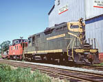
What are the steepest grades on the line between Maine and Vermont in the White Mountains terrain?
There is a grade profile of the entire Portland to Montreal route in Jeff Holt's book "The Grand Trunk in New
England". From Portland the railroad is generally uphill to Locke Mills, then a short downhill to the Androscoggin valley
at Bethel, then mostly uphill again to a summit of 1073' several miles west of Berlin. From there it is downgrade to the
Connecticut River valley with the low point about halfway between Groveton and North Stratford. From this point it is
again generally uphill again to Summit, Vermont 6.5 miles west of Island Pond at an elevation of 1377 feet. This is the
highest point between Portland and Montreal. Westbound the ruling grade is between West Paris (Bates) and Bryant
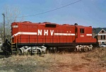
Pond- "Bacon's Grade" - about 1.1%. Employee Timetable 15, 10-31-1971 limits 4400-4500 series GP9's to 1610 tons
westbound and TT#38, 9-27-1953 limits the 3700 series USRA mikes to 1700 tons. Other significant westward grades
are Gorham to Berlin, North Stratford to Wenlock , and Island Pond to Summit. Eastward grades aren't as severe- the
climb from Groveton to west of Berlin and again from Bethel to Locke Mills the latter being the ruling eastbound
grade Island Pond to Portland. The 1971 ETT limits GP9's to 2030 tons and the 1953 ETT limits the USRA mikes to
2800 tons. There is a steeper grade in both directions over the hump between Richmond and Actionvale, PQ. Hope
this helps.