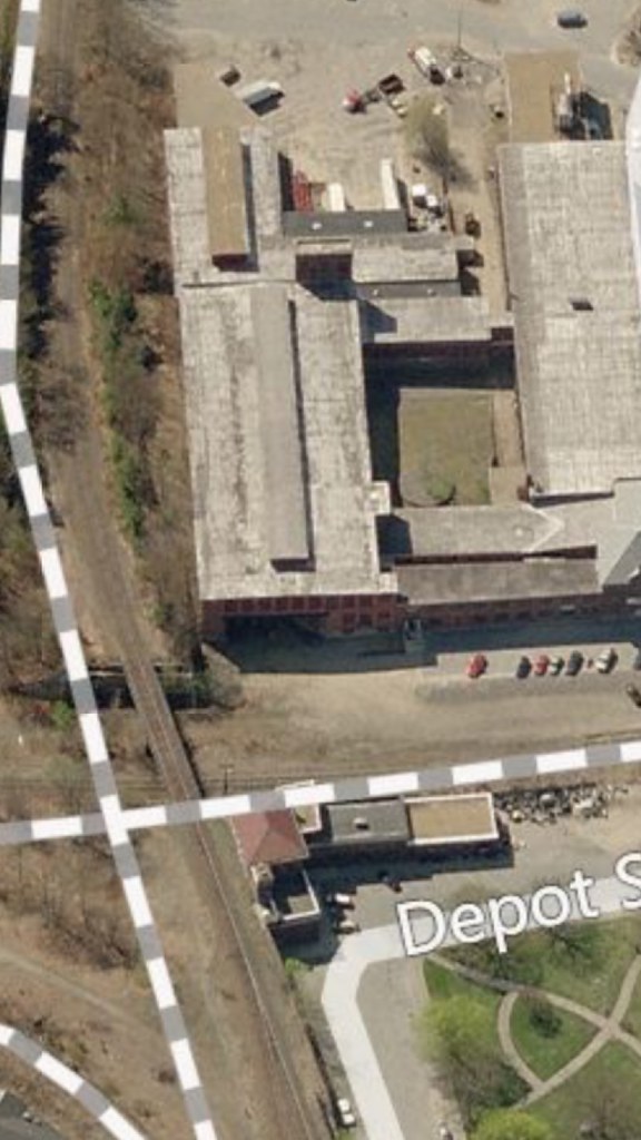
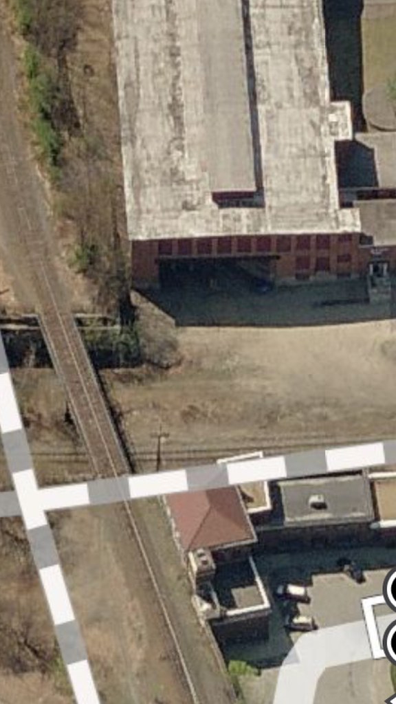
While visiting the Consignment at 56 antique store in the old Clinton Wire Cloth building, I've noticed a sharp curve cut into the back corner of the first floor along the Pan Am tracks. Higher floors stand on columns over this cut-out of the first floor. This is immediately across the tracks from the half-abandoned depot.
Given its location, I was certain this must have accommodated a curved track between the "Ag Branch" above, and the route now owned by Pan Am. But this low-res image of an insurance map of this factory (hosted by the American Textile History Museum in Lowell) shows only a siding along the Ag Branch, perhaps a faint line indicating the curve (at the lower right), and no map of any track:
http://chace.athm.org/images/Watermarke ... 91-379.jpg" onclick="window.open(this.href);return false;
Anyone have any idea what went on in this curve?
