• The CNJ Seashore Branch in its final years (NATCO Secondary)

  • Pertaining to all railroading subjects, past and present, in New Jersey
Pertaining to all railroading subjects, past and present, in New Jersey

Moderator: David

  by michaelk
 
CNJ4104 wrote:OK

....

In all my correspondance with former CNJ employees the crossing of Mohingson Run between the Maxum and Mohingson Jct. was alway referred to as a fill. There WAS a trestle there at one time, as the remnants can still be seen can still be seen sticking out of Mohingsun Run for those who are interested. But I do believe that when it washed out in August of 1955 it was a fill. This gentlemen who talked about the trestle behind Matawan HS, how old was he? I don't know what timeframe he was referring to but he might have been talking about before it was filled in. I don't know when that occurred but railroads were notorius about filling in trestles needing repair.
...

My friend who told me about the trestle is probably about 70-75 or so now. So I'd guess he "was a kid" who would have played on the trestle in the later 40's or 50's. MAYBE it was a trestle until 1955? If not it must have gotten converted not too much before then. He was really specific that they played on a trestle when he was a kid. The story was about something else and used the "trestle" as a way to explain the location, basically he was telling how boys will be boys and how they used to go back there because it was deserted and start fires. (I hope the old trestle wasn't replaced with fill because it burnt down- DOH!)

It's kind of funny because in his mind everyone knew about the trestle. He grumbled something about how i was a dumbass of something that i didn't know about it when he was using it to explain his location. But now I know it didn't exist from at least 1955 or so. Well before I was born. (Hec I dont even know if the yard existed in my lifetime- laughing!)

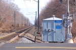
on the crossings- I guess those just the major ones- or maybe ones with protection that wasn't just passive? I know that, for example, in Freneau area (Matawan/Aberdeen) there were also crossings at Texas Rd and Wilson Ave (near the JCPL substation). I think they were just plain crossbucks- Dont recall anything mechanical there really. Was relatively rural there still in the 70's. I think there were more in Marlboro too off the top of my head. And there is another in Matawan now that i think about it- between the trestle and church street. Again that would likely be passive back there.

it's been years since i was down there- was the Rt 520 crossing the one by YMCA Camp Arrowhead? I always wondered what that was about- why there was a crossing there with Flashers that looked so new when I knew the line "stopped" all the way back in Morganville by Tenant Road.

Also Texas and Wilson were HUGE HUMPS in the road- the roads were terribly graded- the tracks were probably 5 feet above the roadway and whoever paid just made huge humps- no grading to speak off- there were always accidents and scrape marks there. You can imagine a country dirt road crossing with elevated roadbed and they just paved it without ever fixing the grade. The crossing at Rt 79 Freneau survived for some time- even after the trains had stopped for years- when the country/state rebuilt 79 and added curbs and the like they left that crossing and didn't even pave over the rails- but the two at Texas and Wilson were removed much sooner because they were such a hazard. I can barely recall the crossing at Tenant Road ever existing- Imperial Oil was before that so they must have pulled that one out pretty quick after they stopped service to Freehold.

Talking about it made me check out google maps. WOW- imperial oil really must have been a superfund mess- you can see the giant excavation where it used to be with the truck scale and all- they must be shipping tons of dirt away. Also speaking of 520 looks like the Henry Hudson trial doesn't follow the ROW on either side of 520 for a bit- I wonder why that is?- is there a bridge or culvert of something around there that was unsafe for the trail?
  by CNJ4104
 
michaelk

My friend started working for the CNJ in 1950 so maybe it was filled in during the late 40's.

Crossings - Yes, the crossings I noted were just the major ones. All others were protected by just a crossbuck.

I do believe Camp Arrowhead was on 520. I know this because when I attended Lloyd Road Middle I took a snow skiing class and that is where they took us for the class and I remember crossing the branch on a bridge and Camp Arrowhead was on the right(?). I don't know what year the bridge at Bradvelt (520) was removed and replace with a crossing with flashers. Had to be after 79 when I left the area.

I do remember the the Texas and Wilson rd crossings. You definitely had to cross it slowly as they were major vehicle launchers.

The Imperial Oil superfund site was a major effort. Google it, there are reports online that I retirived modeling info from. Imperial Oil was previously Champion OIl and if I remember it correctly they made a packaged road patch material. Mixed it right on the ground and boxed it up. Try doing that today!

CNJ4104
Scott
  by CNJ4104
 
michaelk

Sorry missed one...

Yes, one of the major bridges is in that section of the trail between the 79 crossing in Wickatunk and the 520 crossing. I know it spanned a creek so maybe it no longer sound or the google maps photo is out of date. BTW, I know I've seen pis of it online.

Kaback? Are you out there?

CNJ4104

Scott
  by michaelk
 
CNJ4104 wrote:michaelk

Sorry missed one...

Yes, one of the major bridges is in that section of the trail between the 79 crossing in Wickatunk and the 520 crossing. I know it spanned a creek so maybe it no longer sound or the google maps photo is out of date. BTW, I know I've seen pis of it online.

Kaback? Are you out there?

CNJ4104

Scott
had a chance to drive buy the other day and the trail definitely doesn't cross 520. from google maps looks like maybe it ends in the park that is attached/part of the YMCA. Further up Rt79 where the line/trail should cross the road (by station road- wonder if it had the station years ago....)- it stays along the west side of 79 and actualy runs along rt79 for a bit.

So there must be some kaput bridge in there somewhere.

Also happened to drive past the old imperial oil superfund site. Actually the cleanup appears to be ongoing and the resultant construction takes the trail out of service- it's fenced off and there's a sign that says it's closed for a several year period (forget the dates sorry...)
  by michaelk
 
Since it's not that bridge any ideas why the gap in the trail across 520? Something else blocking the ROW? When you look at google maps- you can see the property lines for the ROW- but the train stops on allen road in Big Brook park (which BTW isn't really a road- at least if you try to get to it from maywood drive to the west.) and doesn't start back on the ROW until the west side of the RT 79 crossing.

google maps looks like it crosses 3 streams/creeks in the 'missing' stretch. (I assume tributaries of "the Big brook"...)
  by Kaback9
 
michaelk wrote:Since it's not that bridge any ideas why the gap in the trail across 520? Something else blocking the ROW? When you look at google maps- you can see the property lines for the ROW- but the train stops on allen road in Big Brook park (which BTW isn't really a road- at least if you try to get to it from maywood drive to the west.) and doesn't start back on the ROW until the west side of the RT 79 crossing.

google maps looks like it crosses 3 streams/creeks in the 'missing' stretch. (I assume tributaries of "the Big brook"...)
The reason for the gap in the trail has to do with several factors but the major one is Pleasant Valley Road. In the days of the railroad, there was a road bridge there which has since been filled in. It makes more sense for people to ride/walk along Route 79 in this section than for Monmouth County to go in and have to rebuild a road bridge. Not to mention from a safety point extending the trail to intersect 520 where the railroad crosses it would be very dangerous. Its safer to ride to Rt.79/520 intersection where there is a traffic light.

As for Allen Road. It is indeed a road but can only be accessed by Monmouth County Park vehicles.
  by michaelk
 
Kaback9 wrote:
michaelk wrote:Since it's not that bridge any ideas why the gap in the trail across 520? Something else blocking the ROW? When you look at google maps- you can see the property lines for the ROW- but the train stops on allen road in Big Brook park (which BTW isn't really a road- at least if you try to get to it from maywood drive to the west.) and doesn't start back on the ROW until the west side of the RT 79 crossing.

google maps looks like it crosses 3 streams/creeks in the 'missing' stretch. (I assume tributaries of "the Big brook"...)
The reason for the gap in the trail has to do with several factors but the major one is Pleasant Valley Road. In the days of the railroad, there was a road bridge there which has since been filled in. It makes more sense for people to ride/walk along Route 79 in this section than for Monmouth County to go in and have to rebuild a road bridge. Not to mention from a safety point extending the trail to intersect 520 where the railroad crosses it would be very dangerous. Its safer to ride to Rt.79/520 intersection where there is a traffic light.

As for Allen Road. It is indeed a road but can only be accessed by Monmouth County Park vehicles.
interesting.

Makes sense- but having grown up by the crossing at Rt79 in matawan I didn't think that there could be much more hazardous crossings than that one. Probably it's better now that they blocked Sutphin ave which used to veer off 79 right at the crossing- but when i was kid there were accidents on that curve where the crossing is all the time, at least once with fatalities. But I suppose the speed limits are higher on 79 and 520 in Marlboro.

So for the current train when traveling from the North- where does one get back on the ROW- do you know? is the "official" method to cross over by the school on 79 and then get to allen road to the ROW? I didn't notice how far along 79 the trail went.
  by Kaback9
 
The Current trail route is to follow Allen Road into the housing development and ride along Rt. 79 until you reach the other half of the trail. In theory they could extend the trail all the way to just near Pleasant Valley Road if they wanted, but my guess is lack of funds. However doing that would cut down on riding/walking along side Rt. 79 which would be a plus.

The 520 Crossing was never really a crossing, there was a road bridge there until just about the end of railroad service. The crossing would only be considered dangerous today as a pedestrian crossing.
  by ChrisU
 
Went for a bike ride on the trail yesterday between Port Monmouth and the end of the trail in Matawan here are some cell phone pics of some of the stuff thats still there.


Ties in place on the Aeromarine siding.
http://i677.photobucket.com/albums/vv14 ... 11232a.jpg
Siding in Keyport to I believe Stultz fuel oil.The other rail is still there but you cant see it in the pic.
http://i677.photobucket.com/albums/vv14 ... 011238.jpg
Looking across bridge over highway 35.
http://i677.photobucket.com/albums/vv14 ... 011246.jpg
Old trestle inbetween Rt.35 and the end of the trail in Matawan. It also had other pylons there, what where they from? It was an original RR bridge you can see by the wood work.Also these where the only pictures that my phone resized when I sent them.
http://i677.photobucket.com/albums/vv14 ... 011247.jpg
http://i677.photobucket.com/albums/vv14 ... 011249.jpg
Old intact siding at the end of the trail in Matawan,even the switch handle was still there does anyone know what this went to?
http://i677.photobucket.com/albums/vv14 ... 11254a.jpg
http://i677.photobucket.com/albums/vv14 ... 011255.jpg
http://i677.photobucket.com/albums/vv14 ... 11255a.jpg
  by michaelk
 
NJTArrow2 wrote:Went for a bike ride on the trail yesterday between Port Monmouth and the end of the trail in Matawan here are some cell phone pics of some of the stuff thats still there.


Ties in place on the Aeromarine siding.
http://i677.photobucket.com/albums/vv14 ... 11232a.jpg
Siding in Keyport to I believe Stultz fuel oil.The other rail is still there but you cant see it in the pic.
http://i677.photobucket.com/albums/vv14 ... 011238.jpg
Looking across bridge over highway 35.
http://i677.photobucket.com/albums/vv14 ... 011246.jpg
Old trestle inbetween Rt.35 and the end of the trail in Matawan. It also had other pylons there, what where they from? It was an original RR bridge you can see by the wood work.Also these where the only pictures that my phone resized when I sent them.
http://i677.photobucket.com/albums/vv14 ... 011247.jpg
http://i677.photobucket.com/albums/vv14 ... 011249.jpg
Old intact siding at the end of the trail in Matawan,even the switch handle was still there does anyone know what this went to?
http://i677.photobucket.com/albums/vv14 ... 11254a.jpg
http://i677.photobucket.com/albums/vv14 ... 011255.jpg
http://i677.photobucket.com/albums/vv14 ... 11255a.jpg
Neat that stuff is still there.

By the end of the trail do you mean Clark street and Lloyd road? (I beleive that is techically Keyport or maybe Aberdeen depending on where you stand) There's a fragrance/flavor factory right there on Clark street. Just a guess that maybe the siding went into there?
  by ChrisU
 
Yup thats what I meant,maybe it did it was going into some company in 1972 in historic aerials but when you go to 1979 it the factory is gone and only the siding is still there.
  by OportRailfan
 
michaelk wrote:
NJTArrow2 wrote:Went for a bike ride on the trail yesterday between Port Monmouth and the end of the trail in Matawan here are some cell phone pics of some of the stuff thats still there.


Ties in place on the Aeromarine siding.
http://i677.photobucket.com/albums/vv14 ... 11232a.jpg
Siding in Keyport to I believe Stultz fuel oil.The other rail is still there but you cant see it in the pic.
http://i677.photobucket.com/albums/vv14 ... 011238.jpg
Looking across bridge over highway 35.
http://i677.photobucket.com/albums/vv14 ... 011246.jpg
Old trestle inbetween Rt.35 and the end of the trail in Matawan. It also had other pylons there, what where they from? It was an original RR bridge you can see by the wood work.Also these where the only pictures that my phone resized when I sent them.
http://i677.photobucket.com/albums/vv14 ... 011247.jpg
http://i677.photobucket.com/albums/vv14 ... 011249.jpg
Old intact siding at the end of the trail in Matawan,even the switch handle was still there does anyone know what this went to?
http://i677.photobucket.com/albums/vv14 ... 11254a.jpg
http://i677.photobucket.com/albums/vv14 ... 011255.jpg
http://i677.photobucket.com/albums/vv14 ... 11255a.jpg
Neat that stuff is still there.

By the end of the trail do you mean Clark street and Lloyd road? (I beleive that is techically Keyport or maybe Aberdeen depending on where you stand) There's a fragrance/flavor factory right there on Clark street. Just a guess that maybe the siding went into there?
That's IFF (International Flavors and Fragrances.)
  by ChrisU
 
OportRailfan wrote:
michaelk wrote:
NJTArrow2 wrote:Went for a bike ride on the trail yesterday between Port Monmouth and the end of the trail in Matawan here are some cell phone pics of some of the stuff thats still there.


Ties in place on the Aeromarine siding.
http://i677.photobucket.com/albums/vv14 ... 11232a.jpg
Siding in Keyport to I believe Stultz fuel oil.The other rail is still there but you cant see it in the pic.
http://i677.photobucket.com/albums/vv14 ... 011238.jpg
Looking across bridge over highway 35.
http://i677.photobucket.com/albums/vv14 ... 011246.jpg
Old trestle inbetween Rt.35 and the end of the trail in Matawan. It also had other pylons there, what where they from? It was an original RR bridge you can see by the wood work.Also these where the only pictures that my phone resized when I sent them.
http://i677.photobucket.com/albums/vv14 ... 011247.jpg
http://i677.photobucket.com/albums/vv14 ... 011249.jpg
Old intact siding at the end of the trail in Matawan,even the switch handle was still there does anyone know what this went to?
http://i677.photobucket.com/albums/vv14 ... 11254a.jpg
http://i677.photobucket.com/albums/vv14 ... 011255.jpg
http://i677.photobucket.com/albums/vv14 ... 11255a.jpg
Neat that stuff is still there.

By the end of the trail do you mean Clark street and Lloyd road? (I beleive that is techically Keyport or maybe Aberdeen depending on where you stand) There's a fragrance/flavor factory right there on Clark street. Just a guess that maybe the siding went into there?
That's IFF (International Flavors and Fragrances.)
Nope IFF is in Union Beach.
  • 1
  • 4
  • 5
  • 6
  • 7
  • 8