Continuing south, turn right at the light onto U.S. 27 and continue south towards Somerset. Unfortunately, Somerset has a ton of traffic lights, 30+ to be exact on U.S. 27, as they're nice enough to number them for you. However, there's a nice little way to bypass all of that and only deal with about five lights. This is handy especially when chasing trains. As you get near Somerset, look for signs for the Cumberland Parkway west towards Bowling Green. Hop on the ramp, and then get off at the very first exit. This will put you on KY 914, which will take you south around Somerset. Once you make it back around to U.S. 27, you have two options. Turn right on 27 and go towards Burnside, or continue east on 914 for a few miles and turn right on KY 2747, which will take you to the tracks.
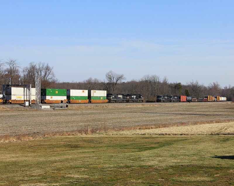
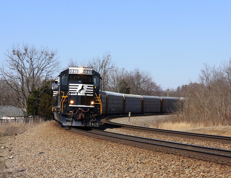
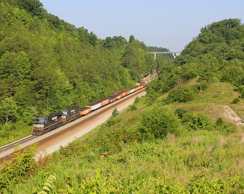
Turning on 2747, this will take you to a place called "Elihu". They've doubled tracked the area here in the last few years, and cleared all of the brush out of the area between the road and the tracks. Some of it has grown back, but it's still an open shot.
 NS 890, Elihu,KY 1/21/2015
 by
Jeff Wagoner, on Flickr
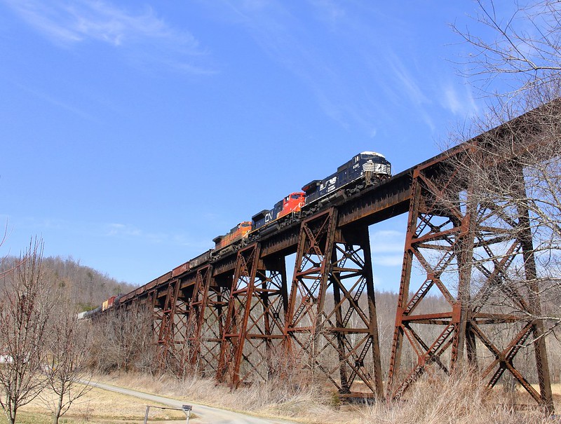
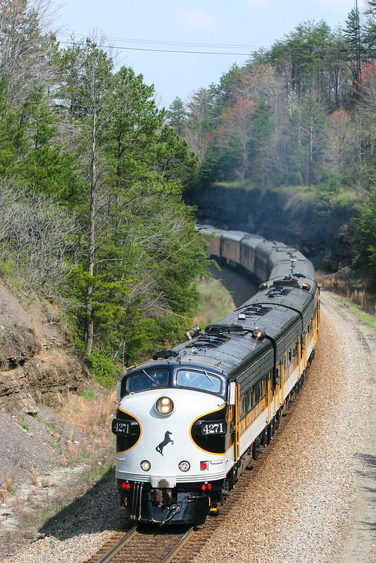
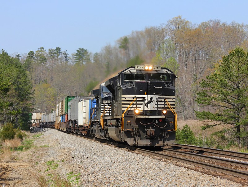
This shot was taken where the tracks start to move away from the road.
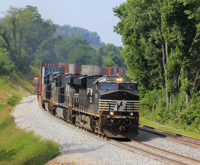 NS 22A, Elihu,KY 7/7/2014
 by
Jeff Wagoner, on Flickr
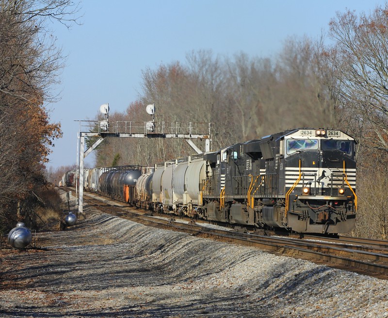
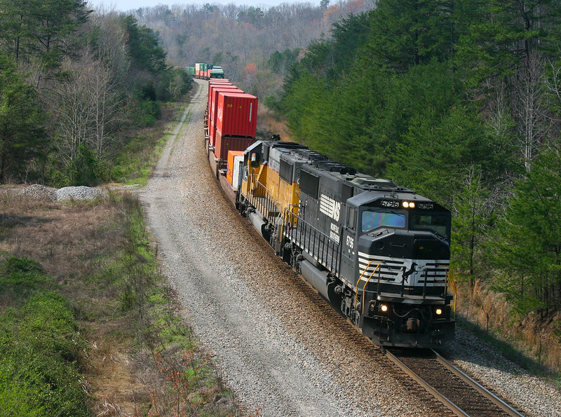
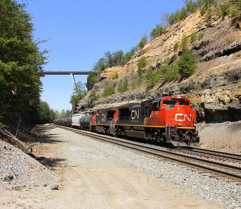
KY 2747 will take you out to KY 90 (in several places). Turn left and take the exit for US 27 south (Burnside) when you see it. South of here the highway and the railroad both cross over the Cumberland River. The bridge is definitely worth shooting. While I've parked on it before to catch a train for just a few minutes, I recommend standing on one of the ends to shoot. U.S. 27 can get really busy at times so standing on the bridge is risky. I would also suggest waiting for a northbound to leave Burnside just south of here and catching them crossing the bridge at the north end of the highway bridge.
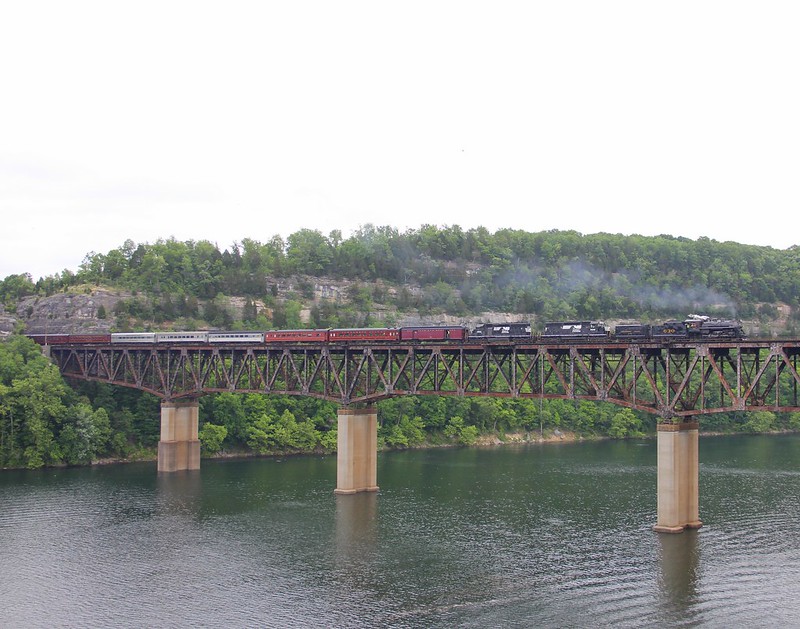 NS 956, Burnside,KY 6/1/2014
 by
Jeff Wagoner, on Flickr
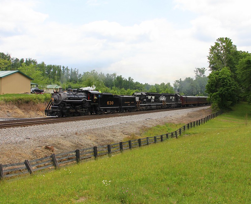
Speaking of Burnside, this is where all trains make crew changes before proceeding to Cincinnati/Louisville or Chattanooga. Both ends of the yard are accessible, along with a nice spot in the middle. Just continue south on U.S. 27 and turn left at the first red light you come to.
North end of the yard at Burnside:
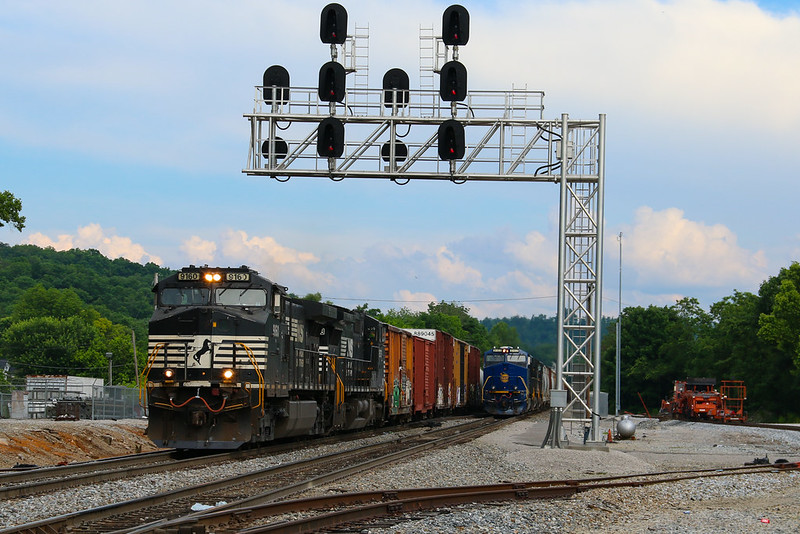 NS 174/124, Burnside,KY 5/31/2016
 by
Jeff Wagoner, on Flickr
If you continue on this road (E French Avenue), it will take you around to the middle of the yard. The main road continues under the overpass back to U.S. 27, but a road (Antioch Church Rd) on the left will take you to another spot worth shooting. You may pass several trains waiting for crews here, but keep going. Where the tracks go into a large cut is what you're here for. Again, there's not much pull off here, so keep in mind where you park, as this road can be busy at times despite being rural. An opening in the guardrail will lead you to this location:
 NS 23G, Burnside,KY 11/5/2015
 by
Jeff Wagoner, on Flickr
To reach the south end of the yard, go back and pass underneath the overpass and go back to the main highway. You'll turn left on U.S. 27 and continue south. Turn left on Antioch Rd (this road connects to the one we just mentioned earlier, but this way is faster, trust me.) The turn is easy to miss, so you may want to check google maps for where to turn. This road takes you back to an at-grade crossing, where you'll cross and turn left. Southbound trains are recrewed here.
 NS 143/175, Tateville,KY
 by
Jeff Wagoner, on Flickr
The Church on Old Hwy 27 Loop 5 here used to be a decent shot but the brush between the cemetery and the tracks has really grown back fast.
Go back to U.S. 27, and go south once again. Pass underneath the railroad overpass here and turn right by the gas station. This is Garland Rd, and will take you to the first of four massive bridges in the deepest parts of the "Rathole".
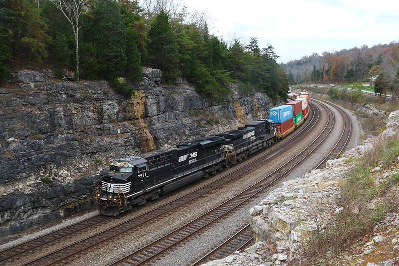
 NS 197, Tateville,KY 1/3/2013
 by
Jeff Wagoner, on Flickr
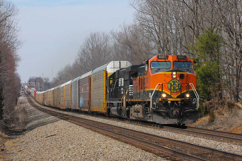
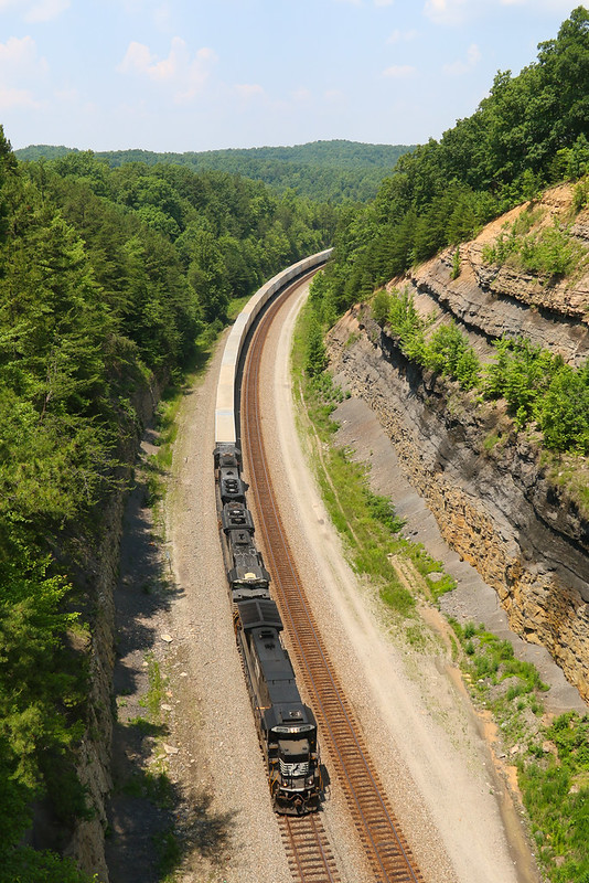
This overpass can see some regular road traffic so keep that in mind when you're here. Trains will call signals at "Tateville" before proceeding south to this point. Head back to U.S. 27 to continue to our next photo location. A half mile or so south, turn right on Keno Rd, KY 751. You'll drive for several miles before reaching the first photo location, on Cave Springs Rd. This is known as "Keno". Probably the tallest overpass to shoot from on the entire railroad. You'll hear trains for several minutes before they arrive here.
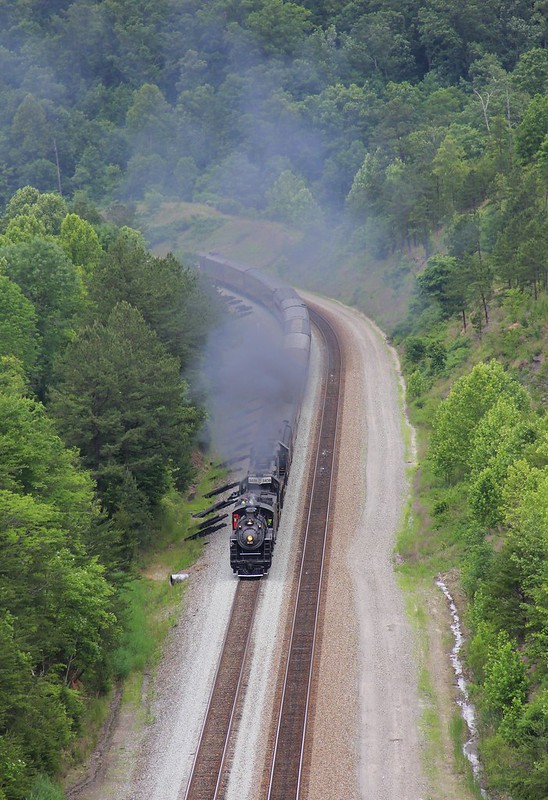 NS 956, Keno,KY 6/1/2014
 by
Jeff Wagoner, on Flickr
Head back to Keno Rd and turn right on it to go to the next bridge just down the line from this one. Keno Rd crosses the tracks on the third massive overpass over the tracks a mile or so south.
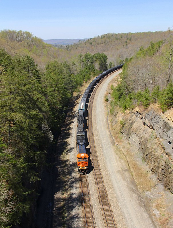 NS 64Q, KD Tower, Keno,KY 4/17/2014
 by
Jeff Wagoner, on Flickr
Pull off on a gravel road on the left just past the bridge to park. This road will take you down to the tracks, I recommend walking as opposed to driving down it. A 4x4 can probably make it down and back with no trouble, but you probably don't want to be stuck down there.
 NS 167, KD Tower, Keno,KY 4/17/2014
 by
Jeff Wagoner, on Flickr
I've crossed the tracks and hiked up the hill to the south of here before. This is something you will probably want to do with a friend, as it's pretty isolated out here.
 NS 167, KD Tower, Keno,KY 7/7/2014
 by
Jeff Wagoner, on Flickr
Keep on Keno Rd until you see a sign for Dead Ox Hollow Rd. There is a fire access road that leads down to the tracks about a half mile or so down this road that takes you to Dead Ox Hollow.
 NS 229, Dead Ox Hollow, Greenwood,KY 4/19/2014
 by
Jeff Wagoner, on Flickr
There's some more shots to be had up at the curve in the distance, but I haven't hiked back there to try it yet.
Dead Ox Hollow Rd becomes Shelton Rd. Stay south on it to go to the fourth and final overpass over the tracks here.
 NS 251, KD Tower (near Greenwood,KY), 6/10/2015
 by
Jeff Wagoner, on Flickr
You'll hear southbounds call KD tower signals before they reach this bridge.
If you keep going on this road, you'll see a gravel road to the right that also leads down to the tracks. The tracks run east/west here in a long straight stretch and it's possible to get shots of entire trains here. It's another location I have yet to try. This road name is Buck Knob Tower Rd. Stay on the main road to reach U.S. 27 again where you'll head further south once more to reach a few other photo locations, which I'll add in the next post.