by LRail
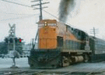
Does anyone have any pics of the Ronkonkoma diesels laying up on the former south layup track. Also, does anyone knw when the track was removed. You used to be able to see some remnants.
Railroad Forums
Moderator: Liquidcamphor
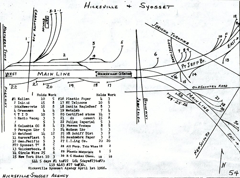
LRail wrote:Part II --- When did they add the 3rd platform track? According to the 1966 map, it wasn't there back then.What map are we referring to?
LRail wrote:Map in the Hicksville section. Still looking for info about the south layup track, and now the north station track. Pics would be really great!Can you provide the link? Is the map on my page: http://www.trainsarefun.com/lirr/hicksv ... sville.htm ?
Head-end View wrote:That map may not be correct re: the track layout in Hicksville Station and the switch set-up in front of Divide Tower. It fails to show the middle station track. Unless my memory is wrong the current track layout and switches just east of the platforms are the original construction design from the 1960's elevation project. I don't think it was ever changed from the time it was built to the present. But, if I'm wrong and anyone knows different, please correct me.You are sure correct. The LIRR 1966 maps are not always accurate as I am familiar with specific track configs in a number of towns. Amazing to me the LIRR created these, but were they for line staff, the public, or? They are crude, etc. Perhaps this is another thread to start. Hmmm...
Another error on that map is the name of the Parkway at the left side of the picture. It definitely is the Wantagh Pkwy, not Northern State Pkwy. Whoever drew that map didn't have much sense of accuracy.
Cannon Ball wrote:I have never seen a full set of similar sheets from any year other than 1966, but enough changes and omissions are evident in the 1966 version to suggest that there must've been earlier versions, too. Anybody else remember these from back then??I have never seen another set either and been looking on eBay for 15 yrs. Why just 1966?